
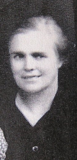
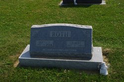
Florence Krabill Roth
| Birth | : | 22 Jan 1897 |
| Death | : | 30 Sep 1971 |
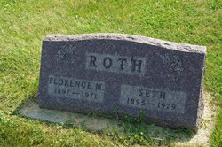
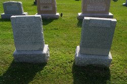
| Burial | : | Ziegler-Lone Star Cemetery, Bouse Junction, Major County, USA |
| Coordinate | : | 36.4775009, -98.8617020 |
| Description | : | Roth, Florence, daughter of Michael and Catherine (Wyse) Krabill, was born in Muscatine, Iowa, Jan. 22. 1897; died at Colorado Springs, Colo., Sept. 30, 1971; aged 74 y. 8 m. 8 d. On May 16, 1915, she was married to Seth R. Roth, who survives. Also surviving are 6 sons and 3 daughters (Gilbert, Everette, Marvin, Eldon, Gene, Robert, Grace - Mrs. Eli Yutzy, Kathryn Mrs. Ezra Gugel, and Darlene - Mrs. Willis Roth), 37 grandchildren, 19 great-grandchildren, one brother (Lester Krabill), and one sister (Mary - Mrs. Earl Hostetler). Two brothers (Omer and Elmer) and one son preceded her... Read More |
frequently asked questions (FAQ):
-
Where is Florence Krabill Roth's memorial?
Florence Krabill Roth's memorial is located at: Ziegler-Lone Star Cemetery, Bouse Junction, Major County, USA.
-
When did Florence Krabill Roth death?
Florence Krabill Roth death on 30 Sep 1971 in
-
Where are the coordinates of the Florence Krabill Roth's memorial?
Latitude: 36.4775009
Longitude: -98.8617020
Family Members:
Parent

Spouse
Siblings
Children
Flowers:


Nearby Cemetories:
1. Ziegler-Lone Star Cemetery
Bouse Junction, Major County, USA
Coordinate: 36.4775009, -98.8617020
2. West Creek Cemetery
Major County, USA
Coordinate: 36.4921989, -98.9317017
3. Walnut Grove Cemetery
Woods County, USA
Coordinate: 36.5353012, -98.7827988
4. Waynoka Municipal Cemetery
Waynoka, Woods County, USA
Coordinate: 36.5793991, -98.8630981
5. Conner Cemetery
Major County, USA
Coordinate: 36.3768310, -98.8192150
6. Liberty Cemetery
Major County, USA
Coordinate: 36.3624992, -98.8878021
7. Galena Cemetery
Waynoka, Woods County, USA
Coordinate: 36.4919014, -98.6980972
8. Highland Cemetery
Woods County, USA
Coordinate: 36.5642014, -98.7292023
9. Union Cemetery
Quinlan, Woodward County, USA
Coordinate: 36.4199982, -99.0235977
10. Red Top Cemetery
Quinlan, Woodward County, USA
Coordinate: 36.4930992, -99.0402985
11. Lone Star Cemetery
Major County, USA
Coordinate: 36.3725014, -98.7300034
12. Mount Zion Cemetery
Major County, USA
Coordinate: 36.3189011, -98.8491974
13. Antioch Cemetery
Major County, USA
Coordinate: 36.3182983, -98.7953033
14. Memorial Hill Cemetery
Waynoka, Woods County, USA
Coordinate: 36.6535988, -98.8550034
15. Cedardale Cemetery
Woodward County, USA
Coordinate: 36.3272018, -98.9978027
16. Elm Grove Cemetery
Mutual, Woodward County, USA
Coordinate: 36.3268814, -98.9982300
17. Highland Cemetery
Woodward County, USA
Coordinate: 36.5341988, -99.1016998
18. Golden Lodge Cemetery
Major County, USA
Coordinate: 36.2757988, -98.7827988
19. Cheyenne Valley Cemetery
Major County, USA
Coordinate: 36.3699989, -98.6224976
20. Curtis Cemetery
Woodward County, USA
Coordinate: 36.4356003, -99.1380997
21. Good Hope Cemetery
Woods County, USA
Coordinate: 36.5360985, -98.5875015
22. Pleasant View Cemetery
Woods County, USA
Coordinate: 36.6385000, -98.6297200
23. Miller Cemetery
Cedardale, Woodward County, USA
Coordinate: 36.3078003, -99.0843964
24. Chester Cemetery
Chester, Major County, USA
Coordinate: 36.2305984, -98.8764038