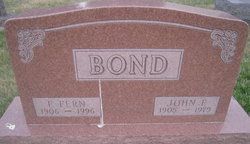
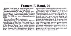
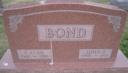
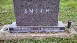
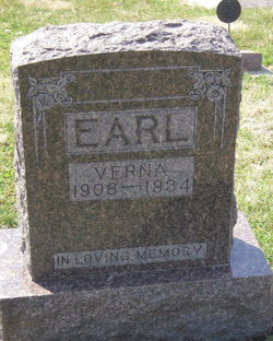
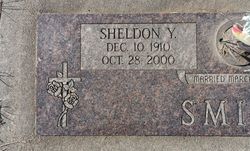
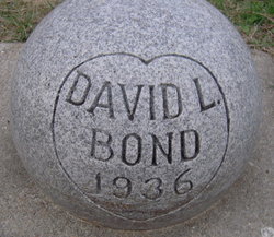
Frances Fern Smith Bond
| Birth | : | 29 Oct 1906 Iowa, USA |
| Death | : | 2 Nov 1996 Missouri, USA |
| Burial | : | Bold Springs Cemetery, Milburn, Johnston County, USA |
| Coordinate | : | 34.3168983, -96.5366974 |
| Plot | : | Section B, Lot 64 |
frequently asked questions (FAQ):
-
Where is Frances Fern Smith Bond's memorial?
Frances Fern Smith Bond's memorial is located at: Bold Springs Cemetery, Milburn, Johnston County, USA.
-
When did Frances Fern Smith Bond death?
Frances Fern Smith Bond death on 2 Nov 1996 in Missouri, USA
-
Where are the coordinates of the Frances Fern Smith Bond's memorial?
Latitude: 34.3168983
Longitude: -96.5366974
Family Members:
Parent
Spouse
Siblings
Children
Flowers:
Nearby Cemetories:
1. Bold Springs Cemetery
Milburn, Johnston County, USA
Coordinate: 34.3168983, -96.5366974
2. Filmore Cemetery
Johnston County, USA
Coordinate: 34.3081017, -96.5306015
3. Greenwood Cemetery
Fillmore, Johnston County, USA
Coordinate: 34.2860985, -96.5261002
4. Wiley Cemetery
Milburn, Johnston County, USA
Coordinate: 34.2775002, -96.5635986
5. Sandy Creek Cemetery
Fillmore, Johnston County, USA
Coordinate: 34.2802450, -96.4966990
6. Cheadle Cemetery
Milburn, Johnston County, USA
Coordinate: 34.2747002, -96.5721970
7. Bronaugh Cemetery
Milburn, Johnston County, USA
Coordinate: 34.2617900, -96.5482400
8. Hollow Spring Cemetery
Fillmore, Johnston County, USA
Coordinate: 34.2691600, -96.4877700
9. Enterprise Cemetery
Wapanucka, Johnston County, USA
Coordinate: 34.3153150, -96.4531900
10. Wells Valley Cemetery
Bromide, Johnston County, USA
Coordinate: 34.3869019, -96.4891968
11. Harris Cemetery
Milburn, Johnston County, USA
Coordinate: 34.2308006, -96.5318985
12. Condon Grove Cemetery
Milburn, Johnston County, USA
Coordinate: 34.2369003, -96.5811005
13. Bynum-Harkins Cemetery
Emet, Johnston County, USA
Coordinate: 34.2279310, -96.4880920
14. Duncan Cemetery
Tishomingo, Johnston County, USA
Coordinate: 34.2630997, -96.6466980
15. Emet Cemetery
Johnston County, USA
Coordinate: 34.2052994, -96.5519028
16. Ego-Coleman Cemetery
Coleman, Johnston County, USA
Coordinate: 34.2543983, -96.4186020
17. Pilgrim Cemetery
Johnston County, USA
Coordinate: 34.4268990, -96.5832977
18. Rose Hill Cemetery
Wapanucka, Johnston County, USA
Coordinate: 34.3883018, -96.4244003
19. Worcester Cemetery
Coal County, USA
Coordinate: 34.4221000, -96.4589590
20. Shady Grove Cemetery
Tishomingo, Johnston County, USA
Coordinate: 34.2256012, -96.6532974
21. Clarita Amish Cemetery
Coal County, USA
Coordinate: 34.4343416, -96.4394419
22. Tishomingo City Cemetery
Tishomingo, Johnston County, USA
Coordinate: 34.2274017, -96.6787033
23. Connerville Cemetery
Connerville, Johnston County, USA
Coordinate: 34.4413660, -96.6362910
24. Seeley Cemetery
Connerville, Johnston County, USA
Coordinate: 34.4556007, -96.6119003

