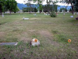
Frank Lyle Pluid
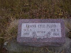
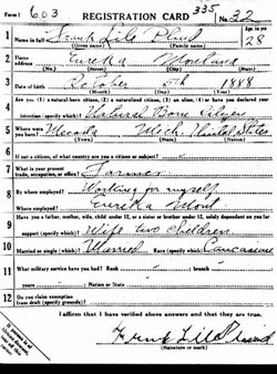
| Birth | : | 5 Oct 1888 Mecosta County, Michigan, USA |
| Death | : | 9 Feb 1964 Eureka, Lincoln County, Montana, USA |
| Burial | : | Chappell Ridge Cemetery, Bullitt County, USA |
| Coordinate | : | 37.9608139, -85.8731092 |
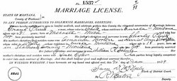
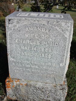
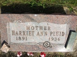
| Description | : | Frank came west in 1903 to the Whitefish, Montana area. He returned to Michigan and then returned to the Eureka, Montana area in 1906. He married Harriet Ann Schulz January 26, 1909 in Kalispell, Montana. They had 11 children. Montana, County Marriages Name: Frank Pluid Gender: Male Race: White Marital Status: Single Age: 21 Birth Date: 1888 Birth Place: Mecosta, Mich Marriage Date: 26 Jan 1909 Marriage Place: Kalispell, , Montana Father: Charles Pluid Mother: Amanda Morton Spouse: Harriet Ann Schulz FHL Film Number: 1902479 U.S., Social Security Death Index Name: Frank Pluid Last Residence: 59917 Eureka, Lincoln, Montana BORN: 5 Oct 1888 Died: Feb 1964 State (Year) SSN issued: Washington (Before 1951) |
frequently asked questions (FAQ):
-
Where is Frank Lyle Pluid's memorial?
Frank Lyle Pluid's memorial is located at: Chappell Ridge Cemetery, Bullitt County, USA.
-
When did Frank Lyle Pluid death?
Frank Lyle Pluid death on 9 Feb 1964 in Eureka, Lincoln County, Montana, USA
-
Where are the coordinates of the Frank Lyle Pluid's memorial?
Latitude: 37.9608139
Longitude: -85.8731092
Family Members:
Parent
Spouse
Siblings
Children
Flowers:
Nearby Cemetories:
1. Chappell Ridge Cemetery
Bullitt County, USA
Coordinate: 37.9608139, -85.8731092
2. Chappel Cemetery
Fort Knox, Bullitt County, USA
Coordinate: 37.9608120, -85.8731130
3. Rawlings Cemetery
Shepherdsville, Bullitt County, USA
Coordinate: 37.9643960, -85.8932390
4. Ridgeway Cemetery
Shepherdsville, Bullitt County, USA
Coordinate: 37.9729210, -85.8506880
5. Anderson Cemetery
Fort Knox, Bullitt County, USA
Coordinate: 37.9841995, -85.8574982
6. Hays Cemetery
Fort Knox, Hardin County, USA
Coordinate: 37.9355690, -85.8628460
7. Davis Cemetery
Salt River, Bullitt County, USA
Coordinate: 37.9416250, -85.8978080
8. Skinner Cemetery (Defunct)
Shepherdsville, Bullitt County, USA
Coordinate: 37.9886200, -85.8622270
9. Anderson Cemetery
Fort Knox, Hardin County, USA
Coordinate: 37.9326910, -85.8840950
10. Bishop Cemetery
Fort Knox, Hardin County, USA
Coordinate: 37.9544060, -85.9115360
11. Ashby Cemetery (Defunct)
Shepherdsville, Bullitt County, USA
Coordinate: 37.9908290, -85.8555470
12. Ormes Cemetery
Shepherdsville, Bullitt County, USA
Coordinate: 37.9905560, -85.8994460
13. Dorsey Cemetery
Fort Knox, Hardin County, USA
Coordinate: 37.9446670, -85.9199120
14. Ann Clark Cemetery (Defunct)
Shepherdsville, Bullitt County, USA
Coordinate: 37.9983250, -85.8538560
15. Hern-Stone Cemetery
Fort Knox, Hardin County, USA
Coordinate: 37.9222310, -85.8888510
16. Stowers Cemetery
Shepherdsville, Bullitt County, USA
Coordinate: 38.0011350, -85.8828970
17. Congrove Cemetery
Fort Knox, Bullitt County, USA
Coordinate: 37.9364014, -85.8296967
18. Froman Cemetery
Fort Knox, Bullitt County, USA
Coordinate: 37.9662870, -85.8191950
19. Long Cemetery
Fort Knox, Hardin County, USA
Coordinate: 37.9745700, -85.9249800
20. Green Key Cemetery (Defunct)
Shepherdsville, Bullitt County, USA
Coordinate: 37.9908310, -85.8311090
21. Smith Cemetery
Fort Knox, Hardin County, USA
Coordinate: 37.9346240, -85.9190630
22. Holsclaw Cemetery
Fort Knox, Bullitt County, USA
Coordinate: 37.9403000, -85.8221970
23. Myers Cemetery
Shepherdsville, Bullitt County, USA
Coordinate: 37.9831009, -85.8227997
24. Crandall Cemetery
Fort Knox, Hardin County, USA
Coordinate: 37.9166985, -85.8582993

