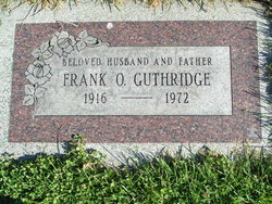
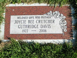
Frank O Guthridge
| Birth | : | 2 Jun 1916 Thomas, Custer County, Oklahoma, USA |
| Death | : | 3 Mar 1972 Modesto, Stanislaus County, California, USA |
| Burial | : | Capac Cemetery, Capac, St. Clair County, USA |
| Coordinate | : | 42.9942017, -82.9274979 |
| Description | : | m: Bernice Patrick 29 May 1952 in Ephrata, Grant Co, WA U.S. World War II Army Enlistment Records, 1938-1946 Name:Frank O Guthridge Birth Year:1916 Race:White, citizen (White) Nativity State or Country:Oklahoma State of Residence:Idaho County or City:Benewah Enlistment Date:21 Sep 1942 Enlistment State:Washington Enlistment City:Spokane Branch:Branch Immaterial - Warrant Officers, USA Branch Code:Branch Immaterial - Warrant Officers, USA Grade:Private Grade Code:Private Term of Enlistment:Enlistment for the duration of the War or other emergency, plus six months, subject to the discretion of the President or otherwise according to law Component:Selectees (Enlisted Men) Source:Civil Life Education:2 years of college Marital Status:Single, without dependents Height:73 Weight:214 |
frequently asked questions (FAQ):
-
Where is Frank O Guthridge's memorial?
Frank O Guthridge's memorial is located at: Capac Cemetery, Capac, St. Clair County, USA.
-
When did Frank O Guthridge death?
Frank O Guthridge death on 3 Mar 1972 in Modesto, Stanislaus County, California, USA
-
Where are the coordinates of the Frank O Guthridge's memorial?
Latitude: 42.9942017
Longitude: -82.9274979
Family Members:
Flowers:
Nearby Cemetories:
1. Capac Cemetery
Capac, St. Clair County, USA
Coordinate: 42.9942017, -82.9274979
2. Mussey Township Cemetery
Capac, St. Clair County, USA
Coordinate: 43.0267690, -82.9265860
3. Evangelical Cemetery
Capac, St. Clair County, USA
Coordinate: 43.0275530, -82.9265750
4. Pine Hill Cemetery
Capac, St. Clair County, USA
Coordinate: 43.0491982, -82.8985977
5. East Berlin Cemetery
Berlin Township, St. Clair County, USA
Coordinate: 42.9399986, -82.8957977
6. West Berlin Cemetery
Allenton, St. Clair County, USA
Coordinate: 42.9217220, -82.9557470
7. Lown Cemetery
Riley Center, St. Clair County, USA
Coordinate: 42.9397500, -82.8373590
8. Clarkes Cemetery
China Township, St. Clair County, USA
Coordinate: 42.9393300, -82.8333100
9. Ferguson Cemetery
Almont, Lapeer County, USA
Coordinate: 42.9364014, -83.0342026
10. Webster Cemetery
Imlay City, Lapeer County, USA
Coordinate: 42.9777985, -83.0616989
11. Lynn Township Cemetery
Yale, St. Clair County, USA
Coordinate: 43.0947227, -82.9100037
12. Rose Hill Cemetery
Armada, Macomb County, USA
Coordinate: 42.8922005, -82.9191971
13. Scotch Settlement Cemetery
Almont, Lapeer County, USA
Coordinate: 42.9014015, -82.9991989
14. Mount Calvary Cemetery
Imlay City, Lapeer County, USA
Coordinate: 43.0203018, -83.0867004
15. Imlay Cemetery
Imlay City, Lapeer County, USA
Coordinate: 43.0382996, -83.0793991
16. Hough Cemetery
Almont, Lapeer County, USA
Coordinate: 42.9061012, -83.0552979
17. Goodrich Cemetery
Bruce Township, Macomb County, USA
Coordinate: 42.8852997, -83.0271988
18. Moore Cemetery
Brockway, St. Clair County, USA
Coordinate: 43.0875015, -82.7941971
19. Bethany Mennonite Cemetery
Dryden, Lapeer County, USA
Coordinate: 42.9901300, -83.1198700
20. Kenockee Cemetery
Emmett, St. Clair County, USA
Coordinate: 42.9942017, -82.7300034
21. Goodland Township Cemetery
Imlay City, Lapeer County, USA
Coordinate: 43.0945015, -83.0718994
22. North Dryden Cemetery
Dryden, Lapeer County, USA
Coordinate: 42.9660988, -83.1258011
23. Sand Hill Cemetery
Almont, Lapeer County, USA
Coordinate: 42.8979240, -83.0836720
24. Mount Pleasant Cemetery
Dryden, Lapeer County, USA
Coordinate: 42.9432983, -83.1200027


