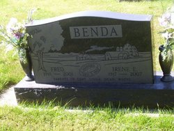
Fred Benda
| Birth | : | 28 Apr 1918 |
| Death | : | 10 Oct 2001 Gladbrook, Tama County, Iowa, USA |
| Burial | : | Woodward Hill Cemetery, Lancaster, Lancaster County, USA |
| Coordinate | : | 40.0280991, -76.3016968 |
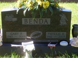
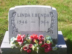
| Description | : | children are Gary,Linda,Dean and Wayne TAMA - Fred Benda, 83, of Tama, formerly of the Vining area, died Wednesday, October 10, 2001 at Westbrook Acres Nursing Home, Gladbrook, following a stroke; survivors include his wife, Irene; three sons, Gary, Dean and Wayne, all of Elberon; ten grandchildren and three great-grandchildren; and a brother, William A. "Bill" of Tama. He was preceded in death by a daughter, Linda; two brothers, Joe and Louis; and a sister, Lillian Upah; services were 10:30 a.m. today at Hand Funeral Home, Tama, with burial in National Cemetery, rural Vining; a memorial fund... Read More |
frequently asked questions (FAQ):
-
Where is Fred Benda's memorial?
Fred Benda's memorial is located at: Woodward Hill Cemetery, Lancaster, Lancaster County, USA.
-
When did Fred Benda death?
Fred Benda death on 10 Oct 2001 in Gladbrook, Tama County, Iowa, USA
-
Where are the coordinates of the Fred Benda's memorial?
Latitude: 40.0280991
Longitude: -76.3016968
Family Members:
Parent
Spouse
Siblings
Children
Flowers:
Nearby Cemetories:
1. Woodward Hill Cemetery
Lancaster, Lancaster County, USA
Coordinate: 40.0280991, -76.3016968
2. Cedar Lawn Cemetery
Lancaster, Lancaster County, USA
Coordinate: 40.0266991, -76.3022003
3. Zion Lutheran Cemetery
Lancaster, Lancaster County, USA
Coordinate: 40.0299000, -76.3038000
4. Greenwood Cemetery
Lancaster, Lancaster County, USA
Coordinate: 40.0256004, -76.3013992
5. Bethel AME Church Cemetery
Lancaster, Lancaster County, USA
Coordinate: 40.0313000, -76.3033300
6. Riverview Burial Park
Lancaster, Lancaster County, USA
Coordinate: 40.0266571, -76.2910767
7. Trinity Lutheran Churchyard
Lancaster, Lancaster County, USA
Coordinate: 40.0372440, -76.3032940
8. Saint Joseph Roman Catholic Cemetery Old
Lancaster, Lancaster County, USA
Coordinate: 40.0345650, -76.3107681
9. Hempfield United Methodist Church Memorial Garden
Lancaster, Lancaster County, USA
Coordinate: 40.0377808, -76.3058319
10. First Presbyterian Church Memorial Gardens
Lancaster, Lancaster County, USA
Coordinate: 40.0397000, -76.3025000
11. First Reformed Church Memorial Garden
Lancaster, Lancaster County, USA
Coordinate: 40.0395010, -76.3046650
12. Stevens Greenland Cemetery
Lancaster, Lancaster County, USA
Coordinate: 40.0250600, -76.2870360
13. English Presbyterian Cemetery
Lancaster, Lancaster County, USA
Coordinate: 40.0398330, -76.3028020
14. Saint James Episcopal Church Cemetery
Lancaster, Lancaster County, USA
Coordinate: 40.0400009, -76.3035965
15. Prince Street Moravian Cemetery (Defunct)
Lancaster, Lancaster County, USA
Coordinate: 40.0404112, -76.3076468
16. Nissley Cemetery
Lancaster, Lancaster County, USA
Coordinate: 40.0415580, -76.3029130
17. Lancaster County Almshouse and Hospital Cemetery
Lancaster, Lancaster County, USA
Coordinate: 40.0363170, -76.2873600
18. Shreiner's Cemetery
Lancaster, Lancaster County, USA
Coordinate: 40.0400009, -76.3107986
19. Saint Johns Episcopal Church Columbarium
Lancaster, Lancaster County, USA
Coordinate: 40.0408000, -76.3119000
20. Unitarian Universalist Church of Lancaster Memoria
Lancaster, Lancaster County, USA
Coordinate: 40.0396430, -76.3145710
21. Saint Lukes United Church of Christ Memorial Garde
Lancaster, Lancaster County, USA
Coordinate: 40.0385400, -76.3183310
22. Lancaster Cemetery
Lancaster, Lancaster County, USA
Coordinate: 40.0457993, -76.3005981
23. Saint Josephs New Roman Catholic Cemetery
Bausman, Lancaster County, USA
Coordinate: 40.0238991, -76.3249969
24. Grace Lutheran Church Memorial Garden
Lancaster, Lancaster County, USA
Coordinate: 40.0461890, -76.3071260


