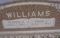
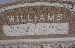
Fred J. Williams
| Birth | : | 12 May 1886 Camden, Ray County, Missouri, USA |
| Death | : | 15 Oct 1955 North Kansas City, Clay County, Missouri, USA |
| Burial | : | Marrar Cemetery, Marrar, Coolamon Shire, Australia |
| Coordinate | : | -34.8320350, 147.3804120 |
| Description | : | MO Death Cert # 32559 Father = John Williams Mother = Mary King Spouse = Zilpha (Sharp) Williams Informant = Mrs. Zilpha Williams Occupation = Farmer COD = Lung Cancer |
frequently asked questions (FAQ):
-
Where is Fred J. Williams's memorial?
Fred J. Williams's memorial is located at: Marrar Cemetery, Marrar, Coolamon Shire, Australia.
-
When did Fred J. Williams death?
Fred J. Williams death on 15 Oct 1955 in North Kansas City, Clay County, Missouri, USA
-
Where are the coordinates of the Fred J. Williams's memorial?
Latitude: -34.8320350
Longitude: 147.3804120
Family Members:
Parent
Spouse
Siblings
Children
Flowers:
Every time I feed the horses or eat bacon, I think of you and wish I had known you better. You were so nice.
Left by Anonymous on 02 May 2009
I think about you.
Left by Anonymous on 14 Aug 2010
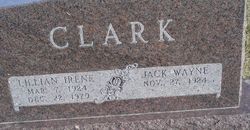
He was a farmer and used horses to plow. He also had the local hog butcher house just east of Orrick, MO at city limits and the railroad. He and his family (Pearl Shults & L. Irene Clark)lived 3 houses west of the slaughter house. He worked very hard and his wife Zilpha was a laundry woman. They also had a large garden and raised chickens. Read less
Left by Anonymous on 19 Jun 2014
Nearby Cemetories:
1. Marrar Cemetery
Marrar, Coolamon Shire, Australia
Coordinate: -34.8320350, 147.3804120
2. Old Junee Cemetery
Old Junee, Junee Shire, Australia
Coordinate: -34.8288640, 147.5153160
3. Junee Pioneer Cemetery
Junee, Junee Shire, Australia
Coordinate: -34.8250950, 147.5234380
4. North Berry Jerry Cemetery
Coolamon, Coolamon Shire, Australia
Coordinate: -34.7388290, 147.2756180
5. Coolamon Cemetery
Coolamon, Coolamon Shire, Australia
Coordinate: -34.8099100, 147.1893200
6. Junee Cemetery
Junee, Junee Shire, Australia
Coordinate: -34.8792860, 147.6090210
7. Ganmain Cemetery
Ganmain, Coolamon Shire, Australia
Coordinate: -34.8022460, 147.0469160
8. Wantabadgery Cemetery
Wantabadgery, Junee Shire, Australia
Coordinate: -35.0548700, 147.7141440
9. Bethungra Cemetery
Bethungra, Junee Shire, Australia
Coordinate: -34.7631900, 147.8387300
10. Mitta Mitta Anglican Cemetery
Mitta Mitta, Junee Shire, Australia
Coordinate: -34.8917820, 147.8526410
11. Cooba Cemetery
Cooba, Cootamundra-Gundagai Regional Council, Australia
Coordinate: -34.9499900, 147.8498100
12. Mundarlo Cemetery
Mundarlo, Cootamundra-Gundagai Regional Council, Australia
Coordinate: -35.0930800, 147.8169500
13. Nangus General Cemetery
Nangus, Cootamundra-Gundagai Regional Council, Australia
Coordinate: -35.0531510, 147.9029060
14. Menz Family Gravesite
The Rock, Lockhart Shire, Australia
Coordinate: -35.2795980, 147.1279510
15. Grong Grong Cemetery
Grong Grong, Narrandera Shire, Australia
Coordinate: -34.7342070, 146.7912080
16. The Rock Cemetery
The Rock, Lockhart Shire, Australia
Coordinate: -35.2787600, 147.1225520
17. Stockinbingal Cemetery
Stockinbingal, Cootamundra-Gundagai Regional Council, Australia
Coordinate: -34.4900260, 147.8755720
18. Cootamundra General Cemetery
Cootamundra, Cootamundra-Gundagai Regional Council, Australia
Coordinate: -34.6331280, 148.0435500
19. Tumblong Cemetery
Tumblong, Cootamundra-Gundagai Regional Council, Australia
Coordinate: -35.1551470, 147.9999310
20. Muttama Cemetery
Muttama, Cootamundra-Gundagai Regional Council, Australia
Coordinate: -34.8178460, 148.1230180
21. Milbrulong Bethlehem Lutheran Cemetery
Milbrulong, Lockhart Shire, Australia
Coordinate: -35.2440200, 146.8274300
22. Ardlethan Cemetery
Ardlethan, Coolamon Shire, Australia
Coordinate: -34.3506640, 146.9146730
23. Yerong Creek Cemetery
Yerong Creek, Lockhart Shire, Australia
Coordinate: -35.3764960, 147.0226730
24. North Gundagai Cemetery
Gundagai, Cootamundra-Gundagai Regional Council, Australia
Coordinate: -35.0513900, 148.1119400


