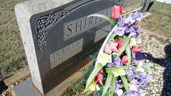
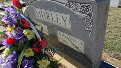
| Birth | : | 3 Sep 1920 Abbeville County, South Carolina, USA |
| Death | : | 6 Oct 2012 Taylors, Greenville County, South Carolina, USA |
| Burial | : | Mountain View Methodist Church Cemetery, Taylors, Greenville County, USA |
| Coordinate | : | 35.0312805, -82.3572693 |
| Description | : | Fred Thomas Shirley, 92, of Taylors, SC, widower of Ramona (Gilreath) Shirley, died Saturday, October 6, 2012 at his home. A native of Abbeville County, he was a son of the late Dewitt Stewart Shirley and Ola (Johnson) Shirley. He was a U.S. Army veteran, where he was squad leader of Company F #325 Glider Infantry serving in Northern France, Ardennes, Rhineland, and Central Europe. A retired employee of Cone Mills, he was a member of Mountain View United Methodist Church. Surviving are two daughters, Sandra Lister (Larry) and Sharon Laney all of Taylors; nine grandchildren, Cale Lister (Tracy), Rory Lister, Lacy... Read More |
frequently asked questions (FAQ):
-
Where is Fred Thomas Shirley's memorial?
Fred Thomas Shirley's memorial is located at: Mountain View Methodist Church Cemetery, Taylors, Greenville County, USA.
-
When did Fred Thomas Shirley death?
Fred Thomas Shirley death on 6 Oct 2012 in Taylors, Greenville County, South Carolina, USA
-
Where are the coordinates of the Fred Thomas Shirley's memorial?
Latitude: 35.0312805
Longitude: -82.3572693
Family Members:
Parent
Spouse
Flowers:
Nearby Cemetories:
1. Mountain View Methodist Church Cemetery
Taylors, Greenville County, USA
Coordinate: 35.0312805, -82.3572693
2. Gum Springs Pentecostal Holiness Church Cemetery
Taylors, Greenville County, USA
Coordinate: 35.0243988, -82.3317032
3. Locust Hill Baptist Church Cemetery
Travelers Rest, Greenville County, USA
Coordinate: 35.0158005, -82.3796997
4. Mush Creek Baptist Church Cemetery
Travelers Rest, Greenville County, USA
Coordinate: 35.0469017, -82.3835983
5. Camp Creek Baptist Church Cemetery
Taylors, Greenville County, USA
Coordinate: 35.0544014, -82.3293991
6. Meadow Fork Baptist Church Cemetery
Travelers Rest, Greenville County, USA
Coordinate: 35.0486183, -82.3908386
7. Few Family Cemetery
Greer, Greenville County, USA
Coordinate: 35.0306282, -82.3128738
8. Old Poole Cemetery
Greenville County, USA
Coordinate: 35.0058330, -82.3891250
9. Mountain Grove Baptist Church Cemetery
Travelers Rest, Greenville County, USA
Coordinate: 35.0244255, -82.4014969
10. Tigerville Baptist Church Cemetery
Tigerville, Greenville County, USA
Coordinate: 35.0715450, -82.3647510
11. Faith Temple Church of God Cemetery
Taylors, Greenville County, USA
Coordinate: 34.9911003, -82.3435974
12. David Jackson Park
Greenville County, USA
Coordinate: 35.0530400, -82.3122500
13. Fews Chapel United Methodist Church Cemetery
Greer, Greenville County, USA
Coordinate: 35.0358009, -82.3019028
14. Tyger Baptist Church Cemetery
Tigerville, Greenville County, USA
Coordinate: 35.0772018, -82.3544006
15. Moon Family Cemetery
Greer, Greenville County, USA
Coordinate: 35.0009840, -82.3146040
16. Saint Luke United Methodist Church Cemetery
Travelers Rest, Greenville County, USA
Coordinate: 34.9863434, -82.3833008
17. Forester-Southern Cemetery
Travelers Rest, Greenville County, USA
Coordinate: 35.0678160, -82.3997340
18. Clark Family Cemetery
Travelers Rest, Greenville County, USA
Coordinate: 34.9912000, -82.3950070
19. Monastery of Saint Clare Cemetery
Travelers Rest, Greenville County, USA
Coordinate: 34.9968430, -82.4047620
20. New Salem Baptist Church Cemetery
Tigerville, Greenville County, USA
Coordinate: 35.0815887, -82.3394928
21. Cool Springs Primitive Baptist Church Cemetery
Travelers Rest, Greenville County, USA
Coordinate: 35.0572014, -82.4131012
22. Saint Paul United Methodist Church Cemetery
Blue Ridge, Greenville County, USA
Coordinate: 35.0213370, -82.2935360
23. Crain Burying Ground
Greenville County, USA
Coordinate: 35.0560110, -82.2986790
24. Double Springs Baptist Church Cemetery
Taylors, Greenville County, USA
Coordinate: 34.9813995, -82.3317032


