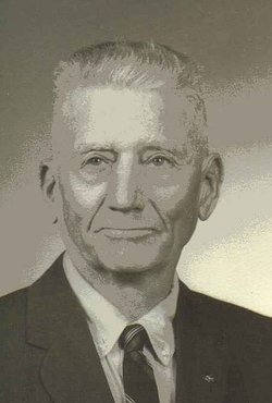
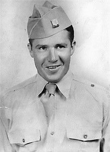
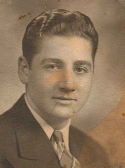
Frederick John “Fred J” Longer
| Birth | : | 9 Nov 1886 Allamakee County, Iowa, USA |
| Death | : | 25 May 1972 Sheldon, Iroquois County, Illinois, USA |
| Burial | : | Elm Grove Cemetery, Washington, Washington County, USA |
| Coordinate | : | 41.2861279, -91.7004451 |
| Plot | : | J-5-5-E 1/2 |
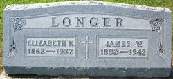
| Inscription | : | Kathryn and Fred's marker has inscriptions' for their two sons that are buried overseas, Killed In Action, WW II. |
| Description | : | Frederick, sometimes called "Fred J", was reared in Washington County and graduated as a Civil Engineer from Iowa State College in Ames, Iowa. Frederick (Fred J) was a farmer and Civil Engineer. At age 30 Fred worked as a Civil Engineer for Marshall County, in Marshalltown, Iowa as a Civil Engineer. He was a member of the United Presbyterian Church, the A.F.&A.M., Lodge # 108, White Shrine and VFW. He was a veteran of World War I where he served as a First Lieutenant in the 7th Corps of Engineers, Company B. |
frequently asked questions (FAQ):
-
Where is Frederick John “Fred J” Longer's memorial?
Frederick John “Fred J” Longer's memorial is located at: Elm Grove Cemetery, Washington, Washington County, USA.
-
When did Frederick John “Fred J” Longer death?
Frederick John “Fred J” Longer death on 25 May 1972 in Sheldon, Iroquois County, Illinois, USA
-
Where are the coordinates of the Frederick John “Fred J” Longer's memorial?
Latitude: 41.2861279
Longitude: -91.7004451
Family Members:
Parent
Spouse
Siblings
Children
Flowers:
Nearby Cemetories:
1. Elm Grove Cemetery
Washington, Washington County, USA
Coordinate: 41.2861279, -91.7004451
2. Woodlawn Cemetery
Washington, Washington County, USA
Coordinate: 41.2943300, -91.6968100
3. County Home Cemetery
Washington County, USA
Coordinate: 41.3125162, -91.7223905
4. Moore Cemetery
Washington, Washington County, USA
Coordinate: 41.2583511, -91.6668326
5. Pleasant Hill Cemetery
Washington, Washington County, USA
Coordinate: 41.2435989, -91.6474991
6. Shiloh Cemetery
Washington, Washington County, USA
Coordinate: 41.2250130, -91.6789390
7. Pattison Cemetery
West Chester, Washington County, USA
Coordinate: 41.3365000, -91.7534000
8. Memorial Miller Cemetery
Washington, Washington County, USA
Coordinate: 41.2400500, -91.7735900
9. Schrock-Eureka Cemetery
Washington County, USA
Coordinate: 41.2050018, -91.7125015
10. Benson Cemetery
Washington County, USA
Coordinate: 41.2376912, -91.6108355
11. Craven Cemetery
West Chester, Washington County, USA
Coordinate: 41.3444595, -91.7835035
12. Martin Cemetery
Marion Township, Washington County, USA
Coordinate: 41.2000194, -91.6668323
13. Custer Cemetery
Washington County, USA
Coordinate: 41.1921500, -91.7125900
14. Todd Cemetery
Franklin Township, Washington County, USA
Coordinate: 41.2555705, -91.8196155
15. Plains Cemetery
Washington, Washington County, USA
Coordinate: 41.3808632, -91.7000885
16. Bethel Mennonite Church Cemetery
Washington County, USA
Coordinate: 41.1963997, -91.6596985
17. Grace Hill Cemetery
Washington County, USA
Coordinate: 41.2593994, -91.8281021
18. Sommers Cemetery
Washington County, USA
Coordinate: 41.1927986, -91.6505966
19. Roberts Chapel Cemetery
West Chester, Washington County, USA
Coordinate: 41.3616982, -91.7893982
20. Gatlin Cemetery
Brighton, Washington County, USA
Coordinate: 41.2416818, -91.8251712
21. Ainsworth Cemetery
Ainsworth, Washington County, USA
Coordinate: 41.2943649, -91.5626373
22. Sandy Hook Cemetery
Brighton, Washington County, USA
Coordinate: 41.2050018, -91.7957993
23. West Chester Cemetery
West Chester, Washington County, USA
Coordinate: 41.3521996, -91.8146973
24. New Haven Cemetery
Washington County, USA
Coordinate: 41.2943993, -91.8480988

