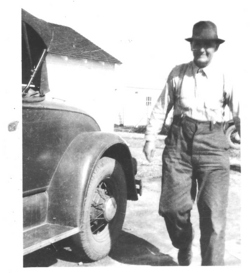
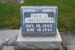
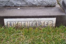
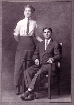
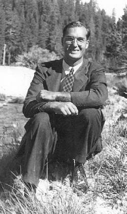
Frederick John Lingenfelter
| Birth | : | 19 Nov 1882 Hillsboro, Henry County, Iowa, USA |
| Death | : | 12 May 1941 Red Bluff, Tehama County, California, USA |
| Burial | : | Pleasant Grove Cemetery, Sigourney, Keokuk County, USA |
| Coordinate | : | 41.3405991, -92.2200012 |
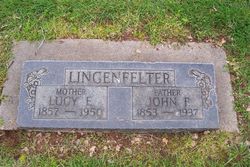
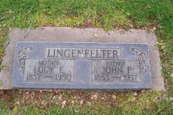
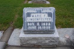
| Description | : | Born to John Francis and Lucy Emma (Mickelwait) Lingenfelter Married Marie Fennett McComb on December 15, 1911 in Keosaukua, Iowa. A farmer and carpenter by trade could do almost any thing he put his hand to. Had to leave Iowa on doctors orders because of the cold winters in which he kept getting pneumonia. Tried Colorado but ended up on Dibble Creek, Tehama County, California and made a living farming his and his father John Francis two properties. Irrigated with "one lunger" pumps from the creek and raised crops, orchards and livestock. He was survived by his wife;... Read More |
frequently asked questions (FAQ):
-
Where is Frederick John Lingenfelter's memorial?
Frederick John Lingenfelter's memorial is located at: Pleasant Grove Cemetery, Sigourney, Keokuk County, USA.
-
When did Frederick John Lingenfelter death?
Frederick John Lingenfelter death on 12 May 1941 in Red Bluff, Tehama County, California, USA
-
Where are the coordinates of the Frederick John Lingenfelter's memorial?
Latitude: 41.3405991
Longitude: -92.2200012
Family Members:
Parent
Spouse
Siblings
Children
Flowers:
Nearby Cemetories:
1. Pleasant Grove Cemetery
Sigourney, Keokuk County, USA
Coordinate: 41.3405991, -92.2200012
2. Sigourney East Cemetery
Sigourney, Keokuk County, USA
Coordinate: 41.3418999, -92.1992035
3. Clary Cemetery
Sigourney, Keokuk County, USA
Coordinate: 41.3589080, -92.2000090
4. County Home Cemetery
Sigourney, Keokuk County, USA
Coordinate: 41.3380013, -92.1770020
5. Conner Cemetery
Sigourney, Keokuk County, USA
Coordinate: 41.3050003, -92.2380981
6. Johnson Cemetery
Sigourney, Keokuk County, USA
Coordinate: 41.3824997, -92.2485962
7. Pennington Cemetery
Sigourney, Keokuk County, USA
Coordinate: 41.2769012, -92.2050018
8. Stoermer Cemetery
Keokuk County, USA
Coordinate: 41.3333449, -92.1335126
9. Sunny Ridge Cemetery
Sigourney, Keokuk County, USA
Coordinate: 41.3367004, -92.1311035
10. Walton Cemetery
Sigourney, Keokuk County, USA
Coordinate: 41.3583445, -92.1335126
11. Garrett Cemetery
Delta, Keokuk County, USA
Coordinate: 41.3368988, -92.3277969
12. Kensler Cemetery
Delta, Keokuk County, USA
Coordinate: 41.2994003, -92.3246994
13. Humes Cemetery
Thornburg, Keokuk County, USA
Coordinate: 41.4085999, -92.2968979
14. Garabaldi Cemetery
Sigourney, Keokuk County, USA
Coordinate: 41.3027800, -92.1111100
15. Saint Martin Evangelical Lutheran Cemetery
Keokuk County, USA
Coordinate: 41.4100075, -92.2971268
16. Doggett Cemetery
Keokuk County, USA
Coordinate: 41.2799988, -92.1306000
17. Bethel Cemetery
Delta, Keokuk County, USA
Coordinate: 41.2794000, -92.3107000
18. Pleasant Hill Cemetery
Webster, Keokuk County, USA
Coordinate: 41.4039001, -92.1224976
19. Trueblood Cemetery
Sigourney, Keokuk County, USA
Coordinate: 41.2583462, -92.1501798
20. Springfield Cemetery
Delta, Keokuk County, USA
Coordinate: 41.3386002, -92.3531036
21. Saint Josephs Cemetery
What Cheer, Keokuk County, USA
Coordinate: 41.4007988, -92.3300018
22. Old Bethel Cemetery
Keokuk County, USA
Coordinate: 41.3333452, -92.0835114
23. Bethel Methodist Cemetery
Sigourney, Keokuk County, USA
Coordinate: 41.3373000, -92.0825500
24. Highland Cemetery
What Cheer, Keokuk County, USA
Coordinate: 41.3936005, -92.3407974

