| Birth | : | 29 Jan 1927 Brunswick, Frederick County, Maryland, USA |
| Death | : | 11 Dec 2000 Leesburg, Loudoun County, Virginia, USA |
| Burial | : | Calvary Cemetery, West Conshohocken, Montgomery County, USA |
| Coordinate | : | 40.0616989, -75.3324966 |
| Plot | : | C094 |
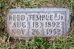
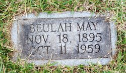
| Description | : | The Frederick Post (Frederick, MD), Wednesday, December 13, 2000 Mrs. Garnetta Irene Everhart, 73, of Lovettsville, Va., died Monday, Dec. 11 in Leesburg, Va. She was the wife of Charlie F. Everhart Sr, her husband of 51 years. Born Jan. 29, 1927 in Brunswick, she was a daughter of the late Reed T. II and Beulah M. Kidwiler Thompson. Mrs. Everhart was a truck driver. With her husband Charlie, she owned and operated C.E. Everhart Livestock Trucking of Lovettsville. She was a member of New Jerusalem Lutheran Church, Lovettsville. Surviving in addition to her husband are three children, Linda D. Everhart of Brunswick, Ruthlee Holler and... Read More |
frequently asked questions (FAQ):
-
Where is Garnetta Irene Thompson Everhart's memorial?
Garnetta Irene Thompson Everhart's memorial is located at: Calvary Cemetery, West Conshohocken, Montgomery County, USA.
-
When did Garnetta Irene Thompson Everhart death?
Garnetta Irene Thompson Everhart death on 11 Dec 2000 in Leesburg, Loudoun County, Virginia, USA
-
Where are the coordinates of the Garnetta Irene Thompson Everhart's memorial?
Latitude: 40.0616989
Longitude: -75.3324966
Family Members:
Parent
Spouse
Siblings
Children
Flowers:
Nearby Cemetories:
1. Calvary Cemetery
West Conshohocken, Montgomery County, USA
Coordinate: 40.0616989, -75.3324966
2. Gulph United Church of Christ Cemetery
West Conshohocken, Montgomery County, USA
Coordinate: 40.0610695, -75.3382263
3. Francisvale Home for Smaller Animals Pet Cemetery
Radnor, Delaware County, USA
Coordinate: 40.0615000, -75.3598000
4. Stoneleigh Pet Cemetery
Villanova, Delaware County, USA
Coordinate: 40.0409883, -75.3388156
5. Henderson Road Cemetery
King of Prussia, Montgomery County, USA
Coordinate: 40.0774155, -75.3537140
6. Saint Matthew's Roman Catholic Church Grounds
Conshohocken, Montgomery County, USA
Coordinate: 40.0751480, -75.3047092
7. Augustinian Community Cemetery
Villanova, Delaware County, USA
Coordinate: 40.0357000, -75.3424000
8. Saint Martins Episcopal Church Memorial Garden
Radnor, Delaware County, USA
Coordinate: 40.0472641, -75.3625488
9. Shrine to Life
Gladwyne, Montgomery County, USA
Coordinate: 40.0673080, -75.2944030
10. Saints Peter and Paul Ukrainian Catholic Cemetery
King of Prussia, Montgomery County, USA
Coordinate: 40.0847430, -75.3634250
11. Lower Merion Baptist Church Cemetery
Bryn Mawr, Montgomery County, USA
Coordinate: 40.0315900, -75.3144800
12. Old Saint Matthew Cemetery
Conshohocken, Montgomery County, USA
Coordinate: 40.0829964, -75.2970276
13. Harriton Family Cemetery
Bryn Mawr, Montgomery County, USA
Coordinate: 40.0303000, -75.3105000
14. Radnor United Methodist Church Cemetery
Bryn Mawr, Delaware County, USA
Coordinate: 40.0251160, -75.3364029
15. Episcopal Church of the Good Shepherd Columbarium
Rosemont, Montgomery County, USA
Coordinate: 40.0247540, -75.3261370
16. Bryn Mawr College Grounds
Bryn Mawr, Montgomery County, USA
Coordinate: 40.0268402, -75.3139572
17. Valley Forge Memorial Gardens
King of Prussia, Montgomery County, USA
Coordinate: 40.0821991, -75.3767014
18. Saint Matthew Cemetery
Conshohocken, Montgomery County, USA
Coordinate: 40.0876000, -75.2922000
19. Saint Benedict's Cemetery
Conshohocken, Montgomery County, USA
Coordinate: 40.0943985, -75.3013992
20. Radnor Friends Burial Ground
Radnor, Delaware County, USA
Coordinate: 40.0299416, -75.3653183
21. Saint Augustine Cemetery
King of Prussia, Montgomery County, USA
Coordinate: 40.0936012, -75.3664017
22. Old Swedes Christ Church Cemetery
Bridgeport, Montgomery County, USA
Coordinate: 40.1028786, -75.3272629
23. Saint Katharine of Siena Roman Catholic Church Grounds (Defunct)
Wayne, Delaware County, USA
Coordinate: 40.0434189, -75.3814678
24. Valley Forge Military Academy and College Memorial
Wayne, Delaware County, USA
Coordinate: 40.0549202, -75.3864288

