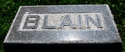
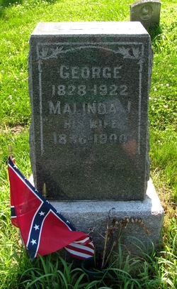
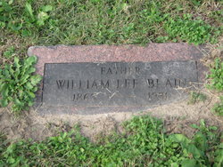
George Blain
| Birth | : | 7 May 1828 Kentucky, USA |
| Death | : | 30 Dec 1922 Fishing River Township, Ray County, Missouri, USA |
| Burial | : | Calvary Cemetery, Hankinson, Richland County, USA |
| Coordinate | : | 46.0586014, -96.9100037 |
| Plot | : | section 2 |
frequently asked questions (FAQ):
-
Where is George Blain's memorial?
George Blain's memorial is located at: Calvary Cemetery, Hankinson, Richland County, USA.
-
When did George Blain death?
George Blain death on 30 Dec 1922 in Fishing River Township, Ray County, Missouri, USA
-
Where are the coordinates of the George Blain's memorial?
Latitude: 46.0586014
Longitude: -96.9100037
Family Members:
Spouse
Children
Nearby Cemetories:
1. Calvary Cemetery
Hankinson, Richland County, USA
Coordinate: 46.0586014, -96.9100037
2. Hillside Cemetery
Hankinson, Richland County, USA
Coordinate: 46.0578003, -96.9100037
3. Saint Francis Convent Cemetery
Hankinson, Richland County, USA
Coordinate: 46.0625300, -96.9027100
4. United Cemetery
Hankinson, Richland County, USA
Coordinate: 46.0650139, -96.9093704
5. Coppin Cemetery
Hankinson, Richland County, USA
Coordinate: 46.0461006, -96.9460983
6. Immanuel Lutheran Cemetery
Hankinson, Richland County, USA
Coordinate: 46.0936012, -96.8869019
7. Saint Johns Cemetery
Richland County, USA
Coordinate: 46.1390620, -96.9167520
8. Trinity Cemetery
Great Bend, Richland County, USA
Coordinate: 46.1422005, -96.8039017
9. Tyson Cemetery
Richland County, USA
Coordinate: 45.9488983, -96.8664017
10. Zion United Methodist Cemetery
Great Bend, Richland County, USA
Coordinate: 46.1524600, -96.8028100
11. Calvary Cemetery
Mantador, Richland County, USA
Coordinate: 46.1678009, -96.9894028
12. Saint Josephs Cemetery
Richland County, USA
Coordinate: 46.1227989, -96.7433014
13. Immanuel Lutheran Cemetery
Lidgerwood, Richland County, USA
Coordinate: 46.0074100, -97.1163300
14. Bohemian Cemetery
Roberts County, USA
Coordinate: 45.9075012, -96.9458008
15. Saint Pauls Cemetery
Hammer, Roberts County, USA
Coordinate: 45.9211006, -97.0186005
16. Saint Nicholas Cemetery
Rosholt, Roberts County, USA
Coordinate: 45.9219000, -96.7986000
17. Pleasant View Cemetery
Lidgerwood, Richland County, USA
Coordinate: 46.0767500, -97.1361020
18. Thompson Cemetery
Roberts County, USA
Coordinate: 45.9068985, -96.9764023
19. Holy Cross Cemetery
Lidgerwood, Richland County, USA
Coordinate: 46.0759600, -97.1376420
20. Plains of Memory Cemetery
Roberts County, USA
Coordinate: 45.9066200, -96.9772100
21. Divet Farm Cemetery
Mooreton, Richland County, USA
Coordinate: 46.2181180, -96.8660410
22. Old Brandvold Cemetery
Roberts County, USA
Coordinate: 45.8932991, -96.8535995
23. Bohemian Cemetery
Lidgerwood, Richland County, USA
Coordinate: 46.0633011, -97.1556015
24. Saint Johns Cemetery
Lidgerwood, Richland County, USA
Coordinate: 46.0555992, -97.1564026

