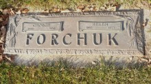
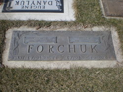
George Forchuk Sr.
| Birth | : | 12 Dec 1888 Ukraine |
| Death | : | 10 Dec 1980 Lethbridge, Lethbridge Census Division, Alberta, Canada |
| Burial | : | Archmount Cemetery, Lethbridge, Lethbridge Census Division, Canada |
| Coordinate | : | 49.7057900, -112.9017500 |
| Description | : | FORCHUK -Passed away in the city on Wednesday. December 10th. 1980.Mr.George Forchuk at the age of 91 years, of Parkland Nursing Home. Lethbridge. beloved husband of the late Mrs. Helen Forchuk. Born, raised and educated in Ihe Ukraine, the late Mr. Forchuk came to Canada in 1908 to Lethbridge. He worked as a miner and also farmed retiring in 1955 and has resided here until his passing, He was a very active outdoorsman. He is survived by three sons three daughters 24 grand-children. 35 great-grandchildren-one brotherLethbridge. Besides his beloved wife he was also predeceased by one brother John. The Funeral Service held on Friday, December 12th. 1980 with... Read More |
frequently asked questions (FAQ):
-
Where is George Forchuk Sr.'s memorial?
George Forchuk Sr.'s memorial is located at: Archmount Cemetery, Lethbridge, Lethbridge Census Division, Canada.
-
When did George Forchuk Sr. death?
George Forchuk Sr. death on 10 Dec 1980 in Lethbridge, Lethbridge Census Division, Alberta, Canada
-
Where are the coordinates of the George Forchuk Sr.'s memorial?
Latitude: 49.7057900
Longitude: -112.9017500
Family Members:
Spouse
Children
Flowers:
Nearby Cemetories:
1. Archmount Cemetery
Lethbridge, Lethbridge Census Division, Canada
Coordinate: 49.7057900, -112.9017500
2. Indian Battle Park
Lethbridge, Lethbridge Census Division, Canada
Coordinate: 49.6928200, -112.8582900
3. Saint Patrick's Cemetery
Lethbridge, Lethbridge Census Division, Canada
Coordinate: 49.7084618, -112.8428726
4. Mountain View Cemetery
Lethbridge, Lethbridge Census Division, Canada
Coordinate: 49.6800385, -112.8297729
5. Royal View Memorial Cemetery
Lethbridge, Lethbridge Census Division, Canada
Coordinate: 49.7518540, -112.8242250
6. Diamond City Cemetery
Diamond City, Lethbridge Census Division, Canada
Coordinate: 49.7979150, -112.8326800
7. Monarch Cemetery
Monarch, Lethbridge Census Division, Canada
Coordinate: 49.8020980, -113.0953220
8. Picture Butte Memorial Cemetery
Picture Butte, Lethbridge Census Division, Canada
Coordinate: 49.8671600, -112.7760500
9. Coaldale Community Cemetery
Coaldale, Lethbridge Census Division, Canada
Coordinate: 49.7355600, -112.6242300
10. Coaldale Mennonite Cemetery
Coaldale, Lethbridge Census Division, Canada
Coordinate: 49.7355600, -112.6242300
11. Nobleford Monarch Cemetery
Nobleford, Lethbridge Census Division, Canada
Coordinate: 49.8456500, -113.0942100
12. Wilson Siding Hutterite Cemetery
Wilson, Lethbridge Census Division, Canada
Coordinate: 49.6203914, -112.5781130
13. Orton Cemetery
Orton, Claresholm Census Division, Canada
Coordinate: 49.7484600, -113.2540900
14. Huntsville Cemetery
Iron Springs, Lethbridge Census Division, Canada
Coordinate: 49.9028100, -112.6886100
15. Albion Ridge Cemetery
Barons, Lethbridge Census Division, Canada
Coordinate: 49.9598350, -112.9169650
16. Temple Hill Cemetery
Raymond, Lethbridge Census Division, Canada
Coordinate: 49.4916300, -112.6605200
17. White Lake Cemetery
Nobleford, Lethbridge Census Division, Canada
Coordinate: 49.9018700, -113.2107750
18. White Lake Hutterite Cemetery
Nobleford, Lethbridge Census Division, Canada
Coordinate: 49.9154153, -113.2084160
19. Keho Lake Hutterite Cemetery
Barons, Lethbridge Census Division, Canada
Coordinate: 49.9891594, -113.0160634
20. Barons Cemetery
Barons, Lethbridge Census Division, Canada
Coordinate: 49.9756500, -113.0993100
21. Stirling Cemetery
Stirling, Lethbridge Census Division, Canada
Coordinate: 49.5093400, -112.5380000
22. Magrath Cemetery
Magrath, Claresholm Census Division, Canada
Coordinate: 49.3985700, -112.8648700
23. Holy Cross Cemetery
Fort Macleod, Claresholm Census Division, Canada
Coordinate: 49.7283000, -113.3882400
24. Union Cemetery
Fort Macleod, Claresholm Census Division, Canada
Coordinate: 49.7306500, -113.3882000

