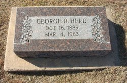
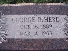
George Robert Herd
| Birth | : | 16 Oct 1889 Charity, Dallas County, Missouri, USA |
| Death | : | 4 Mar 1963 Protection, Comanche County, Kansas, USA |
| Burial | : | Tadcaster Cemetery, Tadcaster, Selby District, England |
| Coordinate | : | 53.8808880, -1.2727280 |
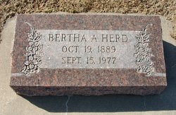
| Description | : | George Robert Herd, 73, farmer died Monday evening following a heart attack. He was born October 16, 1889, at Charity, Mo., and married Bertha Agnes Harmon May 5, 1909. The couple moved to Protection in 1915. |
frequently asked questions (FAQ):
-
Where is George Robert Herd's memorial?
George Robert Herd's memorial is located at: Tadcaster Cemetery, Tadcaster, Selby District, England.
-
When did George Robert Herd death?
George Robert Herd death on 4 Mar 1963 in Protection, Comanche County, Kansas, USA
-
Where are the coordinates of the George Robert Herd's memorial?
Latitude: 53.8808880
Longitude: -1.2727280
Family Members:
Parent
Spouse
Siblings
Children
Flowers:
Nearby Cemetories:
1. Tadcaster Cemetery
Tadcaster, Selby District, England
Coordinate: 53.8808880, -1.2727280
2. Inghamite Chapel
Tadcaster, Selby District, England
Coordinate: 53.8843580, -1.2644470
3. St Mary the Virgin Churchyard
Tadcaster, Selby District, England
Coordinate: 53.8852300, -1.2624100
4. St. Andrew’s Churchyard
Newton Kyme, Selby District, England
Coordinate: 53.8979400, -1.2924300
5. St John the Baptist Churchyard
Kirkby Wharfe, Selby District, England
Coordinate: 53.8627400, -1.2320400
6. Healaugh Priory
Healaugh, Selby District, England
Coordinate: 53.9110440, -1.2624190
7. St John the Baptist Churchyard Extension
Kirkby Wharfe, Selby District, England
Coordinate: 53.8602100, -1.2321200
8. All Saints Churchyard
Wighill, Harrogate Borough, England
Coordinate: 53.9132230, -1.2806050
9. St Leonard Chapelyard
Hazelwood, Selby District, England
Coordinate: 53.8523700, -1.3185500
10. St. Edward King and Confessor Churchyard
Clifford, Metropolitan Borough of Leeds, England
Coordinate: 53.8934000, -1.3467000
11. All Saints Churchyard
Thorp Arch, Metropolitan Borough of Leeds, England
Coordinate: 53.9089160, -1.3349410
12. All Saints Churchyard
Bramham, Metropolitan Borough of Leeds, England
Coordinate: 53.8815900, -1.3514900
13. St John the Baptist Churchyard
Healaugh, Selby District, England
Coordinate: 53.9249590, -1.2424500
14. All Saints Churchyard
Bolton Percy, Selby District, England
Coordinate: 53.8649780, -1.1929000
15. All Saints Churchyard
Saxton, Selby District, England
Coordinate: 53.8261760, -1.2787060
16. St Peter Churchyard
Walton, Metropolitan Borough of Leeds, England
Coordinate: 53.9245200, -1.3297000
17. St James Churchyard
Bilbrough, Selby District, England
Coordinate: 53.9119110, -1.1945130
18. St Paul Churchyard
Colton, Selby District, England
Coordinate: 53.8964660, -1.1773770
19. Boston Spa Methodist Churchyard
Boston Spa, Metropolitan Borough of Leeds, England
Coordinate: 53.9066000, -1.3616010
20. Holy Trinity Churchyard
Barkston Ash, Selby District, England
Coordinate: 53.8189530, -1.2547620
21. St Mary the Virgin Churchyard
Church Fenton, Selby District, England
Coordinate: 53.8243100, -1.2203500
22. St Helen Churchyard
Bilton, Harrogate Borough, England
Coordinate: 53.9474910, -1.2761090
23. St. Ricarius Churchyard
Aberford, Metropolitan Borough of Leeds, England
Coordinate: 53.8287190, -1.3435890
24. Lotherton Hall Chapel
Leeds, Metropolitan Borough of Leeds, England
Coordinate: 53.8186380, -1.3189740

