
| Birth | : | 13 May 1934 Leon, Decatur County, Iowa, USA |
| Death | : | 4 Feb 2001 Newell, Buena Vista County, Iowa, USA |
| Burial | : | Newell Cemetery, Newell, Buena Vista County, USA |
| Coordinate | : | 42.6123800, -94.9994800 |
| Description | : | Geri, the daughter of Floyd and Helen (Boyd) Martindale, was born May 13, 1934, in Leon. She graduated from Guthrie Center High School and went on to earn an associate of arts degree from Sioux Empire College in Hawarden. On April 4, 1953, she was united in marriage to Richard L. Nesbitt in Earlham. The couple lived in Charles City, Pocahontas and Newell. Mrs. Nesbitt worked at the family floral business in Pocahontas and then at Groundswell Direct in Albert City. She was a member of Nain Lutheran Church and the Republican party. She enjoyed crafts, reading, politics, interior decorating and helping... Read More |
frequently asked questions (FAQ):
-
Where is Gerada Mae “Geri” Martindale Nesbitt's memorial?
Gerada Mae “Geri” Martindale Nesbitt's memorial is located at: Newell Cemetery, Newell, Buena Vista County, USA.
-
When did Gerada Mae “Geri” Martindale Nesbitt death?
Gerada Mae “Geri” Martindale Nesbitt death on 4 Feb 2001 in Newell, Buena Vista County, Iowa, USA
-
Where are the coordinates of the Gerada Mae “Geri” Martindale Nesbitt's memorial?
Latitude: 42.6123800
Longitude: -94.9994800
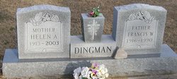
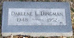
Family Members:
Parent
Siblings
Flowers:


Nearby Cemetories:
1. Newell Cemetery
Newell, Buena Vista County, USA
Coordinate: 42.6123800, -94.9994800
2. Newell Catholic Prairie Cemetery
Newell, Buena Vista County, USA
Coordinate: 42.6144000, -95.0328000
3. Donna Lynn Salis-Christensen Burial Plot
Newell, Buena Vista County, USA
Coordinate: 42.5882134, -95.0544960
4. Varina Cemetery
Newell Township, Buena Vista County, USA
Coordinate: 42.6539993, -94.9339981
5. Saint Johns Church Of Christ Cemetery
Storm Lake, Buena Vista County, USA
Coordinate: 42.7108002, -95.0428009
6. Saint John's Lutheran Cemetery
Albert City, Buena Vista County, USA
Coordinate: 42.7200920, -94.9947630
7. Zion Lutheran Cemetery
Storm Lake, Buena Vista County, USA
Coordinate: 42.7136002, -95.0650024
8. Saint Columbkilles Cemetery
Varina, Pocahontas County, USA
Coordinate: 42.6467018, -94.8443985
9. Nemaha Cemetery
Nemaha, Sac County, USA
Coordinate: 42.5102997, -95.0905991
10. Cedar Township Cemetery
Fonda, Pocahontas County, USA
Coordinate: 42.5810000, -94.8375000
11. Saint Mary's Catholic Cemetery
Storm Lake, Buena Vista County, USA
Coordinate: 42.6470000, -95.1660000
12. Mount Zion Cemetery
Fonda, Pocahontas County, USA
Coordinate: 42.5821991, -94.8300018
13. Storm Lake Cemetery
Storm Lake, Buena Vista County, USA
Coordinate: 42.6352800, -95.1744400
14. Dover Township Cemetery
Varina, Pocahontas County, USA
Coordinate: 42.6896100, -94.8524200
15. Lincoln Township Cemetery
Buena Vista County, USA
Coordinate: 42.7413000, -95.1282000
16. Fairfield Cemetery
Albert City, Buena Vista County, USA
Coordinate: 42.7783012, -94.9692001
17. Saint John Cemetery
Williams Township, Calhoun County, USA
Coordinate: 42.4747009, -94.8672028
18. Marshall Cemetery
Pocahontas County, USA
Coordinate: 42.7633018, -94.8930969
19. Buena Vista Memorial Park Cemetery
Storm Lake, Buena Vista County, USA
Coordinate: 42.6539001, -95.2339020
20. Cedar Cemetery
Sac City, Sac County, USA
Coordinate: 42.4430000, -94.9110000
21. Sacred Heart Cemetery
Early, Sac County, USA
Coordinate: 42.4650002, -95.1446991
22. Immanuel Reformed Cemetery
Schaller, Sac County, USA
Coordinate: 42.5396996, -95.2294006
23. Oakland Cemetery
Sac City, Sac County, USA
Coordinate: 42.4272100, -94.9910760
24. Early Union Cemetery
Early, Sac County, USA
Coordinate: 42.4578018, -95.1425018