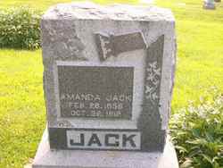
| Birth | : | 6 May 1879 Whiting, Jackson County, Kansas, USA |
| Death | : | 15 Feb 1945 Marysville, Marshall County, Kansas, USA |
| Burial | : | Free Protestant Church Cemetery, Graaff-Reinet, Sarah Baartman District Municipality, South Africa |
| Coordinate | : | -32.2521830, 24.5294330 |
| Description | : | Son of Robert Perry Jack and Amanda Dardin Campbell Jack, he was probably born in Washington Twp, Adair County, IA although there is some confusion that he may have been born in Kansas, as some of the census records indicate this. He lived most of his life as a farmer between Kansas and Iowa. He was previously married to Grace Merritt from Mills Co., Iowa. He had an adopted son Roy Bowman born about 1908, but his whereabouts were unknown at the time of Gerald's death. Obituary: Gerald Ellsworth Jack, 65, died Thursday, February 15, at... Read More |
frequently asked questions (FAQ):
-
Where is Gerald Elsworth Jack's memorial?
Gerald Elsworth Jack's memorial is located at: Free Protestant Church Cemetery, Graaff-Reinet, Sarah Baartman District Municipality, South Africa.
-
When did Gerald Elsworth Jack death?
Gerald Elsworth Jack death on 15 Feb 1945 in Marysville, Marshall County, Kansas, USA
-
Where are the coordinates of the Gerald Elsworth Jack's memorial?
Latitude: -32.2521830
Longitude: 24.5294330
Family Members:
Parent
Siblings
Flowers:
Nearby Cemetories:
1. Free Protestant Church Cemetery
Graaff-Reinet, Sarah Baartman District Municipality, South Africa
Coordinate: -32.2521830, 24.5294330
2. Klipplaat 422_1 Farm Cemetery
Chris Hani District Municipality, South Africa
Coordinate: -32.1645170, 25.0019830
3. Jewish Cemetery
Aberdeen, Sarah Baartman District Municipality, South Africa
Coordinate: -32.4794829, 24.0603082
4. Aberdeen Cemetery
Aberdeen, Sarah Baartman District Municipality, South Africa
Coordinate: -32.4791800, 24.0589900
5. Thembalesizwe Cemetery
Aberdeen, Sarah Baartman District Municipality, South Africa
Coordinate: -32.4835507, 24.0577396
6. Schuil Hoek 242 Farm Cemetery
Chris Hani District Municipality, South Africa
Coordinate: -32.0897830, 25.1122670
7. Klipkraal 101 Farm Cemetery
Cradock, Chris Hani District Municipality, South Africa
Coordinate: -32.0337330, 25.2010830
8. Samekoms 392 Farm Cemetery
Chris Hani District Municipality, South Africa
Coordinate: -32.1795000, 25.2767500
9. Murraysburg Cemetery
Murraysburg, Central Karoo District Municipality, South Africa
Coordinate: -31.9647690, 23.7572300
10. Groote Vlakte 536 Farm Cemetery
Chris Hani District Municipality, South Africa
Coordinate: -32.3481170, 25.4495000
11. Mountain Zebra National Park
Cradock, Chris Hani District Municipality, South Africa
Coordinate: -32.1406506, 25.5096873
12. Middelburg Old Cemetery
Middelburg (Inxuba Yethemba), Chris Hani District Municipality, South Africa
Coordinate: -31.4925555, 25.0084341
13. Kingsway Cemetery
Middelburg (Inxuba Yethemba), Chris Hani District Municipality, South Africa
Coordinate: -31.4731520, 25.0285650
14. Cradock Municipal Cemetery
Cradock, Chris Hani District Municipality, South Africa
Coordinate: -32.1713260, 25.6126930
15. Buffelshoek
Cradock, Chris Hani District Municipality, South Africa
Coordinate: -32.1735500, 25.6178800
16. Richmond Old Cemetery
Richmond, Pixley ka Seme District Municipality, South Africa
Coordinate: -31.4170200, 23.9461100
17. NG Kerk - Rickmond Kerkhof
Richmond, Pixley ka Seme District Municipality, South Africa
Coordinate: -31.4132170, 23.9466500
18. Richmond Cemetery
Richmond, Pixley ka Seme District Municipality, South Africa
Coordinate: -31.4183579, 23.9344954
19. NG Kerk - Richmond New Cemetery
Richmond, Pixley ka Seme District Municipality, South Africa
Coordinate: -31.4173433, 23.9346223
20. NG Kerk - Somerset-Oos Muur van Herinnering
Somerset East, Sarah Baartman District Municipality, South Africa
Coordinate: -32.7196470, 25.5859480
21. Kwazamuxolo Cemetery
Noupoort, Pixley ka Seme District Municipality, South Africa
Coordinate: -31.1956830, 24.9598933
22. Shadrick Street Cemetery
Noupoort, Pixley ka Seme District Municipality, South Africa
Coordinate: -31.1945300, 24.9559600
23. Jakaranda Street Cemetery
Noupoort, Pixley ka Seme District Municipality, South Africa
Coordinate: -31.1884127, 24.9445400
24. Noupoort Old Cemetery
Noupoort, Pixley ka Seme District Municipality, South Africa
Coordinate: -31.1864418, 24.9522526


