Geraldean “Gerry” Sharp Dahl
| Birth | : | 21 Nov 1941 Konawa, Seminole County, Oklahoma, USA |
| Death | : | 30 Aug 2013 Ames, Story County, Iowa, USA |
| Burial | : | Glenwood Cemetery, Ogden, Boone County, USA |
| Coordinate | : | 42.0340000, -94.0440000 |
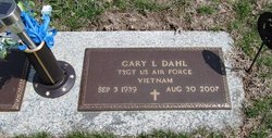
| Description | : | Geraldean "Gerry" Kahl, 71, of Boone, Iowa, passed away on Friday, August 30, 2013, at the Israel Family Hospice House in Ames. Geraldean Sharp was born on November 21, 1941, in Konawa, Oklahoma, the daughter of Gerald and Letha(Bullington)Sharp. She attended Palo Alto High School in Amarillo, Tesas. On December 22, 1959, Gerry was united in marriage to Gary Lee Dahl in Boone. To this union two children were born: Elizabeth and Richard. Gerry was a military wife while Gary served in the United States Air Force. During that time she lived in Indiana, Texas, California, and Nebraska, before the couple... Read More |
frequently asked questions (FAQ):
-
Where is Geraldean “Gerry” Sharp Dahl's memorial?
Geraldean “Gerry” Sharp Dahl's memorial is located at: Glenwood Cemetery, Ogden, Boone County, USA.
-
When did Geraldean “Gerry” Sharp Dahl death?
Geraldean “Gerry” Sharp Dahl death on 30 Aug 2013 in Ames, Story County, Iowa, USA
-
Where are the coordinates of the Geraldean “Gerry” Sharp Dahl's memorial?
Latitude: 42.0340000
Longitude: -94.0440000
Family Members:
Spouse
Flowers:
Nearby Cemetories:
1. Glenwood Cemetery
Ogden, Boone County, USA
Coordinate: 42.0340000, -94.0440000
2. Saint Johns Catholic Cemetery
Ogden, Boone County, USA
Coordinate: 42.0344000, -94.0407000
3. Maple Grove Cemetery
Boxholm, Boone County, USA
Coordinate: 42.0793690, -94.0859890
4. Swede Valley Lutheran Church Cemetery
Ogden, Boone County, USA
Coordinate: 41.9770000, -94.0285000
5. Maas Cemetery
Boone County, USA
Coordinate: 42.0908012, -94.0618973
6. Bluff Creek Cemetery
Boone, Boone County, USA
Coordinate: 42.0774994, -93.9796982
7. Grand Ridge Cemetery
Beaver, Boone County, USA
Coordinate: 42.0786018, -94.1157990
8. Hollaway Cemetery
Moingona, Boone County, USA
Coordinate: 42.0138720, -93.9530080
9. Quincy Cemetery
Boone, Boone County, USA
Coordinate: 42.0074997, -93.9503021
10. Beaver Cemetery
Beaver, Boone County, USA
Coordinate: 42.0462000, -94.1446000
11. Rose Hill Cemetery
Boone, Boone County, USA
Coordinate: 42.0419006, -93.9408035
12. Oakwood Cemetery
Moingona, Boone County, USA
Coordinate: 42.0219002, -93.9396973
13. Sacred Heart Cemetery
Boone, Boone County, USA
Coordinate: 42.0485992, -93.9163971
14. Boone Memorial Gardens Cemetery
Boone, Boone County, USA
Coordinate: 42.0449982, -93.9152985
15. Biblical College Cemetery
Boone, Boone County, USA
Coordinate: 42.0456009, -93.9113998
16. Buckley Cemetery
Boone, Boone County, USA
Coordinate: 42.0999810, -93.9418960
17. Pleasant Hill Cemetery
Boone, Boone County, USA
Coordinate: 41.9618988, -93.9492035
18. Hickory Grove Cemetery
Boone County, USA
Coordinate: 42.1074982, -93.9507980
19. Union Cemetery
Boxholm, Boone County, USA
Coordinate: 42.1369019, -94.0852966
20. Sparks Cemetery
Boone County, USA
Coordinate: 41.9728012, -93.9191971
21. David Peoples Cemetery
Boone, Boone County, USA
Coordinate: 41.9210014, -94.0179977
22. Latham Cemetery
Boone, Boone County, USA
Coordinate: 42.0489006, -93.8878021
23. Linwood Park Cemetery
Boone, Boone County, USA
Coordinate: 42.0550003, -93.8850021
24. Renner Cemetery
Boone County, USA
Coordinate: 42.1380420, -94.1256570


