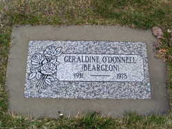
Geraldine Ann Beargeon O'Donnell
| Birth | : | 26 Jan 1931 Entiat, Chelan County, Washington, USA |
| Death | : | 7 Jan 1978 Brewster, Okanogan County, Washington, USA |
| Burial | : | Saint Andrews Cemetery, New Gairloch, Pictou County, Canada |
| Coordinate | : | 45.4796300, -62.8168200 |
| Plot | : | North Fraternal Row48 STBLK47 LN5 |
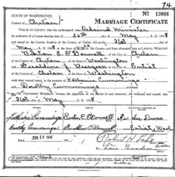
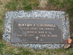
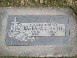
| Description | : | Geraldine J. O'Donnell, 46, Chelan, died Saturday in a Brewster hospital, following an extended illness. Born Geraldind Beargeon, Jan. 26, 1931, at Entiat, she spent her early life here. On May 21, 1948, she married Burton O'Donnell at Entiat. Since her marriage, she has lived in Chelan for the past 21 years. Survivors include her husband, at eh home; two sons, Larry O'Donnell, Chelan, and Timothy O'Donnell, Great Falls, Mont.; one daughter, Debra O'Donnell, Chelan; four sisters, Athie Kingsbury, Grover City, Calif.; Ruth Cox, Wenatchee; Pansy Hurd, Libby, Mont., and Barbara Hartl, Chelan; two brothers, Glen Beargeon, Fremont, Calif.; and... Read More |
frequently asked questions (FAQ):
-
Where is Geraldine Ann Beargeon O'Donnell's memorial?
Geraldine Ann Beargeon O'Donnell's memorial is located at: Saint Andrews Cemetery, New Gairloch, Pictou County, Canada.
-
When did Geraldine Ann Beargeon O'Donnell death?
Geraldine Ann Beargeon O'Donnell death on 7 Jan 1978 in Brewster, Okanogan County, Washington, USA
-
Where are the coordinates of the Geraldine Ann Beargeon O'Donnell's memorial?
Latitude: 45.4796300
Longitude: -62.8168200
Family Members:
Parent
Spouse
Siblings
Flowers:
Nearby Cemetories:
1. Saint Andrews Cemetery
New Gairloch, Pictou County, Canada
Coordinate: 45.4796300, -62.8168200
2. Birch Hill Cemetery
Rocklin, Pictou County, Canada
Coordinate: 45.4967575, -62.7836800
3. Millbrook Cemetery
Millbrook, Pictou County, Canada
Coordinate: 45.5188400, -62.8083400
4. Beaton Cemetery
Millbrook, Pictou County, Canada
Coordinate: 45.5210800, -62.7876300
5. Baillie Cemetery
Salt Springs, Pictou County, Canada
Coordinate: 45.5159700, -62.8769400
6. Marshdale Cemetery
Marshdale, Pictou County, Canada
Coordinate: 45.4498700, -62.7451300
7. Stewart Cemetery
West River Station, Pictou County, Canada
Coordinate: 45.4488600, -62.8900300
8. Gray Road Cemetery
Union Centre, Pictou County, Canada
Coordinate: 45.5244800, -62.7529600
9. Union Centre Pioneer Cemetery
Union Centre, Pictou County, Canada
Coordinate: 45.5275200, -62.7554700
10. Hill-Watervale Cemetery
Watervale, Pictou County, Canada
Coordinate: 45.4671400, -62.9080100
11. Oak Grove Cemetery
Salt Springs, Pictou County, Canada
Coordinate: 45.5347222, -62.8853889
12. Forest Hill Cemetery
Westville, Pictou County, Canada
Coordinate: 45.5431600, -62.7616800
13. Caledonia Cemetery
Salt Springs, Pictou County, Canada
Coordinate: 45.5439200, -62.8755200
14. Ebenezer Cemetery
Salt Springs, Pictou County, Canada
Coordinate: 45.5338100, -62.8960600
15. Hopewell Cemetery
Pictou County, Canada
Coordinate: 45.4858100, -62.7024000
16. MacLeod Cemetery
Fox Brook, Pictou County, Canada
Coordinate: 45.5206111, -62.7106667
17. Lorne Cemetery
Lorne, Pictou County, Canada
Coordinate: 45.4198500, -62.7281100
18. Saint Columba Cemetery
Hopewell, Pictou County, Canada
Coordinate: 45.4591100, -62.6916500
19. Highfield-Johnny Whiskey Cemetery
Westville, Pictou County, Canada
Coordinate: 45.5392100, -62.7196600
20. Stillman Cemetery
Stillman, Pictou County, Canada
Coordinate: 45.5569300, -62.8841000
21. MacLean Cemetery
Hopewell, Pictou County, Canada
Coordinate: 45.4616700, -62.6882100
22. Elgin Pioneer Cemetery
Elgin, Pictou County, Canada
Coordinate: 45.4610200, -62.6878200
23. St Bee’s Cemetery
Westville, Pictou County, Canada
Coordinate: 45.5614800, -62.7314200
24. Riverton Cemetery
Riverton, Pictou County, Canada
Coordinate: 45.5148690, -62.6811860

