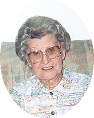
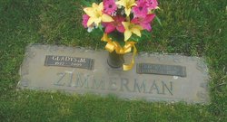
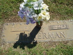
Gladys Schlyter Zimmerman
| Birth | : | 10 Jul 1917 Platte County, Nebraska, USA |
| Death | : | 26 Aug 2009 Columbus, Platte County, Nebraska, USA |
| Burial | : | Fisher Cemetery, Weston, Lewis County, USA |
| Coordinate | : | 39.0331001, -80.5239029 |
| Description | : | Daughter of Phillip & Evalyn (Long) Schlyter. She graduated from St. Edward High School in 1934 and attended Kearney State College where she received her teaching certificate. Gladys was united in marriage to Edward Zimmerman on September 8, 1936, in St. Edward, Nebraska. They farmed in the St. Edward area until 1946 when they moved to Columbus. Gladys was a school teacher, worked as a clerk in the Coast-to-Coast store, and a secretary at the First United Methodist Church. Upon her retirement, Gladys spent her days reading, especially her bible, working crossword puzzles, watching baseball games, and spending time with... Read More |
frequently asked questions (FAQ):
-
Where is Gladys Schlyter Zimmerman's memorial?
Gladys Schlyter Zimmerman's memorial is located at: Fisher Cemetery, Weston, Lewis County, USA.
-
When did Gladys Schlyter Zimmerman death?
Gladys Schlyter Zimmerman death on 26 Aug 2009 in Columbus, Platte County, Nebraska, USA
-
Where are the coordinates of the Gladys Schlyter Zimmerman's memorial?
Latitude: 39.0331001
Longitude: -80.5239029
Family Members:
Parent
Spouse
Siblings
Flowers:
Nearby Cemetories:
1. Fisher Cemetery
Weston, Lewis County, USA
Coordinate: 39.0331001, -80.5239029
2. Waldeck Cemetery
Waldeck, Lewis County, USA
Coordinate: 39.0486860, -80.5095950
3. Middle Run Cemetery
Weston, Lewis County, USA
Coordinate: 39.0149994, -80.5081024
4. Harrison Grove Cemetery
Lewis County, USA
Coordinate: 39.0107994, -80.5586014
5. Ward Cemetery
Lewis County, USA
Coordinate: 38.9975860, -80.5051990
6. Henry Cemetery
Camden, Lewis County, USA
Coordinate: 39.0292350, -80.5751540
7. Weston State Hospital Cemetery
Weston, Lewis County, USA
Coordinate: 39.0395050, -80.4727760
8. Brownsville Cemetery
Lewis County, USA
Coordinate: 39.0163994, -80.4756012
9. Old Arnold Cemetery
Weston, Lewis County, USA
Coordinate: 39.0350120, -80.4693550
10. Machpelah Cemetery
Weston, Lewis County, USA
Coordinate: 39.0475400, -80.4640760
11. Dutch Hollow Road Cemetery
Lewis County, USA
Coordinate: 39.0730330, -80.4860520
12. Rockford-Pletcher Cemetery (Defunct)
Lewis County, USA
Coordinate: 38.9817009, -80.4963989
13. Bailey Cemetery
Weston, Lewis County, USA
Coordinate: 38.9759270, -80.5286020
14. Freemansburg Baptist Cemetery
Freemansburg, Lewis County, USA
Coordinate: 39.0903750, -80.5290080
15. Freemansburg United Methodist Church Cemetery
Freemansburg, Lewis County, USA
Coordinate: 39.0913030, -80.5290410
16. Gee Lick Cemetery
Weston, Lewis County, USA
Coordinate: 39.0787170, -80.4761610
17. Butcher Cemetery
Turnertown, Lewis County, USA
Coordinate: 39.0727997, -80.4614029
18. Snyder Cemetery
Churchville, Lewis County, USA
Coordinate: 39.0918312, -80.5624847
19. Saint Bernard Church Cemetery
Weston, Lewis County, USA
Coordinate: 38.9928000, -80.5926940
20. Oak Grove Cemetery
Lewis County, USA
Coordinate: 38.9641390, -80.5326100
21. Mount Morris Cemetery
Freemansburg, Lewis County, USA
Coordinate: 39.1066510, -80.5128230
22. Smith Family Cemetery
Lewis County, USA
Coordinate: 39.0457993, -80.4297028
23. Beech Grove Cemetery
Weston, Lewis County, USA
Coordinate: 39.1070170, -80.5141540
24. Jackson Cemetery
Jackson Mill, Lewis County, USA
Coordinate: 39.0974998, -80.4705963


