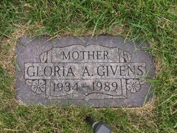
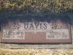
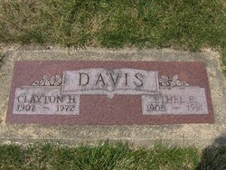
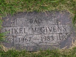
Gloria Ann Davis Givens
| Birth | : | 30 May 1934 |
| Death | : | Mar 1989 |
| Burial | : | Boone Memorial Gardens Cemetery, Boone, Boone County, USA |
| Coordinate | : | 42.0449982, -93.9152985 |
| Description | : | In 1940 she lived with her parents and two brothers in a house they owned at 635 Wells Street in Burton, MI. Their home was valued at $1000. Her father worked in the metal department of an auto plant, with an income in 1939 of $1500 for 40 weeks of work. Her brother Jimmy worked delivering city papers on a paper route. |
frequently asked questions (FAQ):
-
Where is Gloria Ann Davis Givens's memorial?
Gloria Ann Davis Givens's memorial is located at: Boone Memorial Gardens Cemetery, Boone, Boone County, USA.
-
When did Gloria Ann Davis Givens death?
Gloria Ann Davis Givens death on Mar 1989 in
-
Where are the coordinates of the Gloria Ann Davis Givens's memorial?
Latitude: 42.0449982
Longitude: -93.9152985
Family Members:
Parent
Spouse
Siblings
Children
Flowers:
Nearby Cemetories:
1. Boone Memorial Gardens Cemetery
Boone, Boone County, USA
Coordinate: 42.0449982, -93.9152985
2. Biblical College Cemetery
Boone, Boone County, USA
Coordinate: 42.0456009, -93.9113998
3. Sacred Heart Cemetery
Boone, Boone County, USA
Coordinate: 42.0485992, -93.9163971
4. Rose Hill Cemetery
Boone, Boone County, USA
Coordinate: 42.0419006, -93.9408035
5. Latham Cemetery
Boone, Boone County, USA
Coordinate: 42.0489006, -93.8878021
6. Linwood Park Cemetery
Boone, Boone County, USA
Coordinate: 42.0550003, -93.8850021
7. Oakwood Cemetery
Moingona, Boone County, USA
Coordinate: 42.0219002, -93.9396973
8. Sarah Dinwoodie Cemetery
Worth Township, Boone County, USA
Coordinate: 42.0278000, -93.8697000
9. Hollaway Cemetery
Moingona, Boone County, USA
Coordinate: 42.0138720, -93.9530080
10. Quincy Cemetery
Boone, Boone County, USA
Coordinate: 42.0074997, -93.9503021
11. Bass Point Cemetery
Boone, Boone County, USA
Coordinate: 42.0992012, -93.8957977
12. Bluff Creek Cemetery
Boone, Boone County, USA
Coordinate: 42.0774994, -93.9796982
13. Buckley Cemetery
Boone, Boone County, USA
Coordinate: 42.0999810, -93.9418960
14. Squire Boone Cemetery
Luther, Boone County, USA
Coordinate: 42.0032997, -93.8531036
15. Hickory Grove Cemetery
Boone County, USA
Coordinate: 42.1074982, -93.9507980
16. Sparks Cemetery
Boone County, USA
Coordinate: 41.9728012, -93.9191971
17. Pleasant Hill Cemetery
Boone, Boone County, USA
Coordinate: 41.9618988, -93.9492035
18. Hull Cemetery
Luther, Boone County, USA
Coordinate: 41.9603004, -93.8664017
19. Saint Johns Catholic Cemetery
Ogden, Boone County, USA
Coordinate: 42.0344000, -94.0407000
20. Glenwood Cemetery
Ogden, Boone County, USA
Coordinate: 42.0340000, -94.0440000
21. Swede Valley Lutheran Church Cemetery
Ogden, Boone County, USA
Coordinate: 41.9770000, -94.0285000
22. Schlicht Cemetery
Fraser, Boone County, USA
Coordinate: 42.1444200, -93.9780100
23. Boone County Poor Farm Cemetery
Boone County, USA
Coordinate: 42.1591100, -93.9159000
24. Maas Cemetery
Boone County, USA
Coordinate: 42.0908012, -94.0618973


