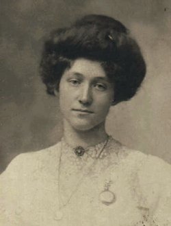
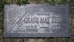
Grace May Smith Bird
| Birth | : | 5 Jul 1885 Centerville, Klickitat County, Washington, USA |
| Death | : | 15 May 1971 Roswell, Chaves County, New Mexico, USA |
| Burial | : | Saint Francis Xavier Cemetery, Seward, Stafford County, USA |
| Coordinate | : | 38.2038994, -98.8193970 |
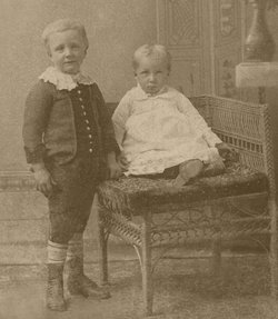
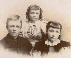
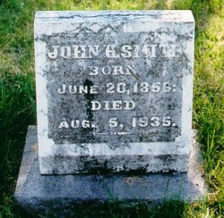
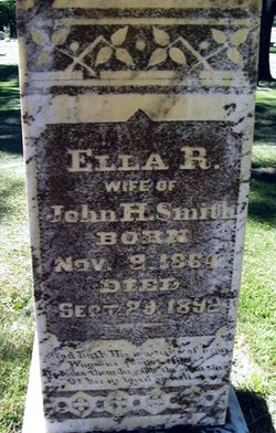
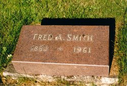
| Description | : | Grace was the daughter of John Henry & Ella Rebecca (Sparks) Smith. Grace and her sister, Edna, had a double wedding in Goldendale, Klickitat, WA on on July 1, 1906. She married Guy Harben Cooper, and her sister, George William Brown. Rev. Henry Brown, pastor of the M.E. Church performed the ceremony. Witnesses were F.A. Smith (their brother) and Mary Coffield. ----- Centralia News Examiner September 01, 1909 "Mrs. Eva Chapman, of Goldendale, this state, was in Centralia last week visiting Mrs. Geo. W. Brown and Mrs. Guy Cooper." ----- The Spokesman-Review Spokane, WA Fri. Aug.... Read More |
frequently asked questions (FAQ):
-
Where is Grace May Smith Bird's memorial?
Grace May Smith Bird's memorial is located at: Saint Francis Xavier Cemetery, Seward, Stafford County, USA.
-
When did Grace May Smith Bird death?
Grace May Smith Bird death on 15 May 1971 in Roswell, Chaves County, New Mexico, USA
-
Where are the coordinates of the Grace May Smith Bird's memorial?
Latitude: 38.2038994
Longitude: -98.8193970
Family Members:
Parent
Spouse
Siblings
Children
Flowers:
Nearby Cemetories:
1. Saint Francis Xavier Cemetery
Seward, Stafford County, USA
Coordinate: 38.2038994, -98.8193970
2. Eden Valley Cemetery
Seward, Stafford County, USA
Coordinate: 38.2182999, -98.7853012
3. Pleasant Ridge Cemetery
Radium, Stafford County, USA
Coordinate: 38.2475014, -98.8758011
4. Point View Cemetery
Pawnee County, USA
Coordinate: 38.1306000, -98.9131012
5. Fertig Cemetery
Pawnee County, USA
Coordinate: 38.1458015, -98.9492035
6. Dundee Valley Cemetery
Great Bend, Barton County, USA
Coordinate: 38.3125130, -98.8778980
7. Peace United Church of Christ Cemetery
Hudson, Stafford County, USA
Coordinate: 38.1591988, -98.6579971
8. Pawnee Rock State Historic Site
Pawnee Rock, Barton County, USA
Coordinate: 38.2721800, -98.9815300
9. Pawnee Rock Cemetery
Pawnee Rock, Barton County, USA
Coordinate: 38.2771988, -98.9858017
10. Salem Cemetery
Hudson, Stafford County, USA
Coordinate: 38.1514015, -98.6399994
11. Bergthal Mennonite Cemetery
Pawnee Rock, Barton County, USA
Coordinate: 38.3053017, -98.9772034
12. Trinity Cemetery
Hudson, Stafford County, USA
Coordinate: 38.1048600, -98.6560400
13. Dominican Sisters Resurrection Cemetery
Barton County, USA
Coordinate: 38.3665090, -98.7886990
14. Great Bend Cemetery
Great Bend, Barton County, USA
Coordinate: 38.3680992, -98.7996979
15. Great Bend Cemetery North
Barton County, USA
Coordinate: 38.3761800, -98.8019840
16. Everett Cemetery
Barton County, USA
Coordinate: 38.3767014, -98.9092026
17. Devore Family Cemetery
St. John, Stafford County, USA
Coordinate: 38.0141200, -98.7947700
18. Fairview Park Cemetery
St. John, Stafford County, USA
Coordinate: 38.0078380, -98.7456540
19. Feldhut Cemetery
Hudson, Stafford County, USA
Coordinate: 38.0415000, -98.6372600
20. Clarence Township Cemetery
Heizer, Barton County, USA
Coordinate: 38.4052590, -98.9230600
21. Saint Pauls Lutheran Cemetery
Albert, Barton County, USA
Coordinate: 38.3770000, -99.0005900
22. Golden Belt Memorial Park
Great Bend, Barton County, USA
Coordinate: 38.4336014, -98.7850037
23. Hillcrest Memorial Park
Great Bend, Barton County, USA
Coordinate: 38.4361000, -98.7782974
24. Strobel Cemetery
Stafford, Stafford County, USA
Coordinate: 38.0414009, -98.6007996

