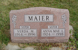
Grace Minnie Maier
| Birth | : | 7 Nov 1915 |
| Death | : | 19 Sep 2008 Elkader, Clayton County, Iowa, USA |
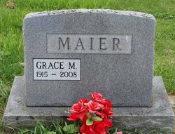
| Burial | : | Vista Verde Memorial Park, Rio Rancho, Sandoval County, USA |
| Coordinate | : | 35.2318260, -106.6507460 |
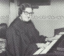
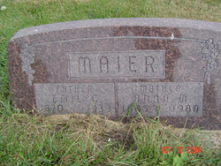
| Description | : | Grace Minnie Maier, 92, of Littleport, died Tuesday, September 16, 2008, at the Elkader Care Center following a brief illness. She was born on November 7, 1915, in rural Littleport, to Emil and Anna (Schaub) Maier. She was baptized, confirmed and was a life long member of Hope Lutheran Church. Grace received her education in Littleport, where she graduated from Littleport High School. Her entire life was spent helping on the farm. Grace enjoyed her job as librarian in the Littleport Library. She was a member of Hope Lutheran Church, where she played the organ for over fifty years and taught... Read More |
frequently asked questions (FAQ):
-
Where is Grace Minnie Maier's memorial?
Grace Minnie Maier's memorial is located at: Vista Verde Memorial Park, Rio Rancho, Sandoval County, USA.
-
When did Grace Minnie Maier death?
Grace Minnie Maier death on 19 Sep 2008 in Elkader, Clayton County, Iowa, USA
-
Where are the coordinates of the Grace Minnie Maier's memorial?
Latitude: 35.2318260
Longitude: -106.6507460
Family Members:
Parent
Siblings
Flowers:
Nearby Cemetories:
1. Vista Verde Memorial Park
Rio Rancho, Sandoval County, USA
Coordinate: 35.2318260, -106.6507460
2. San Ysidro Cemetery
Corrales, Sandoval County, USA
Coordinate: 35.2345000, -106.6180000
3. San Carlos Cemetery
Albuquerque, Bernalillo County, USA
Coordinate: 35.1833330, -106.6025000
4. Mount Carmel Cemetery
Albuquerque, Bernalillo County, USA
Coordinate: 35.1683980, -106.6176730
5. Sandia Memory Gardens
Albuquerque, Bernalillo County, USA
Coordinate: 35.1900000, -106.5770000
6. Shepherd of the Valley Presbyterian Columbarium
Albuquerque, Bernalillo County, USA
Coordinate: 35.1420490, -106.6609790
7. Saint Michael and All Angels Episcopal Church Colu
Albuquerque, Bernalillo County, USA
Coordinate: 35.1393010, -106.6448890
8. Gate of Heaven Cemetery
Albuquerque, Bernalillo County, USA
Coordinate: 35.1731480, -106.5621800
9. Romero Cemetery
Albuquerque, Bernalillo County, USA
Coordinate: 35.1329840, -106.6270320
10. Old Rio Rancho Cemetery
Rio Rancho, Sandoval County, USA
Coordinate: 35.3303679, -106.5707600
11. Saint Andrew Columbarium
Albuquerque, Bernalillo County, USA
Coordinate: 35.1261710, -106.5840320
12. Albuquerque Indian School Cemetery
Albuquerque, Bernalillo County, USA
Coordinate: 35.1122880, -106.6599120
13. Perea Cemetery
Bernalillo, Sandoval County, USA
Coordinate: 35.3146350, -106.5400030
14. Bernalillo Cemetery
Bernalillo, Sandoval County, USA
Coordinate: 35.3146380, -106.5399660
15. Sunset Memorial Park
Albuquerque, Bernalillo County, USA
Coordinate: 35.1081009, -106.6333008
16. Best Friends Forever at Sunset Memorial Park
Albuquerque, Bernalillo County, USA
Coordinate: 35.1082100, -106.6312940
17. Mount Calvary Cemetery
Albuquerque, Bernalillo County, USA
Coordinate: 35.1027985, -106.6355972
18. San Felipe de Neri Church
Albuquerque, Bernalillo County, USA
Coordinate: 35.0966770, -106.6700620
19. Faith Lutheran Church Columbarium
Albuquerque, Bernalillo County, USA
Coordinate: 35.1384670, -106.5292480
20. Chapel at Villa Mathias
Albuquerque, Bernalillo County, USA
Coordinate: 35.0956060, -106.6603660
21. San Ignacio Cemetery
Albuquerque, Bernalillo County, USA
Coordinate: 35.0954880, -106.6382420
22. Mountain View Cemetery
Albuquerque, Bernalillo County, USA
Coordinate: 35.0920820, -106.6292700
23. Our Lady of Perpetual Help Church Columbarium
Albuquerque, Bernalillo County, USA
Coordinate: 35.0964110, -106.5823230
24. Saint Thomas of Canterbury Church Cinerarium
Albuquerque, Bernalillo County, USA
Coordinate: 35.0848240, -106.6264810

