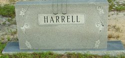
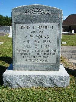
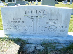
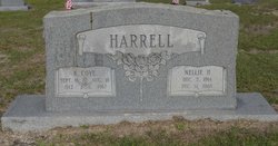
Grover Cleveland Harrell
| Birth | : | 10 Jan 1892 |
| Death | : | 9 Sep 1989 |
| Burial | : | Bethany Cemetery, Florence County, USA |
| Coordinate | : | 33.9944000, -79.8822021 |
| Description | : | Incorrect date on marker for death, obituary in State Newspaper dated 9/11/1989 indicating death on 9/9/1989 |
frequently asked questions (FAQ):
-
Where is Grover Cleveland Harrell's memorial?
Grover Cleveland Harrell's memorial is located at: Bethany Cemetery, Florence County, USA.
-
When did Grover Cleveland Harrell death?
Grover Cleveland Harrell death on 9 Sep 1989 in
-
Where are the coordinates of the Grover Cleveland Harrell's memorial?
Latitude: 33.9944000
Longitude: -79.8822021
Family Members:
Parent
Spouse
Siblings
Children
Flowers:
Nearby Cemetories:
1. Bethany Cemetery
Florence County, USA
Coordinate: 33.9944000, -79.8822021
2. Pigate Family Farm Cemetery
Timmonsville, Florence County, USA
Coordinate: 34.0040940, -79.8840170
3. Bethel Baptist Cemetery
Olanta, Florence County, USA
Coordinate: 33.9791985, -79.9032974
4. Unity Christian Fellowship Cemetery
Timmonsville, Florence County, USA
Coordinate: 34.0090940, -79.8551480
5. Saint Mark Cemetery
Hobbs Crossroads, Sumter County, USA
Coordinate: 33.9985540, -79.9303720
6. McKay Cemetery
Timmonsville, Florence County, USA
Coordinate: 34.0346076, -79.8795688
7. Jones Huggins Cemetery
Cusac Crossroads, Florence County, USA
Coordinate: 34.0196610, -79.8442720
8. Matthews Family Cemetery
Timmonsville, Florence County, USA
Coordinate: 34.0364700, -79.8981000
9. Upper Lee Cemetery
Scranton, Florence County, USA
Coordinate: 33.9654300, -79.8420670
10. Beulah Free Will Baptist Church Pentecostal Faith
Scranton, Florence County, USA
Coordinate: 33.9782906, -79.8322678
11. Byrd Cemetery
Scranton, Florence County, USA
Coordinate: 33.9536140, -79.8598140
12. Lower Lee Burying Ground
Scranton, Florence County, USA
Coordinate: 33.9695230, -79.8339130
13. Dusty Road Cemetery
Scranton, Florence County, USA
Coordinate: 33.9787200, -79.8251400
14. Hewitt Family Cemetery
Olanta, Florence County, USA
Coordinate: 33.9884000, -79.8205000
15. Kirby Family Cemetery
Timmonsville, Florence County, USA
Coordinate: 34.0380600, -79.9164200
16. Jordan Chapel Church Cemetery
Olanta, Florence County, USA
Coordinate: 33.9541960, -79.9230640
17. Wilkes Cemetery
Scranton, Florence County, USA
Coordinate: 33.9836430, -79.8198150
18. Sims Family Cemetery
Timmonsville, Florence County, USA
Coordinate: 34.0374900, -79.9205000
19. Mount Zion Free Will Baptist
Norwood Crossroad, Sumter County, USA
Coordinate: 33.9754110, -79.9453050
20. Dawson Graveyard
Florence County, USA
Coordinate: 33.9932020, -79.8147650
21. Cusaac Cemetery
Effingham, Florence County, USA
Coordinate: 34.0043730, -79.8142470
22. Sparrow Swamp Cemetery
Timmonsville, Florence County, USA
Coordinate: 34.0541992, -79.8771973
23. Anderson Langston Cemetery
Florence County, USA
Coordinate: 34.0524460, -79.8570440
24. Meadow Prong Cemetery
Florence County, USA
Coordinate: 34.0372009, -79.8268967

