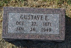
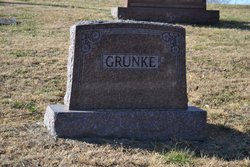
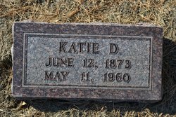
Gustave E. Grunke
| Birth | : | 22 Oct 1871 Cuming County, Nebraska, USA |
| Death | : | 26 Jan 1949 Omaha, Douglas County, Nebraska, USA |
| Burial | : | Mount Hope Cemetery, West Point, Cuming County, USA |
| Coordinate | : | 41.8450012, -96.6994019 |
| Description | : | Gustave E. Grunke, 72, passed away Wednesday, January 26, 1949, at a convalescent home in Omaha. Funeral services were held at 2:00 p.m., Monday, January 31, at the Ray J. Smith Mortuary, West Point. The Rev. G. P. Krebs of Grace Lutheran officiated. Burial was in Mt. Hope Cemetery, West Point, Nebraska. Gustave E. Grunke was born October 22, 1871, in Cuming County, the son of Ludwig and Amelia (Schunke) Grunke. He married Catharine Dorothea Ralph on September 9, 1897, in West Point. They lived on the Grunke family farm, until they retired and built a new home... Read More |
frequently asked questions (FAQ):
-
Where is Gustave E. Grunke's memorial?
Gustave E. Grunke's memorial is located at: Mount Hope Cemetery, West Point, Cuming County, USA.
-
When did Gustave E. Grunke death?
Gustave E. Grunke death on 26 Jan 1949 in Omaha, Douglas County, Nebraska, USA
-
Where are the coordinates of the Gustave E. Grunke's memorial?
Latitude: 41.8450012
Longitude: -96.6994019
Family Members:
Parent
Spouse
Siblings
Children
Flowers:
Nearby Cemetories:
1. Mount Hope Cemetery
West Point, Cuming County, USA
Coordinate: 41.8450012, -96.6994019
2. Saint Josephs Cemetery
West Point, Cuming County, USA
Coordinate: 41.8460999, -96.7011032
3. Saint Michael Cemetery
West Point, Cuming County, USA
Coordinate: 41.8288994, -96.7080994
4. Saint Charles Pioneer Cemetery
Saint Charles, Cuming County, USA
Coordinate: 41.8086800, -96.7532700
5. Saint Anthony Cemetery
Cuming County, USA
Coordinate: 41.7924995, -96.7491989
6. Greenwood Cemetery
Beemer, Cuming County, USA
Coordinate: 41.8821983, -96.7825012
7. Dewitt Cemetery
Cuming County, USA
Coordinate: 41.9089012, -96.7478027
8. Saint Boniface Cemetery
Monterey, Cuming County, USA
Coordinate: 41.7947006, -96.8041992
9. Peterson Pioneer Cemetery
Cuming County, USA
Coordinate: 41.7854900, -96.5933500
10. Pioneer Cemetery
Cuming County, USA
Coordinate: 41.8300018, -96.5599976
11. Blomgren Cemetery
Cuming County, USA
Coordinate: 41.7998400, -96.5650300
12. West Side Cemetery
Oakland, Burt County, USA
Coordinate: 41.8582100, -96.5512400
13. Immanuel Lutheran Cemetery
Beemer, Cuming County, USA
Coordinate: 41.9067001, -96.8264008
14. Salem Cemetery
Burt County, USA
Coordinate: 41.8008003, -96.5494003
15. Beemer Cemetery
Beemer, Cuming County, USA
Coordinate: 41.9334488, -96.8130188
16. Saint Johns Lutheran Cemetery
Scribner, Dodge County, USA
Coordinate: 41.7414020, -96.6085930
17. Manhattan Cemetery
Dodge County, USA
Coordinate: 41.7136002, -96.6836014
18. Zion Lutheran Cemetery
Bancroft, Cuming County, USA
Coordinate: 41.9772300, -96.6497000
19. Rock Creek Cemetery
Cuming County, USA
Coordinate: 41.9164009, -96.8602982
20. Saint Peters Cemetery
Snyder, Dodge County, USA
Coordinate: 41.7117004, -96.7893982
21. Saint Pauls Lutheran Cemetery
Burt County, USA
Coordinate: 41.7722900, -96.5213300
22. Saint Aloysius Catholic Cemetery
Aloys, Cuming County, USA
Coordinate: 41.8310700, -96.9034500
23. Saint Johns Lutheran Cemetery
Beemer, Cuming County, USA
Coordinate: 41.9165000, -96.8807000
24. Saint Wenceslaus Cemetery
Cuming County, USA
Coordinate: 41.7435989, -96.8546982

