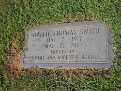
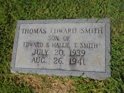
Hallie Alma Thomas Smith
| Birth | : | 2 Aug 1917 Patrick County, Virginia, USA |
| Death | : | 27 Mar 2007 Mount Airy, Surry County, North Carolina, USA |
| Burial | : | Evergreen Cemetery, Clarion, Wright County, USA |
| Coordinate | : | 42.7313995, -93.7069016 |
| Description | : | Mrs. Hallie Alma Thomas Smith age 89 of 156 Salem Drive, Mt. Airy, NC passed away Tuesday, March 27, 2007 at Northern Hospital of Surry County. She was born August 2, 1917 in Carroll County, VA to the late Robert Martin and Martha Elizabeth McMillian Thomas. She was retired from Perry Manufacturing, was a member of Salem United Methodist Church and was a homemaker. Surviving are two daughters and a son-in-law, Ann Smith, Cana, VA, Bonnie and Bruce Ayers, Cana,. VA, son and daughter-in-law, Robert and Pat Smith, Mt. Airy, NC, Five grandsons and four spouses, Jamie Smith and Gloria,... Read More |
frequently asked questions (FAQ):
-
Where is Hallie Alma Thomas Smith's memorial?
Hallie Alma Thomas Smith's memorial is located at: Evergreen Cemetery, Clarion, Wright County, USA.
-
When did Hallie Alma Thomas Smith death?
Hallie Alma Thomas Smith death on 27 Mar 2007 in Mount Airy, Surry County, North Carolina, USA
-
Where are the coordinates of the Hallie Alma Thomas Smith's memorial?
Latitude: 42.7313995
Longitude: -93.7069016
Family Members:
Parent
Siblings
Children
Nearby Cemetories:
1. Evergreen Cemetery
Clarion, Wright County, USA
Coordinate: 42.7313995, -93.7069016
2. Saint Johns Cemetery
Clarion, Wright County, USA
Coordinate: 42.7324982, -93.7039032
3. Galt Cemetery
Wright County, USA
Coordinate: 42.7030983, -93.5960999
4. Graceland Cemetery
Rowan, Wright County, USA
Coordinate: 42.7453003, -93.5714035
5. Holmes Lutheran Cemetery
Holmes, Wright County, USA
Coordinate: 42.7172012, -93.8424988
6. Saint Josephs Cemetery
Wright County, USA
Coordinate: 42.6296997, -93.7838974
7. Belmond Cemetery
Belmond, Wright County, USA
Coordinate: 42.8360000, -93.6020000
8. Saint Francis Cemetery
Belmond, Wright County, USA
Coordinate: 42.8297005, -93.5905991
9. Ringsaker Cemetery
Wright County, USA
Coordinate: 42.8636017, -93.7244034
10. Saint Olaf Lutheran Cemetery
Belmond, Wright County, USA
Coordinate: 42.8634000, -93.7317000
11. Norway Township Cemetery
Drew, Wright County, USA
Coordinate: 42.8636093, -93.7772217
12. Wright County Burying Grounds
Goldfield, Wright County, USA
Coordinate: 42.7249710, -93.9210580
13. Wright Christian Reformed Church Cemetery
Wright County, USA
Coordinate: 42.8630000, -93.8257000
14. Glenwood Cemetery
Goldfield, Wright County, USA
Coordinate: 42.7407990, -93.9253006
15. Vernon Township Lutheran Cemetery
Dows, Wright County, USA
Coordinate: 42.5864000, -93.5994000
16. French Church Cemetery
Woolstock, Wright County, USA
Coordinate: 42.5724000, -93.7719000
17. Fairview Cemetery
Dows, Wright County, USA
Coordinate: 42.6511002, -93.5044022
18. Woolstock Cemetery
Woolstock, Wright County, USA
Coordinate: 42.5942001, -93.8414001
19. Simonson Family Cemetery
Belmond Township, Wright County, USA
Coordinate: 42.8999672, -93.6835466
20. Hickory Grove Cemetery
Wright County, USA
Coordinate: 42.8958015, -93.6421967
21. Mount Hope Cemetery
Morgan Township, Franklin County, USA
Coordinate: 42.6777992, -93.4792023
22. Immanuel Reformed Cemetery
Belmond, Wright County, USA
Coordinate: 42.8635000, -93.5484000
23. Calvary Cemetery
Eagle Grove, Wright County, USA
Coordinate: 42.6632996, -93.9289017
24. Rose Hill Cemetery
Eagle Grove, Wright County, USA
Coordinate: 42.6610985, -93.9282990


