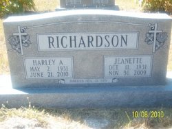
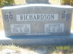
Harley A. Richardson
| Birth | : | 2 May 1931 Dawson County, Nebraska, USA |
| Death | : | 21 Jun 2010 Cozad, Dawson County, Nebraska, USA |
| Burial | : | St. Peter's Churchyard, Woolton, Metropolitan Borough of Liverpool, England |
| Coordinate | : | 53.3759310, -2.8693390 |
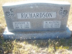
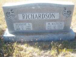
| Description | : | Harley A. Richardson, 79, of Lexington, Nebraska, died Monday, June 21, 2010, at Cozad Community Hospital. Harley was born May 2, 1931, on the farm south of Lexington, Nebraska to Herbert and Matilda (Lantz) Richardson. Harley was a 1948 graduate of Lexington High School and a 1952 graduate of the University of Nebraska. Harley was united in marriage to Jeanette Neville on November 10, 1951, at Broken Bow, Nebraska. Following the couple's marriage Harley entered the United States Air Force and was stationed in Cheyenne, Wyoming. After moving a few times with the military, they returned to the... Read More |
frequently asked questions (FAQ):
-
Where is Harley A. Richardson's memorial?
Harley A. Richardson's memorial is located at: St. Peter's Churchyard, Woolton, Metropolitan Borough of Liverpool, England.
-
When did Harley A. Richardson death?
Harley A. Richardson death on 21 Jun 2010 in Cozad, Dawson County, Nebraska, USA
-
Where are the coordinates of the Harley A. Richardson's memorial?
Latitude: 53.3759310
Longitude: -2.8693390
Family Members:
Parent
Spouse
Flowers:
Nearby Cemetories:
1. St. Peter's Churchyard
Woolton, Metropolitan Borough of Liverpool, England
Coordinate: 53.3759310, -2.8693390
2. St. Mary's Churchyard
Woolton, Metropolitan Borough of Liverpool, England
Coordinate: 53.3750550, -2.8703760
3. Calderstones Park
Liverpool, Metropolitan Borough of Liverpool, England
Coordinate: 53.3817419, -2.8956218
4. Allerton Cemetery
Allerton, Metropolitan Borough of Liverpool, England
Coordinate: 53.3615646, -2.8844030
5. All Saints Churchyard
Childwall, Metropolitan Borough of Liverpool, England
Coordinate: 53.3952880, -2.8816030
6. All Hallows Churchyard
Mossley Hill, Metropolitan Borough of Liverpool, England
Coordinate: 53.3808740, -2.9039930
7. St. Nicholas Churchyard
Halewood, Metropolitan Borough of Knowsley, England
Coordinate: 53.3694400, -2.8284900
8. Saint Michael's Church
Garston, Metropolitan Borough of Liverpool, England
Coordinate: 53.3518400, -2.8973800
9. St Austin's Churchyard
Grassendale, Metropolitan Borough of Liverpool, England
Coordinate: 53.3614552, -2.9124587
10. St Matthew & St James Churchyard
Mossley Hill, Metropolitan Borough of Liverpool, England
Coordinate: 53.3764200, -2.9204740
11. All Saints Churchyard
Speke, Metropolitan Borough of Liverpool, England
Coordinate: 53.3439300, -2.8582400
12. Holy Trinity Churchyard
Wavertree, Metropolitan Borough of Liverpool, England
Coordinate: 53.3946000, -2.9175700
13. St. Bartholomew's Churchyard
Huyton with Roby, Metropolitan Borough of Knowsley, England
Coordinate: 53.4120023, -2.8556125
14. St. Anne's Churchyard
Aigburth, Metropolitan Borough of Liverpool, England
Coordinate: 53.3695480, -2.9305760
15. Broadgreen Jewish Cemetery
Liverpool, Metropolitan Borough of Liverpool, England
Coordinate: 53.4101320, -2.8977320
16. St. Agnes Roman Catholic
Huyton with Roby, Metropolitan Borough of Knowsley, England
Coordinate: 53.4090600, -2.8320100
17. St Michael Churchyard Extension
Huyton with Roby, Metropolitan Borough of Knowsley, England
Coordinate: 53.4143310, -2.8418050
18. St. Michael Churchyard
Huyton with Roby, Metropolitan Borough of Knowsley, England
Coordinate: 53.4139560, -2.8396720
19. St. John the Evangelist Churchyard
Knotty Ash, Metropolitan Borough of Liverpool, England
Coordinate: 53.4160757, -2.8913708
20. Quaker Burial Ground
Liverpool, Metropolitan Borough of Liverpool, England
Coordinate: 53.3922330, -2.9348120
21. Hunter Street Burial Ground
Liverpool, Metropolitan Borough of Liverpool, England
Coordinate: 53.3922470, -2.9348630
22. Saint Oswald King & Martyr Catholic Churchyard
Old Swan, Metropolitan Borough of Liverpool, England
Coordinate: 53.4121650, -2.9146190
23. Toxteth Park Cemetery
Toxteth, Metropolitan Borough of Liverpool, England
Coordinate: 53.3952960, -2.9396300
24. St Michael's in the Hamlet
Aigburth, Metropolitan Borough of Liverpool, England
Coordinate: 53.3765870, -2.9499850


