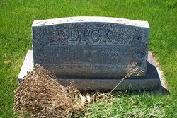
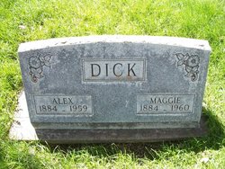
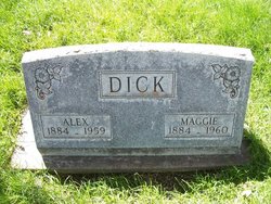
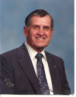
Harold Arthur Dick
| Birth | : | 11 Oct 1912 Sterling, Logan County, Colorado, USA |
| Death | : | 12 Jul 1989 Logan County, Colorado, USA |
| Burial | : | Old Mount Wesley Cemetery, Dargaville, Kaipara District, New Zealand |
| Coordinate | : | -35.9594200, 173.8673300 |
| Description | : | Closed casket funeral services for Harold A. Dick of 19800 County Road 36, Sterling, will be conducted 10 a.m. Saturday from First English Lutheran Church, the Rev. Lohn M.Johnson officiating. Military graveside rites by Jake Uhrig Post No. 3541, Veterans of Foreign Wars, Sterling and burial will follow in Riverside cemetery. Mr. Dick, 76, died Wednesday, July 12, 1989, at his home. He was born Oct. 11, 1912, in Sterling, the son of Alex and Margaret Wagner Dick, grew up on a farm near Padroni and graduated from Padroni High School at the height of the Great Depression. He married Esther A. Walker, Oct. 5,... Read More |
frequently asked questions (FAQ):
-
Where is Harold Arthur Dick's memorial?
Harold Arthur Dick's memorial is located at: Old Mount Wesley Cemetery, Dargaville, Kaipara District, New Zealand.
-
When did Harold Arthur Dick death?
Harold Arthur Dick death on 12 Jul 1989 in Logan County, Colorado, USA
-
Where are the coordinates of the Harold Arthur Dick's memorial?
Latitude: -35.9594200
Longitude: 173.8673300
Family Members:
Parent
Spouse
Siblings
Children
Flowers:
Nearby Cemetories:
1. Old Mount Wesley Cemetery
Dargaville, Kaipara District, New Zealand
Coordinate: -35.9594200, 173.8673300
2. New Mount Wesley RSA Cemetery
Dargaville, Kaipara District, New Zealand
Coordinate: -35.9640600, 173.8617200
3. New Mount Wesley Cemetery
Dargaville, Kaipara District, New Zealand
Coordinate: -35.9645800, 173.8604600
4. Oturei Māori Cemetery
Aratapu, Kaipara District, New Zealand
Coordinate: -36.0074880, 173.8831320
5. Arapohue Cemetery
Arapohue, Kaipara District, New Zealand
Coordinate: -35.9955070, 173.9685500
6. Redhill Cemetery
Te Kopuru, Kaipara District, New Zealand
Coordinate: -36.0657120, 173.8779410
7. Tokatoka Cemetery
Tokatoka, Kaipara District, New Zealand
Coordinate: -36.0595817, 173.9679173
8. Maitahi Māori Cemetery
Maitahi, Kaipara District, New Zealand
Coordinate: -35.8548300, 173.7611800
9. Avoca Public Cemetery
Tangowahine, Kaipara District, New Zealand
Coordinate: -35.8076900, 173.9042800
10. Waikaraka Urupa
Kaihu, Kaipara District, New Zealand
Coordinate: -35.7738320, 173.7070600
11. Kaihu Cemetery
Kaihu, Kaipara District, New Zealand
Coordinate: -35.7693860, 173.6965430
12. Waikiekie Cemetery
Waiotira, Whangārei District, New Zealand
Coordinate: -35.9459300, 174.2296660
13. Matakohe Cemetery
Matakohe, Kaipara District, New Zealand
Coordinate: -36.1297650, 174.1857490
14. Nukutawhiti Cemetery
Nukutawhiti, Whangārei District, New Zealand
Coordinate: -35.6457870, 173.8625100
15. Paparoa Methodist Cemetery
Paparoa, Kaipara District, New Zealand
Coordinate: -36.0969090, 174.2424960
16. St Marks Anglican Church Cemetery
Paparoa, Kaipara District, New Zealand
Coordinate: -36.0977590, 174.2433940
17. Hukatere Cemetery
Kaipara District, New Zealand
Coordinate: -36.1763510, 174.1863840
18. Mangere Falls
Kokopu, Whangārei District, New Zealand
Coordinate: -35.7001952, 174.1390070
19. Pipiwai Cemetery
Whangārei District, New Zealand
Coordinate: -35.6227520, 174.0127010
20. Whakapirau Church Cemetery
Whakapirau, Kaipara District, New Zealand
Coordinate: -36.1551200, 174.2389200
21. Mangapai Cemetery
Mangapai, Whangārei District, New Zealand
Coordinate: -35.8435970, 174.2871730
22. Tau Henare Marae Urupā
Whangārei District, New Zealand
Coordinate: -35.6198870, 174.0192130
23. Tau Henare Marae Urupā
Whangārei District, New Zealand
Coordinate: -35.6198870, 174.0192130
24. Te Wehenga Cemetery
Whangārei District, New Zealand
Coordinate: -35.6078790, 174.0003730

