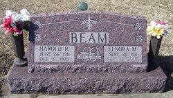
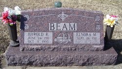
Harold Raymond Beam
| Birth | : | 24 Jun 1911 Jackson County, Kansas, USA |
| Death | : | 31 Oct 1995 Holton, Jackson County, Kansas, USA |
| Burial | : | Sullivan Cemetery, Winthrop, Okanogan County, USA |
| Coordinate | : | 48.4742012, -120.1707993 |
| Plot | : | Section L |
| Description | : | s/o Warner Leroy Beam & Olive Belle Davidson |
frequently asked questions (FAQ):
-
Where is Harold Raymond Beam's memorial?
Harold Raymond Beam's memorial is located at: Sullivan Cemetery, Winthrop, Okanogan County, USA.
-
When did Harold Raymond Beam death?
Harold Raymond Beam death on 31 Oct 1995 in Holton, Jackson County, Kansas, USA
-
Where are the coordinates of the Harold Raymond Beam's memorial?
Latitude: 48.4742012
Longitude: -120.1707993
Family Members:
Parent
Spouse
Siblings
Flowers:
Nearby Cemetories:
1. Sullivan Cemetery
Winthrop, Okanogan County, USA
Coordinate: 48.4742012, -120.1707993
2. Old Winthrop Cemetery
Winthrop, Okanogan County, USA
Coordinate: 48.4748000, -120.1864700
3. Beaver Creek Cemetery
Twisp, Okanogan County, USA
Coordinate: 48.3272000, -120.0564000
4. Conconully Cemetery
Conconully, Okanogan County, USA
Coordinate: 48.5441600, -119.7400100
5. Ruby Cemetery
Okanogan County, USA
Coordinate: 48.5085983, -119.7221985
6. Chiliwist Cemetery
Okanogan County, USA
Coordinate: 48.2630997, -119.7363968
7. Malott Community Cemetery
Malott, Okanogan County, USA
Coordinate: 48.2925000, -119.7047300
8. Paradise Hill Cemetery
Brewster, Okanogan County, USA
Coordinate: 48.1848980, -119.8411900
9. Spring Coulee Family Cemetery
Okanogan County, USA
Coordinate: 48.3895950, -119.6289460
10. Methow Cemetery
Methow, Okanogan County, USA
Coordinate: 48.1102982, -120.0124969
11. Pine Creek Cemetery
Tonasket, Okanogan County, USA
Coordinate: 48.6330560, -119.6502780
12. Okanogan City Cemetery
Okanogan, Okanogan County, USA
Coordinate: 48.3546982, -119.6061020
13. Okanogan Valley Memorial Gardens
Omak, Okanogan County, USA
Coordinate: 48.3911018, -119.5691986
14. Omak Memorial Cemetery
Okanogan, Okanogan County, USA
Coordinate: 48.3874000, -119.5565800
15. South Pine Creek Cemetery
Riverside, Okanogan County, USA
Coordinate: 48.5925900, -119.5663400
16. Stoddard Gravesite
Okanogan, Okanogan County, USA
Coordinate: 48.4531140, -119.5411680
17. Elizabeth Osborn Mikel Gravesite
Brewster, Okanogan County, USA
Coordinate: 48.1498900, -119.7514700
18. Riverside Cemetery
Riverside, Okanogan County, USA
Coordinate: 48.4944400, -119.5022200
19. Cameron Lake Pioneer Memorial Cemetery
Malott, Okanogan County, USA
Coordinate: 48.2708330, -119.5700000
20. Locust Grove Cemetery
Brewster, Okanogan County, USA
Coordinate: 48.1114006, -119.7746964
21. Miller Family Cemetery
Okanogan County, USA
Coordinate: 48.0530300, -119.9288000
22. Dick Family Cemetery
Okanogan County, USA
Coordinate: 48.0502700, -119.9241700
23. Pateros Cemetery
Pateros, Okanogan County, USA
Coordinate: 48.0516600, -119.9097300
24. Sand Flats Cemetery
Omak, Okanogan County, USA
Coordinate: 48.4157600, -119.4836600


