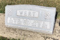
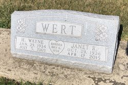
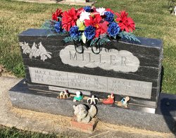
Harold Wayne Wert
| Birth | : | 29 Jan 1934 Monticello, White County, Indiana, USA |
| Death | : | 5 Jul 2003 Nashville, Brown County, Indiana, USA |
| Burial | : | Four Corners Cemetery, Sullivan, Cheshire County, USA |
| Coordinate | : | 43.0103989, -72.2291031 |
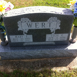
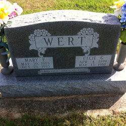
| Description | : | Brown County Democrat 9 Jul 2003 H. Wayne Wert Harold Wayne Wert, resident of Nashville, died Saturday, July 5, 2003, at his home on Greasy Creek Road. He was 69. Mr. Wert was born January 29, 1934, in Monticello and was the son of Cecil G. Wert and Mary (McCloud) Wert. They preceded him in death. He married Janet R. Haughee May 6, 1956, in Monticello. She survives. Mr. Wert graduated in 1952 from Monticello High School. He was an electrician for local #166 in Layette for several years. After retiring as an electrician, he did a lot of carpentry work and he enjoyed fishing.... Read More |
frequently asked questions (FAQ):
-
Where is Harold Wayne Wert's memorial?
Harold Wayne Wert's memorial is located at: Four Corners Cemetery, Sullivan, Cheshire County, USA.
-
When did Harold Wayne Wert death?
Harold Wayne Wert death on 5 Jul 2003 in Nashville, Brown County, Indiana, USA
-
Where are the coordinates of the Harold Wayne Wert's memorial?
Latitude: 43.0103989
Longitude: -72.2291031
Family Members:
Parent
Spouse
Siblings
Flowers:
Nearby Cemetories:
1. Four Corners Cemetery
Sullivan, Cheshire County, USA
Coordinate: 43.0103989, -72.2291031
2. Sullivan Center Cemetery
Sullivan, Cheshire County, USA
Coordinate: 43.0143433, -72.2217636
3. East Sullivan Cemetery
East Sullivan, Cheshire County, USA
Coordinate: 42.9953600, -72.1963500
4. Vessel Rock Cemetery
Gilsum, Cheshire County, USA
Coordinate: 43.0255000, -72.2793000
5. South Cemetery
Gilsum, Cheshire County, USA
Coordinate: 43.0006320, -72.2861450
6. Centennial Cemetery
Gilsum, Cheshire County, USA
Coordinate: 43.0419998, -72.2712021
7. Gilsum Village Cemetery
Gilsum, Cheshire County, USA
Coordinate: 43.0497818, -72.2639999
8. Nash's Corner Cemetery
Gilsum, Cheshire County, USA
Coordinate: 43.0580788, -72.2277679
9. Munsonville Cemetery
Munsonville, Cheshire County, USA
Coordinate: 43.0071200, -72.1577200
10. Hillside Cemetery
Roxbury Center, Cheshire County, USA
Coordinate: 42.9534360, -72.2117930
11. Joslin Cemetery
Stoddard, Cheshire County, USA
Coordinate: 43.0657997, -72.1903000
12. South Cemetery
Surry, Cheshire County, USA
Coordinate: 42.9934700, -72.3113700
13. Surry Village Cemetery
Surry, Cheshire County, USA
Coordinate: 43.0199020, -72.3226130
14. Nye Burying Ground
Roxbury Center, Cheshire County, USA
Coordinate: 42.9393600, -72.2266900
15. North Cemetery
Keene, Cheshire County, USA
Coordinate: 42.9595100, -72.3013900
16. Woodland Cemetery
Keene, Cheshire County, USA
Coordinate: 42.9404755, -72.2700806
17. Nelson Congregational Church Pauper Graves
Nelson, Cheshire County, USA
Coordinate: 42.9899440, -72.1271560
18. Nelson Cemetery
Nelson, Cheshire County, USA
Coordinate: 42.9861200, -72.1281000
19. Greenlawn Cemetery
Keene, Cheshire County, USA
Coordinate: 42.9402100, -72.2750300
20. Washington Cemetery
Keene, Cheshire County, USA
Coordinate: 42.9367750, -72.2765080
21. Pond Road Cemetery
Surry, Cheshire County, USA
Coordinate: 42.9986000, -72.3416800
22. Saint James Episcopal Church Columbarium
Keene, Cheshire County, USA
Coordinate: 42.9334099, -72.2793505
23. Monadnock View Cemetery
Keene, Cheshire County, USA
Coordinate: 42.9516983, -72.3169022
24. East Cemetery
Marlborough, Cheshire County, USA
Coordinate: 42.9317000, -72.1696000

