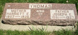
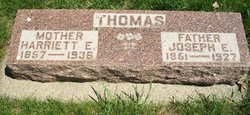
Harriet Eunice “Hattie” Smith Thomas
| Birth | : | 17 Dec 1857 Wright County, Iowa, USA |
| Death | : | 10 Dec 1936 Estherville, Emmet County, Iowa, USA |
| Burial | : | Okoboji Cemetery, Arnolds Park, Dickinson County, USA |
| Coordinate | : | 43.3649406, -95.1303558 |
| Plot | : | 3-34/6 |
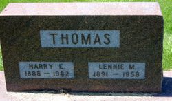
| Description | : | Parents are Cyrus Edward Smith & Nancy Smith Wife of Joseph E. Thomas (Married: July 20, 1878, Manchester, Delaware Co., Iowa) ----------- Mrs. Harriet Thomas Mrs. Harriet Thomas, for years a resident of Terril, died at the home of her daughter, Mrs. L. R. Guile at Estherville Thursday. Burial in the Okoboji cemetery took place Sunday afternoon. The funeral was conducted by the Rev. F. W. Ortmeyer of the Methodist Episcopal church in Estherville. Surviving Mrs. Thomas are five children and two sisters, Mrs. Mabel Wood and Mrs. Bessie Guile, both of Estherville; Mrs. Anna Dowden of Marysville, Mo.; Harry Thomas of Webb;... Read More |
frequently asked questions (FAQ):
-
Where is Harriet Eunice “Hattie” Smith Thomas's memorial?
Harriet Eunice “Hattie” Smith Thomas's memorial is located at: Okoboji Cemetery, Arnolds Park, Dickinson County, USA.
-
When did Harriet Eunice “Hattie” Smith Thomas death?
Harriet Eunice “Hattie” Smith Thomas death on 10 Dec 1936 in Estherville, Emmet County, Iowa, USA
-
Where are the coordinates of the Harriet Eunice “Hattie” Smith Thomas's memorial?
Latitude: 43.3649406
Longitude: -95.1303558
Family Members:
Flowers:
Nearby Cemetories:
1. Okoboji Cemetery
Arnolds Park, Dickinson County, USA
Coordinate: 43.3649406, -95.1303558
2. Pioneer Cemetery
Arnolds Park, Dickinson County, USA
Coordinate: 43.3655000, -95.1403000
3. Gardner Family Cemetery
Arnolds Park, Dickinson County, USA
Coordinate: 43.3654410, -95.1403480
4. Lakeview Gardens Cemetery
Spirit Lake, Dickinson County, USA
Coordinate: 43.3925000, -95.1119000
5. Rose Hill Cemetery (Defunct)
Spirit Lake, Dickinson County, USA
Coordinate: 43.4077600, -95.0976130
6. Calvary Cemetery
Milford, Dickinson County, USA
Coordinate: 43.3213997, -95.1688995
7. Saint Albans Episcopal Church Columbarium
Spirit Lake, Dickinson County, USA
Coordinate: 43.4175000, -95.1222000
8. Milford Cemetery
Milford, Dickinson County, USA
Coordinate: 43.3092003, -95.1481018
9. Spirit Lake Memorial Gardens
Spirit Lake, Dickinson County, USA
Coordinate: 43.4227982, -95.1331024
10. Lakeview Cemetery
Spirit Lake, Dickinson County, USA
Coordinate: 43.4239006, -95.1213989
11. Bedell Gravesite
Spirit Lake, Dickinson County, USA
Coordinate: 43.4128430, -95.0773690
12. Saint Margaret Cemetery
Orleans, Dickinson County, USA
Coordinate: 43.4450130, -95.1130370
13. Richland Township Cemetery
Terril, Dickinson County, USA
Coordinate: 43.3565323, -94.9927821
14. Little Sioux Lutheran Cemetery
Milford, Dickinson County, USA
Coordinate: 43.2702065, -95.2109528
15. Excelsior Township Cemetery
Milford, Dickinson County, USA
Coordinate: 43.3565000, -95.2907000
16. Superior Township Cemetery
Superior, Dickinson County, USA
Coordinate: 43.4399986, -94.9533005
17. Silver Lake Cemetery
Lake Park, Dickinson County, USA
Coordinate: 43.4441986, -95.3078003
18. Westport Cemetery
Dickinson County, USA
Coordinate: 43.3130989, -95.3289032
19. Fairview Cemetery
Terril, Dickinson County, USA
Coordinate: 43.2977982, -94.9349976
20. Loon Lake Cemetery
Jackson County, USA
Coordinate: 43.5249672, -95.0949554
21. Evergreen Cemetery
Clay County, USA
Coordinate: 43.2052994, -95.2086029
22. First Reformed Cemetery
Clay County, USA
Coordinate: 43.2399500, -95.2889000
23. Fairview Cemetery
Clay County, USA
Coordinate: 43.1899986, -95.0800018
24. Holy Trinity Lutheran Cemetery
Lakefield, Jackson County, USA
Coordinate: 43.5562920, -95.1868880


