| Birth | : | 26 Jun 1843 Rutland County, Vermont, USA |
| Death | : | 28 Jun 1844 Fair Haven, Rutland County, Vermont, USA |
| Burial | : | West Street Cemetery, Fair Haven, Rutland County, USA |
| Coordinate | : | 43.5950900, -73.2708500 |
| Inscription | : | HARRIET E. daughter of Benaijah & Salome GOULD died June 28, 1844. AE. 1 year & 2 Ds. |
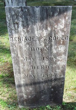
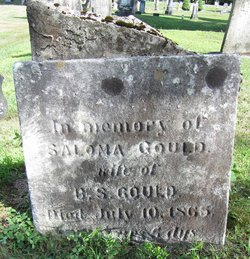
| Description | : | Daughter of Benajah Gould and Saloma Clark. . |
frequently asked questions (FAQ):
-
Where is Harriet Gould's memorial?
Harriet Gould's memorial is located at: West Street Cemetery, Fair Haven, Rutland County, USA.
-
When did Harriet Gould death?
Harriet Gould death on 28 Jun 1844 in Fair Haven, Rutland County, Vermont, USA
-
Where are the coordinates of the Harriet Gould's memorial?
Latitude: 43.5950900
Longitude: -73.2708500
Family Members:
Parent
Siblings
Flowers:
Nearby Cemetories:
1. West Street Cemetery
Fair Haven, Rutland County, USA
Coordinate: 43.5950900, -73.2708500
2. Saint Marys Cemetery
Fair Haven, Rutland County, USA
Coordinate: 43.5968500, -73.2728800
3. Old Burial Ground
Fair Haven, Rutland County, USA
Coordinate: 43.6011800, -73.2740400
4. Cedar Grove Cemetery
Fair Haven, Rutland County, USA
Coordinate: 43.5824200, -73.2689000
5. William Miller Cemetery
Low Hampton, Washington County, USA
Coordinate: 43.5950600, -73.2997200
6. Blissville Cemetery
Blissville, Rutland County, USA
Coordinate: 43.5923000, -73.2292000
7. Hydeville Cemetery
Hydeville, Rutland County, USA
Coordinate: 43.6027600, -73.2278000
8. Culver Cemetery
Blissville, Rutland County, USA
Coordinate: 43.5867004, -73.2268982
9. Carvers Falls Cemetery
West Haven, Rutland County, USA
Coordinate: 43.6264000, -73.3007965
10. Hampton Flats Cemetery
Hampton, Washington County, USA
Coordinate: 43.5550003, -73.2574997
11. Fifield Cemetery
Poultney, Rutland County, USA
Coordinate: 43.5750008, -73.2181015
12. Gates Cemetery
Castleton Corners, Rutland County, USA
Coordinate: 43.5938988, -73.2080994
13. Hosford Crossing Cemetery
Poultney, Rutland County, USA
Coordinate: 43.5621600, -73.2252200
14. Hackett Dam Cemetery
West Haven, Rutland County, USA
Coordinate: 43.6329800, -73.3329300
15. Bartholomew Cemetery
Whitehall, Washington County, USA
Coordinate: 43.5662600, -73.3493400
16. Hillside Cemetery
Castleton, Rutland County, USA
Coordinate: 43.6133003, -73.1864014
17. Sciota Rural Cemetery
Whitehall, Washington County, USA
Coordinate: 43.6156200, -73.3546400
18. Hitchcock Cemetery
West Haven, Rutland County, USA
Coordinate: 43.6530800, -73.3239700
19. Juckett Cemetery
Whitehall, Washington County, USA
Coordinate: 43.6103410, -73.3651060
20. Brick Church Cemetery
Whitehall, Washington County, USA
Coordinate: 43.5367300, -73.3259800
21. Congregational Cemetery
Castleton, Rutland County, USA
Coordinate: 43.6127396, -73.1755524
22. Hampton Hill Cemetery
Hampton, Washington County, USA
Coordinate: 43.5218900, -73.2576800
23. Humiston Cemetery
West Haven, Rutland County, USA
Coordinate: 43.6241380, -73.3728930
24. West Haven Center Cemetery
West Haven, Rutland County, USA
Coordinate: 43.6528800, -73.3464500


