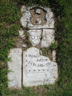
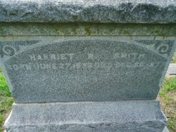
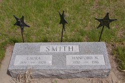
Harriet “Hattie” Rogers Garrison Smith
| Birth | : | 28 Jul 1832 Tompkins County, New York, USA |
| Death | : | 20 Dec 1877 Saint Paul, Howard County, Nebraska, USA |
| Burial | : | Elmwood Cemetery, Saint Paul, Howard County, USA |
| Coordinate | : | 41.2002983, -98.4677963 |
| Description | : | Married first, Unknown Garrison Married second, Jan 1864 NY, Hanford Smith No known children Harriet is buried next to Hanford, and his second wife, Laura, whom he married May 20 1884 Harriet's name is also on the back of Enoch Spencer Chadwick's marker. (Will research the connection) ----------------------------- Recovered After Fifty Years - Found After Fifty Years. Bible Lost by Hanford Smith During Civil War Recently Recovered On the blank page between the Old and New Testaments is: Ahira Rogers, June 14, 1803 Mandana Rogers, Nov. 13, 1806 Harriet Rogers, July 28, 1832 Ellen M. Rogers, December 7, 1835 George M. Rogers,... Read More |
frequently asked questions (FAQ):
-
Where is Harriet “Hattie” Rogers Garrison Smith's memorial?
Harriet “Hattie” Rogers Garrison Smith's memorial is located at: Elmwood Cemetery, Saint Paul, Howard County, USA.
-
When did Harriet “Hattie” Rogers Garrison Smith death?
Harriet “Hattie” Rogers Garrison Smith death on 20 Dec 1877 in Saint Paul, Howard County, Nebraska, USA
-
Where are the coordinates of the Harriet “Hattie” Rogers Garrison Smith's memorial?
Latitude: 41.2002983
Longitude: -98.4677963
Family Members:
Flowers:
Nearby Cemetories:
1. Elmwood Cemetery
Saint Paul, Howard County, USA
Coordinate: 41.2002983, -98.4677963
2. Warsaw Cemetery
Saint Paul, Howard County, USA
Coordinate: 41.1844400, -98.5575000
3. Canada Hill Methodist Episcopal Cemetery
Howard County, USA
Coordinate: 41.1843987, -98.5575027
4. Saint Wenceslaus Cemetery
Howard County, USA
Coordinate: 41.2056007, -98.5702972
5. Hamm Cemetery
Howard County, USA
Coordinate: 41.2933006, -98.4672012
6. Fairdale Cemetery
Howard County, USA
Coordinate: 41.2891998, -98.5152969
7. Elba Cemetery
Elba, Howard County, USA
Coordinate: 41.2764015, -98.5643997
8. Oak Ridge Cemetery
Dannebrog, Howard County, USA
Coordinate: 41.1138992, -98.5485992
9. Bohemian National Graveyard
Howard County, USA
Coordinate: 41.2492070, -98.5927620
10. Scotch Cemetery
Farwell, Howard County, USA
Coordinate: 41.1917000, -98.6130981
11. Czechoslovakia Cemetery
Farwell, Howard County, USA
Coordinate: 41.2132988, -98.6224976
12. Saint Josephs Cemetery
Elba, Howard County, USA
Coordinate: 41.2930984, -98.5746994
13. South Logan Cemetery
Howard County, USA
Coordinate: 41.3222100, -98.4352600
14. North Cemetery
Howard County, USA
Coordinate: 41.3222008, -98.4347000
15. Danish Lutheran Cemetery
Farwell, Howard County, USA
Coordinate: 41.2134660, -98.6336020
16. Nysted Cemetery
Nysted, Howard County, USA
Coordinate: 41.1307983, -98.6136017
17. Saint Anthony Catholic Cemetery
Farwell, Howard County, USA
Coordinate: 41.1845400, -98.6414700
18. Saint Libory Catholic Cemetery
Saint Libory, Howard County, USA
Coordinate: 41.0828700, -98.3569700
19. Spring Creek Cemetery
Cushing, Howard County, USA
Coordinate: 41.3314200, -98.3833300
20. Rose Hill Cemetery
Palmer, Merrick County, USA
Coordinate: 41.2256012, -98.2692032
21. Haggart Cemetery
Saint Libory, Howard County, USA
Coordinate: 41.0698500, -98.3547500
22. Kelso Cemetery
Howard County, USA
Coordinate: 41.1627998, -98.6707993
23. Fairdale Sunrise Cemetery
Elba, Howard County, USA
Coordinate: 41.3580000, -98.4887000
24. Swedish Pioneer Cemetery
Howard County, USA
Coordinate: 41.0910988, -98.6324997


