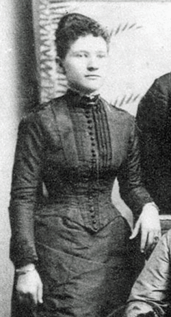
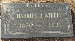
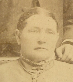
Harriet J “Hattie” Guess Steele
| Birth | : | May 1870 California, USA |
| Death | : | 15 Jul 1931 Rosemead, Los Angeles County, California, USA |
| Burial | : | Friends Cemetery, Jamestown, Newport County, USA |
| Coordinate | : | 41.5262489, -71.3833771 |
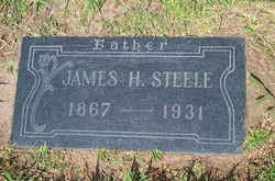
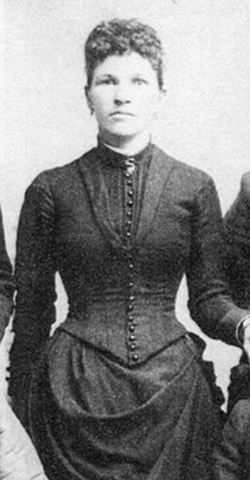
| Description | : | Los Angeles Times July 16, 1931 pg. 6 Valley Pioneer Dies Amid Kin ROSEMEAD July 15 -- Mrs. J. H. Steele, 56 years of age, life-long resident, died at her home on Steele avenue here shortly after noon today following several strokes of paralysis. Her husband, who is also suffering from a stroke of paralysis which has affected his entire left side, was at her bedside with their five children. Harriet Steele was the only daughter of the late Mr. and Mrs. John Guess, pioneers of the San Gabriel Valley. She was born in a house on the property where she... Read More |
frequently asked questions (FAQ):
-
Where is Harriet J “Hattie” Guess Steele's memorial?
Harriet J “Hattie” Guess Steele's memorial is located at: Friends Cemetery, Jamestown, Newport County, USA.
-
When did Harriet J “Hattie” Guess Steele death?
Harriet J “Hattie” Guess Steele death on 15 Jul 1931 in Rosemead, Los Angeles County, California, USA
-
Where are the coordinates of the Harriet J “Hattie” Guess Steele's memorial?
Latitude: 41.5262489
Longitude: -71.3833771
Family Members:
Parent
Spouse
Siblings
Flowers:
Nearby Cemetories:
1. Friends Cemetery
Jamestown, Newport County, USA
Coordinate: 41.5262489, -71.3833771
2. Hazard Lot
Jamestown, Newport County, USA
Coordinate: 41.5265300, -71.3831500
3. Quaker Records
Jamestown, Newport County, USA
Coordinate: 41.5262740, -71.3840550
4. Cedar Cemetery
Jamestown, Newport County, USA
Coordinate: 41.5264664, -71.3822861
5. Watson Lot (Defunct)
Jamestown, Newport County, USA
Coordinate: 41.5264600, -71.3822800
6. Tew Cemetery
Jamestown, Newport County, USA
Coordinate: 41.5314816, -71.3757173
7. George F. Gardiner Farm Cemetery
Jamestown, Newport County, USA
Coordinate: 41.5314460, -71.3753960
8. Saint Mark Cemetery
Jamestown, Newport County, USA
Coordinate: 41.5300800, -71.3657500
9. Governor Carr Lot
Jamestown, Newport County, USA
Coordinate: 41.5205420, -71.3659670
10. Dutch Island Small Pox Lot (Defunct)
Washington County, USA
Coordinate: 41.5049310, -71.3971470
11. Fort Greble Post Cemetery (Defunct)
Jamestown, Newport County, USA
Coordinate: 41.5030556, -71.4005556
12. Cautantowwits Indian Lot
Jamestown, Newport County, USA
Coordinate: 41.4986940, -71.3800830
13. David Greene Lot
North Kingstown, Washington County, USA
Coordinate: 41.5324500, -71.4222100
14. Town Cemetery
Jamestown, Newport County, USA
Coordinate: 41.4965300, -71.3745200
15. Central Baptist Church Memorial Garden
Jamestown, Newport County, USA
Coordinate: 41.4958840, -71.3743750
16. Saint Matthew’s Memorial Garden
Jamestown, Newport County, USA
Coordinate: 41.4959550, -71.3738060
17. John Congdon Lot
North Kingstown, Washington County, USA
Coordinate: 41.5138610, -71.4240560
18. Albert Arnold Lot
North Kingstown, Washington County, USA
Coordinate: 41.5081701, -71.4223422
19. Joseph Greene Lot
Jamestown, Newport County, USA
Coordinate: 41.4924200, -71.3727520
20. Browning Family Servants Cemetery
North Kingstown, Washington County, USA
Coordinate: 41.5335520, -71.4297803
21. Cottrell-Green Cemetery
Jamestown, Newport County, USA
Coordinate: 41.4908000, -71.3894870
22. Paine Cemetery
Jamestown, Newport County, USA
Coordinate: 41.5592170, -71.3635900
23. John Cashman Lot
North Kingstown, Washington County, USA
Coordinate: 41.5205280, -71.4345000
24. Arnold Lot
Jamestown, Newport County, USA
Coordinate: 41.4869120, -71.3899760

