| Birth | : | 4 Aug 1845 Wabash County, Indiana, USA |
| Death | : | 28 Oct 1906 Lagro, Wabash County, Indiana, USA |
| Burial | : | Carisbrook Cemetery, Carisbrook, Central Goldfields Shire, Australia |
| Coordinate | : | -37.0666840, 143.8054560 |
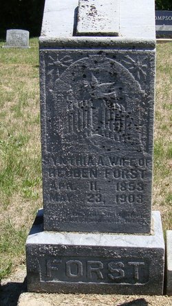
| Description | : | Harriet's 1st marriage was to Jacob Carr on Dec. 22, 1864 in Wabash Co., Ind. There were at least four(possibly six) children born; Mary, Nancy, Margaret and Adaline(Ronlla & Harvey). Jacob died Mar 1875 in Rutland, Meigs, Ohio. Harriet's 2nd marriage was to Alfred C. Fisher on May 27, 1877 in Wabash Co., Ind. 1 child born to this marrige(Andrew). 3rd marriage was to Frank Forst on April 21, 1887 in Wabash Co., Ind. 1900 census states that Harriet had 8 children, 5 were still living. Obit: Wabash Daily Plain Dealer Monday,... Read More |
frequently asked questions (FAQ):
-
Where is Harriet Van Dyne Forst's memorial?
Harriet Van Dyne Forst's memorial is located at: Carisbrook Cemetery, Carisbrook, Central Goldfields Shire, Australia.
-
When did Harriet Van Dyne Forst death?
Harriet Van Dyne Forst death on 28 Oct 1906 in Lagro, Wabash County, Indiana, USA
-
Where are the coordinates of the Harriet Van Dyne Forst's memorial?
Latitude: -37.0666840
Longitude: 143.8054560
Family Members:
Parent
Spouse
Siblings
Children
Nearby Cemetories:
1. Carisbrook Cemetery
Carisbrook, Central Goldfields Shire, Australia
Coordinate: -37.0666840, 143.8054560
2. Bald Hill Cemetery
Carisbrook, Central Goldfields Shire, Australia
Coordinate: -37.0333328, 143.8166656
3. Maryborough Cemetery
Maryborough, Central Goldfields Shire, Australia
Coordinate: -37.0601530, 143.7584990
4. Majorca Cemetery
Majorca, Central Goldfields Shire, Australia
Coordinate: -37.1160350, 143.8052200
5. Bristol Hill Cemetery
Maryborough, Central Goldfields Shire, Australia
Coordinate: -37.0483806, 143.7304521
6. Timor Cemetery
Timor, Central Goldfields Shire, Australia
Coordinate: -36.9890010, 143.7058740
7. Amherst Old Cemetery
Amherst, Central Goldfields Shire, Australia
Coordinate: -37.1433760, 143.6704700
8. Amherst Public Cemetery
Amherst, Central Goldfields Shire, Australia
Coordinate: -37.1638690, 143.6771220
9. Norwood Cemetery
Wareek, Central Goldfields Shire, Australia
Coordinate: -36.9767978, 143.6637254
10. Joyces Creek Cemetery
Joyces Creek, Mount Alexander Shire, Australia
Coordinate: -37.1029560, 143.9827690
11. Baringhup Cemetery
Baringhup, Mount Alexander Shire, Australia
Coordinate: -36.9834600, 143.9833800
12. Bung Bong Cemetery
Bung Bong, Central Goldfields Shire, Australia
Coordinate: -37.0427000, 143.5864000
13. Glengower Kooroocherang Cemetery
Campbelltown, Mount Alexander Shire, Australia
Coordinate: -37.2119210, 143.9386720
14. Burnt Creek Cemetery
Bromley, Central Goldfields Shire, Australia
Coordinate: -36.8816685, 143.7526013
15. Eddington Cemetery
Eddington, Loddon Shire, Australia
Coordinate: -36.8817980, 143.8711490
16. Welshman's Reef Cemetery
Welshmans Reef, Mount Alexander Shire, Australia
Coordinate: -37.0542000, 144.0518000
17. Sandon Cemetery
Yandoit, Hepburn Shire, Australia
Coordinate: -37.1685000, 144.0419000
18. Maldon Cemetery
Maldon, Mount Alexander Shire, Australia
Coordinate: -36.9727980, 144.0540260
19. Dunolly Old Cemetery
Dunolly, Central Goldfields Shire, Australia
Coordinate: -36.8517480, 143.7185490
20. Clunes Cemetery
Clunes, Hepburn Shire, Australia
Coordinate: -37.2945740, 143.7559320
21. Newstead Cemetery
Newstead, Mount Alexander Shire, Australia
Coordinate: -37.1203000, 144.0900000
22. Newstead Roman Catholic Ground
Newstead, Mount Alexander Shire, Australia
Coordinate: -37.1208660, 144.0917730
23. Dunolly Public Cemetery
Dunolly, Central Goldfields Shire, Australia
Coordinate: -36.8402610, 143.7217830
24. German Gully Burial Ground
Dunolly, Central Goldfields Shire, Australia
Coordinate: -36.8271280, 143.7303480


