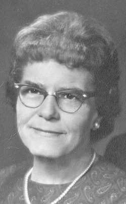
| Birth | : | 16 Apr 1880 Muscotah, Atchison County, Kansas, USA |
| Death | : | 15 May 1949 Atchison County, Kansas, USA |
| Burial | : | George Town General Cemetery, George Town, George Town Council, Australia |
| Coordinate | : | -41.1030870, 146.8384460 |
| Description | : | Harry Otto Moore was the son of Henry Harrison Moore and Lydia Ann Sloyer Moore. Harry Otto Moore married Iva Gay Bathurst on September 3, 1902 in the home of Iva's parents in Horton, KS-Roland and Keziah(North)Bathurst. To this union the following children were born Henry Roland Moore Theodore Clyde Moore Elizabeth Pearle Moore Leonard Otto Moore Mildred Marie Moore Harry Eugene Moore Walter Lou Moore Ruth Fern Moore Robert Keith Moore Betty Gay Moore Harry died in May 15,1949 and is buried in Oak Hill cemetery in Atchison County Kansas |
frequently asked questions (FAQ):
-
Where is Harry Otto Moore's memorial?
Harry Otto Moore's memorial is located at: George Town General Cemetery, George Town, George Town Council, Australia.
-
When did Harry Otto Moore death?
Harry Otto Moore death on 15 May 1949 in Atchison County, Kansas, USA
-
Where are the coordinates of the Harry Otto Moore's memorial?
Latitude: -41.1030870
Longitude: 146.8384460
Family Members:
Spouse
Siblings
Children
Flowers:
Nearby Cemetories:
1. George Town General Cemetery
George Town, George Town Council, Australia
Coordinate: -41.1030870, 146.8384460
2. Riverlinks Anglican Church Cemetery
George Town, George Town Council, Australia
Coordinate: -41.1075360, 146.8240910
3. Beaconsfield General Cemetery
Beaconsfield, West Tamar Council, Australia
Coordinate: -41.1848620, 146.8087650
4. Lefroy Public Cemetery
Lefroy, George Town Council, Australia
Coordinate: -41.0989400, 146.9926300
5. Auld Kirk Uniting Cemetery
Sidmouth, West Tamar Council, Australia
Coordinate: -41.2130230, 146.9058730
6. Pipers River St. Albans Anglican Cemetery
Pipers River, George Town Council, Australia
Coordinate: -41.1012446, 147.0914777
7. Winkleigh General Cemetery
Winkleigh, West Tamar Council, Australia
Coordinate: -41.2983150, 146.8543860
8. Supply River Methodist Church Cemetery
Winkleigh, West Tamar Council, Australia
Coordinate: -41.2943060, 146.8975210
9. St. Canice Catholic Cemetery
Glengarry, West Tamar Council, Australia
Coordinate: -41.3350250, 146.8701150
10. St. Matthias Churchyard
Windermere, Launceston City, Australia
Coordinate: -41.3162000, 147.0040000
11. Bangor Cemetery
Bangor, Launceston City, Australia
Coordinate: -41.2172070, 147.1384410
12. Harford Methodist Cemetery
Harford, Latrobe Council, Australia
Coordinate: -41.2391390, 146.5463210
13. Frankford Cemetery
Frankford, West Tamar Council, Australia
Coordinate: -41.3611110, 146.8022220
14. Turners Marsh Uniting Church Cemetery
Karoola, Launceston City, Australia
Coordinate: -41.2475306, 147.1341972
15. Tunnel Methodist Cemetery
Tunnel, Launceston City, Australia
Coordinate: -41.1942330, 147.1820610
16. St. George’s Anglican Church Cemetery New Ground
Thirlstane, Latrobe Council, Australia
Coordinate: -41.2178020, 146.5069040
17. Karoola Sacred Heart Catholic Church Cemetery
Karoola, Launceston City, Australia
Coordinate: -41.2597310, 147.1431340
18. St. James Anglican Cemetery
Northdown, Latrobe Council, Australia
Coordinate: -41.1801780, 146.4771670
19. Uniting Church Cemetery
Moriarty, Latrobe Council, Australia
Coordinate: -41.2344220, 146.4977560
20. Wesley Vale Uniting Church New Cemetery
Wesley Vale, Latrobe Council, Australia
Coordinate: -41.1898130, 146.4635470
21. Wesley Vale Uniting Church Old Cemetery
Wesley Vale, Latrobe Council, Australia
Coordinate: -41.1906560, 146.4563100
22. St. Andrew's Anglican Cemetery
Lebrina, Launceston City, Australia
Coordinate: -41.1758350, 147.2295600
23. Sassafras Uniting Church Cemetery
Sassafras, Latrobe Council, Australia
Coordinate: -41.2841730, 146.5071220
24. Sassafras Baptist Church Cemetery
Sassafras East, Latrobe Council, Australia
Coordinate: -41.2892740, 146.5059210


