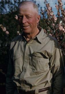
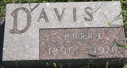
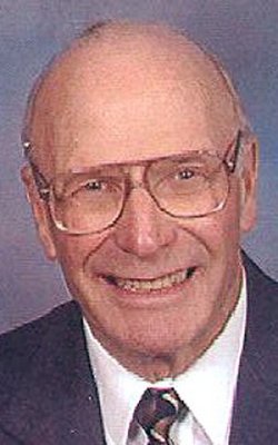
Harry Wayne Davis
| Birth | : | 18 Nov 1896 Sac County, Iowa, USA |
| Death | : | 2 Aug 1976 Sac County, Iowa, USA |
| Burial | : | Nemaha Cemetery, Nemaha, Sac County, USA |
| Coordinate | : | 42.5102997, -95.0905991 |
| Description | : | NEMAHA -- Harry W. Davis, 79, of Nemaha, died Monday, Aug. 2, at his son Gale's farm near Nemaha. Funeral services will be held at 10:30 a. m. Thursday at the United Methodist Church here, with burial in the Nemaha Cemetery. The Farber and Otteman Funeral home of Sac City in in charge of arrangements. Mr. Davis was a life-long resident of the Nemaha and Sac City area and was a retired farmer. He is survived by his sons, Gale and Ritchie, both of Nemaha; a daughter, Mrs. Monroe Lundberg of Hawarden; seven grandchildren and three great-grandchildren; and two... Read More |
frequently asked questions (FAQ):
-
Where is Harry Wayne Davis's memorial?
Harry Wayne Davis's memorial is located at: Nemaha Cemetery, Nemaha, Sac County, USA.
-
When did Harry Wayne Davis death?
Harry Wayne Davis death on 2 Aug 1976 in Sac County, Iowa, USA
-
Where are the coordinates of the Harry Wayne Davis's memorial?
Latitude: 42.5102997
Longitude: -95.0905991
Family Members:
Parent
Spouse
Siblings
Children
Flowers:
Nearby Cemetories:
1. Nemaha Cemetery
Nemaha, Sac County, USA
Coordinate: 42.5102997, -95.0905991
2. Sacred Heart Cemetery
Early, Sac County, USA
Coordinate: 42.4650002, -95.1446991
3. Early Union Cemetery
Early, Sac County, USA
Coordinate: 42.4578018, -95.1425018
4. Donna Lynn Salis-Christensen Burial Plot
Newell, Buena Vista County, USA
Coordinate: 42.5882134, -95.0544960
5. Sac County Farm Cemetery
Early, Sac County, USA
Coordinate: 42.4295560, -95.1175190
6. Protestant Union Cemetery
Early, Sac County, USA
Coordinate: 42.4294014, -95.1483002
7. Chase Cemetery
Sac County, USA
Coordinate: 42.5036011, -95.2288971
8. Immanuel Reformed Cemetery
Schaller, Sac County, USA
Coordinate: 42.5396996, -95.2294006
9. Oakland Cemetery
Sac City, Sac County, USA
Coordinate: 42.4272100, -94.9910760
10. Newell Catholic Prairie Cemetery
Newell, Buena Vista County, USA
Coordinate: 42.6144000, -95.0328000
11. German Methodist Cemetery
Schaller, Sac County, USA
Coordinate: 42.5045000, -95.2481000
12. Newell Cemetery
Newell, Buena Vista County, USA
Coordinate: 42.6123800, -94.9994800
13. Storm Lake Cemetery
Storm Lake, Buena Vista County, USA
Coordinate: 42.6352800, -95.1744400
14. Emmanuel Cemetery
Cook Township, Sac County, USA
Coordinate: 42.3993988, -95.2063980
15. Cory Grove Cemetery
Sac City, Sac County, USA
Coordinate: 42.3932991, -94.9788971
16. Cook Center Cemetery
Schaller, Sac County, USA
Coordinate: 42.4432983, -95.2649994
17. Saint Mary's Catholic Cemetery
Storm Lake, Buena Vista County, USA
Coordinate: 42.6470000, -95.1660000
18. Cedar Cemetery
Sac City, Sac County, USA
Coordinate: 42.4430000, -94.9110000
19. Saint Josephs Catholic Church Cemetery
Schaller, Sac County, USA
Coordinate: 42.5035000, -95.3095000
20. Schaller Cemetery
Schaller, Sac County, USA
Coordinate: 42.5046000, -95.3117600
21. Saint John Cemetery
Williams Township, Calhoun County, USA
Coordinate: 42.4747009, -94.8672028
22. Salem Reform Cemetery
Sac County, USA
Coordinate: 42.3555984, -95.1866989
23. Buena Vista Memorial Park Cemetery
Storm Lake, Buena Vista County, USA
Coordinate: 42.6539001, -95.2339020
24. Maple Valley Township Cemetery
Alta, Buena Vista County, USA
Coordinate: 42.5752600, -95.3199980

