| Birth | : | 8 Nov 1911 Pilot Mountain, Surry County, North Carolina, USA |
| Death | : | 13 Jan 2005 Pilot Mountain, Surry County, North Carolina, USA |
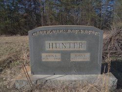
| Burial | : | Westfield Friends Cemetery, Westfield, Surry County, USA |
| Coordinate | : | 36.4687220, -80.4527220 |
| Description | : | PILOT MOUNTAIN - Mr. Harvey Hunter, 93, of Old Westfield Road, Pilot Mountain, passed away Thursday, Jan. 13, 2005, at the Kate B. Reynolds Hospice Home. He was born Nov. 9, 1911, in Surry County to John Edgar and Rosa Lee Adams Hunter. As a young man, he was an ambitious basketball player whose aspirations were interrupted by the Great Depression era. He dedicated his remaining years to his family through hard work. Mr. Hunter worked as floor manager at Cooks Tobacco Warehouse for 35 years and raised tobacco and cattle until he retired. He was a member of Westfield... Read More |
frequently asked questions (FAQ):
-
Where is Harvey Armstead Hunter's memorial?
Harvey Armstead Hunter's memorial is located at: Westfield Friends Cemetery, Westfield, Surry County, USA.
-
When did Harvey Armstead Hunter death?
Harvey Armstead Hunter death on 13 Jan 2005 in Pilot Mountain, Surry County, North Carolina, USA
-
Where are the coordinates of the Harvey Armstead Hunter's memorial?
Latitude: 36.4687220
Longitude: -80.4527220
Family Members:
Parent
Spouse
Siblings
Children
Flowers:
Nearby Cemetories:
1. Westfield Friends Cemetery
Westfield, Surry County, USA
Coordinate: 36.4687220, -80.4527220
2. Westfield Baptist Church Cemetery
Westfield, Surry County, USA
Coordinate: 36.4753850, -80.4464010
3. Adams Family Cemetery
Surry County, USA
Coordinate: 36.4765278, -80.4665833
4. Inman Cemetery
Westfield, Surry County, USA
Coordinate: 36.4835790, -80.4531080
5. Hunter Cemetery
Surry County, USA
Coordinate: 36.4566994, -80.4700012
6. True Word Baptist Church Cemetery
Westfield, Surry County, USA
Coordinate: 36.4807560, -80.4793860
7. Simmons Family Cemetery
Pilot Mountain, Surry County, USA
Coordinate: 36.4809840, -80.4834370
8. Waugh Cemetery
Westfield, Surry County, USA
Coordinate: 36.4413986, -80.4480972
9. Hills Village Family Cemetery
Hills Grove, Surry County, USA
Coordinate: 36.4352200, -80.4594500
10. Jessup Grove Baptist Church Cemetery
Pilot Mountain, Surry County, USA
Coordinate: 36.4432780, -80.4865280
11. McDaniel Family Cemetery
Pilot Mountain, Surry County, USA
Coordinate: 36.4285800, -80.4560500
12. Jessup Family Cemetery
Pilot Mountain, Surry County, USA
Coordinate: 36.4282990, -80.4563980
13. Beasley Cemetery
Johnstown, Stokes County, USA
Coordinate: 36.4831009, -80.4044037
14. Simmons Family Cemetery
Pilot Mountain, Surry County, USA
Coordinate: 36.4463110, -80.4982480
15. Pine Ridge Presbyterian Church Cemetery
Pilot Mountain, Surry County, USA
Coordinate: 36.4537700, -80.5030000
16. Jessup Family Cemetery
Asbury, Stokes County, USA
Coordinate: 36.5066000, -80.4214200
17. Nunn Cemetery
Johnstown, Stokes County, USA
Coordinate: 36.4749985, -80.3964005
18. Hills Presbyterian Church Cemetery
Hills Grove, Surry County, USA
Coordinate: 36.4234161, -80.4621658
19. Albion Community Church Cemetery
Albion, Surry County, USA
Coordinate: 36.5152400, -80.4496760
20. Word of God Baptist Church Cemetery
Asbury, Stokes County, USA
Coordinate: 36.5108000, -80.4264880
21. Alexander Lee Joyce Family Cemetery
Brims Grove, Stokes County, USA
Coordinate: 36.4272000, -80.4233000
22. Albion Missionary Baptist Church Cemetery
Albion, Surry County, USA
Coordinate: 36.5199660, -80.4493940
23. Flippin-Lawson Cemetery
Asbury, Stokes County, USA
Coordinate: 36.5179690, -80.4318440
24. Bobby and Arbra Inman Family Cemetery
Mount Airy, Surry County, USA
Coordinate: 36.4974900, -80.5075100

