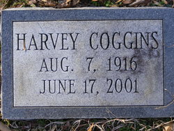
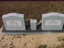
Harvey “Crip” Coggins
| Birth | : | 7 Aug 1916 Greenville County, South Carolina, USA |
| Death | : | 17 Jun 2001 Hendersonville, Henderson County, North Carolina, USA |
| Burial | : | Riverview Cemetery, Washburn, McLean County, USA |
| Coordinate | : | 47.2846985, -101.0113983 |
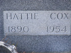
| Description | : | Harvey "Crip" Coggins, 84, of 618 Rayna Drive, Greer, died Sunday, June 17, 2001, at Beverly Health Center in Hendersonville, N.C. Born in Greenville County, he was a son of the late Oscar and Hattie Cox Coggins. Faith: Baptist. Survivors: A sister, Cora Lee Oliver, of Landrum. Visitation: 1:30 to 2:30 p.m. Thursday at The Howze Mortuary. Graveside service: 3 p.m. Thursday at Cox Chapel Baptist Church Cemetery, Marietta. Family: Home of Cora Lee Oliver, 4699 Howe Road, Landrum. — The Howze Mortuary, Funeral Directors, Travelers Rest, is in charge of arrangements. Published in The Greenville News: 06-20-2001 |
frequently asked questions (FAQ):
-
Where is Harvey “Crip” Coggins's memorial?
Harvey “Crip” Coggins's memorial is located at: Riverview Cemetery, Washburn, McLean County, USA.
-
When did Harvey “Crip” Coggins death?
Harvey “Crip” Coggins death on 17 Jun 2001 in Hendersonville, Henderson County, North Carolina, USA
-
Where are the coordinates of the Harvey “Crip” Coggins's memorial?
Latitude: 47.2846985
Longitude: -101.0113983
Family Members:
Parent
Siblings
Flowers:
Nearby Cemetories:
1. Riverview Cemetery
Washburn, McLean County, USA
Coordinate: 47.2846985, -101.0113983
2. Baptist Cemetery
Washburn, McLean County, USA
Coordinate: 47.3013500, -101.0243000
3. Zion Lutheran Cemetery
Washburn, McLean County, USA
Coordinate: 47.3015500, -101.0349000
4. Hensler Cemetery
Hensler, Oliver County, USA
Coordinate: 47.2708015, -101.0864029
5. Bagnell Cemetery
Oliver County, USA
Coordinate: 47.2224998, -101.0111008
6. Gaines Cemetery
Oliver County, USA
Coordinate: 47.2141991, -101.0108032
7. Sverdrup Cemetery
McLean County, USA
Coordinate: 47.3563995, -101.0028000
8. Wing Cemetery
McLean County, USA
Coordinate: 47.2291985, -100.9285965
9. Sanger Cemetery
Sanger, Oliver County, USA
Coordinate: 47.1852989, -101.0017014
10. Conkling Cemetery
McLean County, USA
Coordinate: 47.3125000, -101.1825027
11. Daub Hill Cemetery
Fort Clark, Oliver County, USA
Coordinate: 47.2365300, -101.1941760
12. Fairview Methodist Cemetery
Wilton, McLean County, USA
Coordinate: 47.2905952, -100.8125186
13. Bethal Baptist Cemetery
McLean County, USA
Coordinate: 47.4038700, -100.9071400
14. Zion Baptist Cemetery
McLean County, USA
Coordinate: 47.3518982, -100.7985992
15. Ingersoll Cemetery
Washburn, McLean County, USA
Coordinate: 47.4516000, -100.9915800
16. South Saint Olaf Cemetery
Turtle Lake, McLean County, USA
Coordinate: 47.4079933, -100.8432465
17. Birka Lutheran Cemetery
Falkirk, McLean County, USA
Coordinate: 47.3572300, -101.2478000
18. Saint Johns Cemetery
Underwood, McLean County, USA
Coordinate: 47.4364014, -101.1641998
19. Riverview Cemetery
Wilton, McLean County, USA
Coordinate: 47.1589012, -100.8007965
20. Saint Bonaventure Catholic Church Cemetery
Underwood, McLean County, USA
Coordinate: 47.4535800, -101.1422450
21. Sacred Heart Cemetery
Wilton, McLean County, USA
Coordinate: 47.1791992, -100.7705994
22. Holy Trinity Orthodox Cemetery
Wilton, McLean County, USA
Coordinate: 47.1780160, -100.7709360
23. Saints Peter and Paul Cemetery
Wilton, McLean County, USA
Coordinate: 47.1786003, -100.7703018
24. Zoar Cemetery
Underwood, McLean County, USA
Coordinate: 47.4157982, -101.2260971

