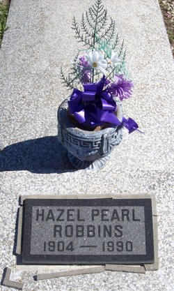
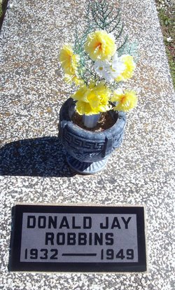
Hazel Pearl Mobley Robbins
| Birth | : | 19 Jun 1904 Liberal, Barton County, Missouri, USA |
| Death | : | 11 Jun 1990 Girard, Crawford County, Kansas, USA |
| Burial | : | South Park Cemetery, Roswell, Chaves County, USA |
| Coordinate | : | 33.3586006, -104.5136032 |
| Plot | : | Section 6, Row 11, Lot 130 |
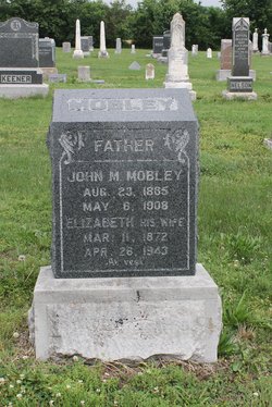
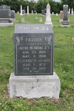
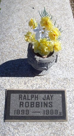
| Description | : | Hazel Robbins GIRARD — Hazel Robbins, 85, of Girard died at 11:27 a.m. Monday June 11, 1990, at the Girard Hospital District No. 1, where she had been a patient in the hospital for two weeks and ill for the past three months. She was born June 19, 1904, at Liberal, Mo., to John and Elizabeth (Short) Mobley. She was married to Ralph Robbins on April 15, 1922, at Columbus. They farmed in the McCune area until 1960 when they moved to St. Charles, Ill. They retired to Stark and later moved to Girard in 1977. He died... Read More |
frequently asked questions (FAQ):
-
Where is Hazel Pearl Mobley Robbins's memorial?
Hazel Pearl Mobley Robbins's memorial is located at: South Park Cemetery, Roswell, Chaves County, USA.
-
When did Hazel Pearl Mobley Robbins death?
Hazel Pearl Mobley Robbins death on 11 Jun 1990 in Girard, Crawford County, Kansas, USA
-
Where are the coordinates of the Hazel Pearl Mobley Robbins's memorial?
Latitude: 33.3586006
Longitude: -104.5136032
Family Members:
Parent
Spouse
Siblings
Children
Flowers:
Nearby Cemetories:
1. South Park Cemetery
Roswell, Chaves County, USA
Coordinate: 33.3586006, -104.5136032
2. General Douglas L. McBride Roswell Vet. Cemetery
Roswell, Chaves County, USA
Coordinate: 33.3617580, -104.5137780
3. Anderson Bethany Funeral Home and Columbarium
Roswell, Chaves County, USA
Coordinate: 33.3625540, -104.5224580
4. Saint Peter's Catholic Church Columbarium
Roswell, Chaves County, USA
Coordinate: 33.3855000, -104.5225000
5. Saint Johns Catholic Church Columbarium
Roswell, Chaves County, USA
Coordinate: 33.3887620, -104.5184580
6. First United Methodist Church Columbarium
Roswell, Chaves County, USA
Coordinate: 33.3950000, -104.5262000
7. Saint Andrews Columbarium
Roswell, Chaves County, USA
Coordinate: 33.3980000, -104.5258000
8. New Mexico Military Institute Columbarium
Roswell, Chaves County, USA
Coordinate: 33.4098500, -104.5236500
9. Westminster Presbyterian Church Columbarium
Roswell, Chaves County, USA
Coordinate: 33.3964000, -104.5629000
10. Poor Clare Monastery Cemetery
Roswell, Chaves County, USA
Coordinate: 33.4178000, -104.5100000
11. Memory Lawn Memorial Park
Roswell, Chaves County, USA
Coordinate: 33.4160900, -104.4852200
12. Assumption Catholic Church Columbarium
Roswell, Chaves County, USA
Coordinate: 33.4300000, -104.5280000
13. Saint Marks Evangelical Lutheran Memorial Garden
Roswell, Chaves County, USA
Coordinate: 33.4317930, -104.5223160
14. Grace Community Church Columbarium
Roswell, Chaves County, USA
Coordinate: 33.4319250, -104.5355390
15. Saint Marys Cemetery
Roswell, Chaves County, USA
Coordinate: 33.4375000, -104.4878006
16. Spring Mound Valley Cemetery
Dexter, Chaves County, USA
Coordinate: 33.2221130, -104.3196640
17. Hagerman Masonic Cemetery
Hagerman, Chaves County, USA
Coordinate: 33.1144310, -104.3536600
18. Hagerman Cemetery
Hagerman, Chaves County, USA
Coordinate: 33.1131570, -104.3536380
19. Acme Cemetery
Chaves County, USA
Coordinate: 33.5978012, -104.3328018
20. Eden Valley Cemetery
Chaves County, USA
Coordinate: 33.6417000, -104.5346000
21. Lake Arthur Cemetery
Lake Arthur, Chaves County, USA
Coordinate: 33.0074997, -104.3788986
22. Twin Oaks Memorial Park
Artesia, Eddy County, USA
Coordinate: 32.8892000, -104.3990000
23. First Presbyterian Church Columbarium
Artesia, Eddy County, USA
Coordinate: 32.8392140, -104.4015750
24. Picacho Cemetery
Picacho, Lincoln County, USA
Coordinate: 33.3530000, -105.1493000

