
| Birth | : | 5 Oct 1933 Maryville, Nodaway County, Missouri, USA |
| Death | : | 27 Aug 1993 Omaha, Douglas County, Nebraska, USA |
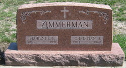
| Burial | : | Mount Pleasant United Methodist Church Cemetery, Taylorstown, Loudoun County, USA |
| Coordinate | : | 39.2483330, -77.5669403 |
| Description | : | Services for Helen Zimmerman Bowers, 59, Council Bluffs, Iowa, were held today at the Queen of the Apostles Church with Frs. Tedd Witte and Phillip Kruse as celebrants. Mrs. Bowers died Friday, August 27, 1993 in an Omaha, Nebraska Hospital. She was a Maryville native and a graduate of Maryville High School, and attended Northwest Missouri State College. She was employed by the Internal Revenue Service as a Quality Assurance coordinator at the Omaha, Nebraska office. Mrs. Bowers was a member of Queen of the Apostles Church and Altar Society. She had served on the St. Albert School Foundation Board and... Read More |
frequently asked questions (FAQ):
-
Where is Helen Dorothy Zimmerman Bowers's memorial?
Helen Dorothy Zimmerman Bowers's memorial is located at: Mount Pleasant United Methodist Church Cemetery, Taylorstown, Loudoun County, USA.
-
When did Helen Dorothy Zimmerman Bowers death?
Helen Dorothy Zimmerman Bowers death on 27 Aug 1993 in Omaha, Douglas County, Nebraska, USA
-
Where are the coordinates of the Helen Dorothy Zimmerman Bowers's memorial?
Latitude: 39.2483330
Longitude: -77.5669403
Family Members:
Parent

Spouse
Siblings
Flowers:


Nearby Cemetories:
1. Mount Pleasant United Methodist Church Cemetery
Taylorstown, Loudoun County, USA
Coordinate: 39.2483330, -77.5669403
2. Furnace Mountain Presbyterian Cemetery
Lucketts, Loudoun County, USA
Coordinate: 39.2563896, -77.5430527
3. Mount Pleasant Baptist Church Cemetery
Lucketts, Loudoun County, USA
Coordinate: 39.2219746, -77.5581165
4. New Valley Baptist Cemetery
Lucketts, Loudoun County, USA
Coordinate: 39.2191800, -77.5474600
5. Point of Rocks Colored Cemetery
Point of Rocks, Frederick County, USA
Coordinate: 39.2816800, -77.5344000
6. Bethel United Methodist Church Cemetery
Stumptown, Loudoun County, USA
Coordinate: 39.2069435, -77.5586090
7. Faith Chapel Presbyterian Church Cemetery
Lucketts, Loudoun County, USA
Coordinate: 39.2230263, -77.5175781
8. Saint Pauls Episcopal Church Cemetery
Point of Rocks, Frederick County, USA
Coordinate: 39.2872009, -77.5291977
9. Saint James Reformed Cemetery
Lovettsville, Loudoun County, USA
Coordinate: 39.2702713, -77.6296844
10. Otho Thomas Cemetery
Point of Rocks, Frederick County, USA
Coordinate: 39.2753600, -77.5051100
11. New Jerusalem Lutheran Church Cemetery
Lovettsville, Loudoun County, USA
Coordinate: 39.2573624, -77.6389084
12. Lovettsville Union Cemetery
Lovettsville, Loudoun County, USA
Coordinate: 39.2583400, -77.6395800
13. Old Presbyterian Cemetery
Lovettsville, Loudoun County, USA
Coordinate: 39.2734299, -77.6394119
14. African Methodist Episcopal Church Cemetery
Lovettsville, Loudoun County, USA
Coordinate: 39.2759705, -77.6389542
15. Rehobeth United Methodist Church Cemetery
Lovettsville, Loudoun County, USA
Coordinate: 39.2270355, -77.6489182
16. Fairfax Friends Cemetery
Waterford, Loudoun County, USA
Coordinate: 39.1855698, -77.6058884
17. Black Waterford Union of Churches Cemetery
Waterford, Loudoun County, USA
Coordinate: 39.1854744, -77.6074524
18. Waterford Union of Churches Cemetery
Waterford, Loudoun County, USA
Coordinate: 39.1855698, -77.6080170
19. Grace Episcopal Church Columbarium
Brunswick, Frederick County, USA
Coordinate: 39.3127200, -77.6244000
20. Park Heights Cemetery
Brunswick, Frederick County, USA
Coordinate: 39.3177900, -77.6138000
21. Lakin Cemetery
Jefferson, Frederick County, USA
Coordinate: 39.3257500, -77.5388600
22. Old Berlin Cemetery
Brunswick, Frederick County, USA
Coordinate: 39.3144500, -77.6301900
23. Mount Olivet United Methodist Church Cemetery
Lovettsville, Loudoun County, USA
Coordinate: 39.2811317, -77.6757278
24. David Trundle Cemetery
Dickerson, Montgomery County, USA
Coordinate: 39.2004590, -77.4585700