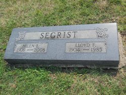
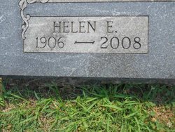
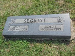
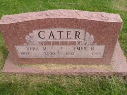
Helen E. Cater Segrist
| Birth | : | 27 May 1906 Missouri, USA |
| Death | : | 8 Feb 2008 |
| Burial | : | Oak Hill Memorial Park, Escondido, San Diego County, USA |
| Coordinate | : | 33.1292000, -117.0271988 |
| Plot | : | Section 5 east |
| Description | : | Segrist, Helen E. (Cater) Helen E. Segrist (Cater), 101, of Lee's Summit, Mo., died Friday, Feb. 8, 2008 at John Knox Village Care Center. Husband of 60 years, Lloyd F. Segrist, preceded her in death in 1985. She is survived by a son, F. H. Segrist and his wife Gerry, a grandson, Lloyd E. Segrist, a granddaughter, Monica Simpson, a step grandson Roger Ensley, a step granddaughter, Linda Charleson, nine great grandchildren and three great great grandchildren. In 1986 Mrs. Segrist moved to John Knox Village in Lee's Summit from North Kansas City where she... Read More |
frequently asked questions (FAQ):
-
Where is Helen E. Cater Segrist's memorial?
Helen E. Cater Segrist's memorial is located at: Oak Hill Memorial Park, Escondido, San Diego County, USA.
-
When did Helen E. Cater Segrist death?
Helen E. Cater Segrist death on 8 Feb 2008 in
-
Where are the coordinates of the Helen E. Cater Segrist's memorial?
Latitude: 33.1292000
Longitude: -117.0271988
Family Members:
Flowers:
Nearby Cemetories:
1. Oak Hill Memorial Park
Escondido, San Diego County, USA
Coordinate: 33.1292000, -117.0271988
2. Community Lutheran Church Columbarium
Escondido, San Diego County, USA
Coordinate: 33.1597140, -117.0295190
3. Trinity Episcopal Church Columbarium
Escondido, San Diego County, USA
Coordinate: 33.1186300, -117.0699000
4. San Diego Zoo Safari Park
Escondido, San Diego County, USA
Coordinate: 33.0944900, -117.0024200
5. First United Methodist Church Columbarium
Escondido, San Diego County, USA
Coordinate: 33.1197710, -117.0786030
6. San Pasqual Indian Cemetery
San Pasqual, San Diego County, USA
Coordinate: 33.0923996, -116.9798965
7. San Pasquale Cemetery
Escondido, San Diego County, USA
Coordinate: 33.0938668, -116.9556266
8. San Pasqual Cemetery
San Pasqual, San Diego County, USA
Coordinate: 33.0943985, -116.9543991
9. San Marcos Cemetery
San Marcos, San Diego County, USA
Coordinate: 33.1598280, -117.1502850
10. Valley Center Cemetery
Valley Center, San Diego County, USA
Coordinate: 33.2388992, -117.0317001
11. Incarnation Lutheran Church Columbarium
Poway, San Diego County, USA
Coordinate: 33.0194200, -117.0510600
12. Rancho Bernardo Presbyterian Church Columbarium
Rancho Bernardo, San Diego County, USA
Coordinate: 33.0204391, -117.0612717
13. Grace Episcopal Church Cemetery
San Marcos, San Diego County, USA
Coordinate: 33.1433296, -117.1652832
14. Saint Bartholomew Episcopal Church Columbarium
Poway, San Diego County, USA
Coordinate: 33.0084830, -117.0557540
15. Valley Creek Farm Burial Site
Valley Center, San Diego County, USA
Coordinate: 33.2684790, -117.0123020
16. San Marcos Lutheran Church Columbarium
San Marcos, San Diego County, USA
Coordinate: 33.1479360, -117.2067170
17. Nuevo Memory Gardens
Ramona, San Diego County, USA
Coordinate: 33.0583200, -116.8640200
18. Dearborn Memorial Park
Poway, San Diego County, USA
Coordinate: 32.9738998, -117.0255966
19. Saint Bartholomew Cemetery
Rincon, San Diego County, USA
Coordinate: 33.2769012, -116.9468994
20. Meadowlark Pioneer Memorial Cemetery
San Marcos, San Diego County, USA
Coordinate: 33.1100998, -117.2253036
21. Meadowlark Community Church Columbarium
San Marcos, San Diego County, USA
Coordinate: 33.1122030, -117.2273590
22. Saint Francis Episcopal Church Memorial Garden
Pauma Valley, San Diego County, USA
Coordinate: 33.2956530, -116.9686810
23. Caskey-Campbell-Winfree-Smith Cemetery
Poway, San Diego County, USA
Coordinate: 32.9568500, -117.0031200
24. Church of The Nativity Columbarium
Rancho Santa Fe, San Diego County, USA
Coordinate: 32.9971120, -117.1978040


