Helen Johanna Bartholomew Rohlman
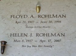
| Birth | : | 8 Mar 1917 Waterville, Douglas County, Washington, USA |
| Death | : | 17 Apr 2007 Wenatchee, Chelan County, Washington, USA |
| Burial | : | Martin Luther Cemetery, Bucyrus, Crawford County, USA |
| Coordinate | : | 40.8113650, -83.0744290 |
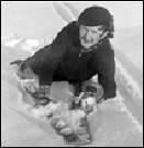
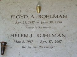
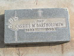
| Description | : | Helen J. Rohlman, 90, a longtime Waterville and East Wenatchee resident, passed away April 17, 2007, at Wenatchee, WA. For the past 18 months she had resided at Riverwest Assisted Living. Helen was born March 8, 1917, in Waterville, WA to Cassius and Anna Bell Bartholomew, the fifth of nine children. She received her education in Waterville and graduated from Waterville High School on June 6, 1935. Helen married Floyd A. Rohlman at Coulee City on March 18, 1939. They lived in Entiat and Seattle, WA for a short time, returning to the Palisades area until 1949, when they moved... Read More |
frequently asked questions (FAQ):
-
Where is Helen Johanna Bartholomew Rohlman's memorial?
Helen Johanna Bartholomew Rohlman's memorial is located at: Martin Luther Cemetery, Bucyrus, Crawford County, USA.
-
When did Helen Johanna Bartholomew Rohlman death?
Helen Johanna Bartholomew Rohlman death on 17 Apr 2007 in Wenatchee, Chelan County, Washington, USA
-
Where are the coordinates of the Helen Johanna Bartholomew Rohlman's memorial?
Latitude: 40.8113650
Longitude: -83.0744290
Family Members:
Parent
Spouse
Siblings
Flowers:
Nearby Cemetories:
1. Martin Luther Cemetery
Bucyrus, Crawford County, USA
Coordinate: 40.8113650, -83.0744290
2. Oceola Cemetery #2
Oceola, Crawford County, USA
Coordinate: 40.8388350, -83.0927630
3. Oceola Cemetery #3
Oceola, Crawford County, USA
Coordinate: 40.8416110, -83.0934010
4. Oceola Cemetery #1
Oceola, Crawford County, USA
Coordinate: 40.8439630, -83.0886740
5. Mount Zion Cemetery
Bucyrus, Crawford County, USA
Coordinate: 40.7759552, -83.0548328
6. Captain Harters Farm Burial Site
Oceola, Crawford County, USA
Coordinate: 40.8465500, -83.0967700
7. Nevada Cemetery
Nevada, Wyandot County, USA
Coordinate: 40.8342018, -83.1327972
8. Spore Cemetery
Spore, Crawford County, USA
Coordinate: 40.8633064, -83.0520272
9. Hill Burial Site
Edenville, Wyandot County, USA
Coordinate: 40.8541490, -83.1318860
10. Burke's Church Cemetery
Nevada, Wyandot County, USA
Coordinate: 40.7893982, -83.1500015
11. Oakwood Cemetery
Bucyrus, Crawford County, USA
Coordinate: 40.7989006, -82.9863968
12. City Cemetery
Bucyrus, Crawford County, USA
Coordinate: 40.7975750, -82.9857500
13. Bucyrus Mausoleum
Bucyrus, Crawford County, USA
Coordinate: 40.7971700, -82.9856500
14. Holy Trinity Cemetery
Bucyrus, Crawford County, USA
Coordinate: 40.8145750, -82.9803230
15. Union Cemetery
Bucyrus, Crawford County, USA
Coordinate: 40.8147640, -82.9794310
16. Lutheran Burying Ground (Defunct)
Bucyrus, Crawford County, USA
Coordinate: 40.8071380, -82.9791190
17. Quaker Cemetery
Bucyrus, Crawford County, USA
Coordinate: 40.8335090, -82.9790930
18. White Cemetery
Crawford County, USA
Coordinate: 40.7350006, -83.1018982
19. Wyandot Indian Cemetery
Nevada, Wyandot County, USA
Coordinate: 40.7675216, -83.1617790
20. Swartz Cemetery
Nevada, Wyandot County, USA
Coordinate: 40.7728336, -83.1688090
21. Gilliland Cemetery
Edenville, Wyandot County, USA
Coordinate: 40.8331100, -83.1793600
22. Salem Cemetery
Eden Township, Wyandot County, USA
Coordinate: 40.8408230, -83.1929050
23. Monnett Chapel Cemetery
Bucyrus Township, Crawford County, USA
Coordinate: 40.7391243, -82.9920906
24. Ulrich Cemetery
Wyandot County, USA
Coordinate: 40.8480988, -83.1913986

