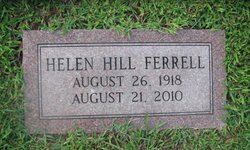
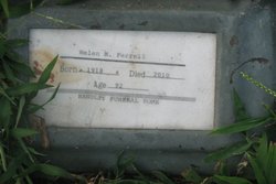
Helen Marie “Grammie” Hill Ferrell
| Birth | : | Apr 1918 |
| Death | : | 21 Aug 2010 |
| Burial | : | Anthony Catholic Cemetery, Anthony, Doña Ana County, USA |
| Coordinate | : | 32.0102000, -106.5996000 |
| Description | : | Helen Marie "Grammie" Hill Ferrell, 92, of Madison went home be with the Lord on August 21, 2010, at her home, surrounded by her family, after a long illness. Helen was born to Gertrude and Dennie Edison Hill on April 1918 in Fred. She graduated from Sherman High School and, after leaving her family, she worked and retired from Ferrell and Hill Insurance Agency in Madison with 23 years of service. She was preceded in death by her parents; her brothers, Roy and Dennie Lee Hill; her stepbrothers, Bill and Robert Ferrell; stepsister, Tressa Brock; and her sons, Harry Lee and Charles Edward... Read More |
frequently asked questions (FAQ):
-
Where is Helen Marie “Grammie” Hill Ferrell's memorial?
Helen Marie “Grammie” Hill Ferrell's memorial is located at: Anthony Catholic Cemetery, Anthony, Doña Ana County, USA.
-
When did Helen Marie “Grammie” Hill Ferrell death?
Helen Marie “Grammie” Hill Ferrell death on 21 Aug 2010 in
-
Where are the coordinates of the Helen Marie “Grammie” Hill Ferrell's memorial?
Latitude: 32.0102000
Longitude: -106.5996000
Family Members:
Spouse
Children
Flowers:
Nearby Cemetories:
1. Anthony Catholic Cemetery
Anthony, Doña Ana County, USA
Coordinate: 32.0102000, -106.5996000
2. Anthony Community Cemetery
Anthony, Doña Ana County, USA
Coordinate: 32.0095000, -106.6025000
3. Saint Anthony's Catholic Cemetery
Anthony, Doña Ana County, USA
Coordinate: 32.0027290, -106.6023290
4. Story Cemetery
Anthony, Doña Ana County, USA
Coordinate: 32.0025770, -106.6029420
5. Saint Anthony's Columbarium
Anthony, Doña Ana County, USA
Coordinate: 32.0016900, -106.6037700
6. Berino Cemetery
Berino, Doña Ana County, USA
Coordinate: 32.0686750, -106.6159270
7. Old Berino Cemetery
Doña Ana County, USA
Coordinate: 32.0708008, -106.6207962
8. Chamberino Cemetery
Chamberino, Doña Ana County, USA
Coordinate: 32.0334000, -106.6870000
9. La Union Cemetery
La Union, Doña Ana County, USA
Coordinate: 31.9483500, -106.6640660
10. Canutillo Cemetery
El Paso County, USA
Coordinate: 31.9167614, -106.5948029
11. Saint Luke's Episcopal Church Columbarium
La Union, Doña Ana County, USA
Coordinate: 31.9190930, -106.6319730
12. Vado Riverview Cemetery
Vado, Doña Ana County, USA
Coordinate: 32.1185000, -106.6373000
13. San Jose Cemetery
La Mesa, Doña Ana County, USA
Coordinate: 32.1154400, -106.7048200
14. Tompkins Family Cemetery
Chaparral, Doña Ana County, USA
Coordinate: 32.0159760, -106.4282670
15. Memory Gardens of the Valley
Santa Teresa, Doña Ana County, USA
Coordinate: 31.8387080, -106.6191660
16. Desert View Cemetery
Chaparral, Doña Ana County, USA
Coordinate: 32.0400490, -106.3949600
17. Saint Francis on the Hill Episcopal Church Columba
El Paso, El Paso County, USA
Coordinate: 31.8429910, -106.5307440
18. San Miguel Cemetery
San Miguel, Doña Ana County, USA
Coordinate: 32.1622440, -106.7278000
19. Memorial Pines Cemetery
Sunland Park, Doña Ana County, USA
Coordinate: 31.8207000, -106.6058500
20. Missionary Ridge Cemetery
Mesquite, Doña Ana County, USA
Coordinate: 32.1858020, -106.6857560
21. Restlawn Memorial Park
El Paso, El Paso County, USA
Coordinate: 31.8626790, -106.4325110
22. McGill County Cemetery
El Paso, El Paso County, USA
Coordinate: 31.8574333, -106.4262543
23. Smeltertown Cemetery
El Paso County, USA
Coordinate: 31.7869950, -106.5214060
24. Fort Bliss National Cemetery
El Paso, El Paso County, USA
Coordinate: 31.8236008, -106.4222031


