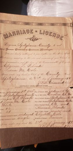
Helena Adeline “Lena” Cole Rhoads
| Birth | : | 14 May 1858 Caroline County, Virginia, USA |
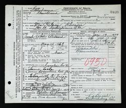
| Death | : | 19 Jan 1939 Spotsylvania County, Virginia, USA |
| Burial | : | Cherry Hill Community Cemetery, Ladson, Berkeley County, USA |
| Coordinate | : | 32.9974442, -80.0999374 |
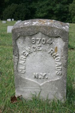
| Plot | : | Grave 6704 |
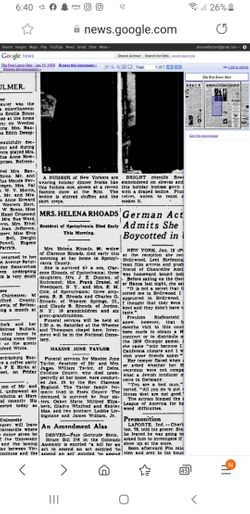
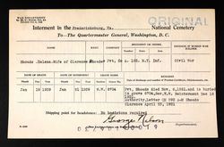
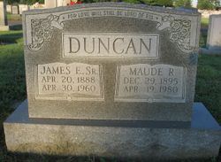
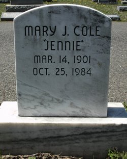
| Description | : | 2nd wife of Clarence Rhodes per Civil War Burials Fredericksburg Va p 81∼Mrs. Helena Rhoads, 80, widow of Clarence Rhoads, died at her home. She was survived by a son, Clarence Rhoads, of Spotsylvania; three daughters, Mrs. J. E. Duncan, of Richmond, Mrs. Frank Drabel, of Weedsport, NY, and Mrs. E. M. Cole, of Spotsylvania; three stepsons, B. W. Rhoads and Charles G. Rhoads, of Western Springs, IL, and Claude B. Rhoads, of Jordan, NY; 16 grandchildren and six great-grandchildren. Funeral services were to be held Saturday, 21 Jan 1939, at the Wheeler and Thompson Chapel, with interment in... Read More |
frequently asked questions (FAQ):
-
Where is Helena Adeline “Lena” Cole Rhoads's memorial?
Helena Adeline “Lena” Cole Rhoads's memorial is located at: Cherry Hill Community Cemetery, Ladson, Berkeley County, USA.
-
When did Helena Adeline “Lena” Cole Rhoads death?
Helena Adeline “Lena” Cole Rhoads death on 19 Jan 1939 in Spotsylvania County, Virginia, USA
-
Where are the coordinates of the Helena Adeline “Lena” Cole Rhoads's memorial?
Latitude: 32.9974442
Longitude: -80.0999374
Family Members:
Spouse
Children
Flowers:
Nearby Cemetories:
1. Cherry Hill Community Cemetery
Ladson, Berkeley County, USA
Coordinate: 32.9974442, -80.0999374
2. Philadelphia Missionary Baptist Church Cemetery
Ladson, Charleston County, USA
Coordinate: 32.9873314, -80.1043320
3. Huff Cemetery
Berkeley County, USA
Coordinate: 33.0275002, -80.0883026
4. Pear Cemetery
Berkeley County, USA
Coordinate: 33.0289001, -80.0935974
5. Zion Baptist Church Cemetery
Summerville, Dorchester County, USA
Coordinate: 33.0115980, -80.1363820
6. Mount Zion Missionary Baptist Church
Lincolnville, Charleston County, USA
Coordinate: 33.0038695, -80.1525422
7. Ridge Baptist Church Cemetery
Summerville, Berkeley County, USA
Coordinate: 33.0419006, -80.1110992
8. Droze Cemetery
Goose Creek, Berkeley County, USA
Coordinate: 33.0299988, -80.0569000
9. Finucan Family Cemetery
Summerville, Berkeley County, USA
Coordinate: 33.0255280, -80.1473160
10. Grove Hall Plantation Cemetery
Berkeley County, USA
Coordinate: 33.0452200, -80.0777500
11. Salem Baptist Church Cemetery
Summerville, Berkeley County, USA
Coordinate: 33.0480000, -80.1102500
12. Casey Cemetery
Goose Creek, Berkeley County, USA
Coordinate: 33.0183550, -80.0432930
13. Grove Hall U.M. Church Cemetery
Summerville, Berkeley County, USA
Coordinate: 33.0467560, -80.0783440
14. New Grove Hall Christian Church Cemetery
Summerville, Berkeley County, USA
Coordinate: 33.0489800, -80.0817000
15. Pet Rest Cemetery & Cremation
Goose Creek, Berkeley County, USA
Coordinate: 32.9908490, -80.0362330
16. Scott Family Cemetery
Summerville, Berkeley County, USA
Coordinate: 33.0322270, -80.1508510
17. Pine Hill Cemetery
Summerville, Dorchester County, USA
Coordinate: 33.0012020, -80.1684420
18. Whaley Family Cemetery
Mount Holly, Berkeley County, USA
Coordinate: 33.0547140, -80.0824010
19. Trinity Missionary Baptist Church
Goose Creek, Berkeley County, USA
Coordinate: 32.9814970, -80.0320500
20. Pineland Cemetery
Summerville, Dorchester County, USA
Coordinate: 33.0118550, -80.1687390
21. Jones Cemetery
Summerville, Berkeley County, USA
Coordinate: 33.0367931, -80.1534988
22. Saint James Goose Creek Cemetery
Goose Creek, Berkeley County, USA
Coordinate: 32.9754400, -80.0326100
23. Dr. William Morgan Cemetery
Summerville, Dorchester County, USA
Coordinate: 32.9818649, -80.1707764
24. Hillcrest Cemetery
Charleston County, USA
Coordinate: 33.0100670, -80.1727524

