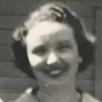
| Birth | : | 15 Jan 1933 Enning, Meade County, South Dakota, USA |
| Death | : | 4 Dec 2010 Rapid Valley, Pennington County, South Dakota, USA |
| Burial | : | Saint Mary's Cemetery, Altus, Franklin County, USA |
| Coordinate | : | 35.4522950, -93.7573680 |
| Description | : | Helena Elizabeth ("Betty") [nee Printz] Erickson January 15, 1933 to December 4, 2010 At about 5:30 p.m. on Saturday, December 4, 2010, Betty Erickson died unexpectedly of apparent natural causes at her beloved home — which she shared with Don, her husband of nearly 60 years — on Radar Hill Road seven miles southeast of Rapid City, South Dakota. Betty died precisely as her family members recollect her saying she always wanted — at home, quickly, at peace with the world and her place in it, with her dignity, her mobility, and all her mental faculties in tact. Nine days... Read More |
frequently asked questions (FAQ):
-
Where is Helena Elizabeth “Betty” Printz Erickson's memorial?
Helena Elizabeth “Betty” Printz Erickson's memorial is located at: Saint Mary's Cemetery, Altus, Franklin County, USA.
-
When did Helena Elizabeth “Betty” Printz Erickson death?
Helena Elizabeth “Betty” Printz Erickson death on 4 Dec 2010 in Rapid Valley, Pennington County, South Dakota, USA
-
Where are the coordinates of the Helena Elizabeth “Betty” Printz Erickson's memorial?
Latitude: 35.4522950
Longitude: -93.7573680
Family Members:
Parent
Siblings
Flowers:
Nearby Cemetories:
1. Altus City Cemetery
Altus, Franklin County, USA
Coordinate: 35.4402350, -93.7682560
2. Blanscet Cemetery
Altus, Franklin County, USA
Coordinate: 35.4675690, -93.7548900
3. Nichols Chapel Cemetery
Altus, Franklin County, USA
Coordinate: 35.4597015, -93.7789001
4. Houston Cemetery
Alix, Franklin County, USA
Coordinate: 35.4401500, -93.7343100
5. Pond Creek Cemetery
Altus, Franklin County, USA
Coordinate: 35.4557991, -93.7881012
6. English Cemetery
Ozark, Franklin County, USA
Coordinate: 35.4413700, -93.7883840
7. Liberty Cemetery
Denning, Franklin County, USA
Coordinate: 35.4305992, -93.7799988
8. Greenwood Cemetery
Franklin County, USA
Coordinate: 35.4185982, -93.7481003
9. Forbus Cemetery
Wiederkehr Village, Franklin County, USA
Coordinate: 35.4958000, -93.7418976
10. Philips Cemetery
Wiederkehr Village, Franklin County, USA
Coordinate: 35.4939003, -93.7324982
11. Burnett Cemetery
Franklin County, USA
Coordinate: 35.4816100, -93.7066500
12. Pilot Grove Cemetery
Ozark, Franklin County, USA
Coordinate: 35.4272003, -93.8221970
13. Shiloh Cemetery
Ozark, Franklin County, USA
Coordinate: 35.5085983, -93.7900009
14. Coal Hill Cemetery
Coal Hill, Johnson County, USA
Coordinate: 35.4357986, -93.6821976
15. Harmon Cemetery
Ozark, Franklin County, USA
Coordinate: 35.5125008, -93.7319031
16. Oak Bend Cemetery
Franklin County, USA
Coordinate: 35.4463800, -93.8409600
17. Highland Cemetery
Ozark, Franklin County, USA
Coordinate: 35.4866982, -93.8396988
18. Morgan Hill Cemetery
Ozark, Franklin County, USA
Coordinate: 35.4418983, -93.8491974
19. West Cemetery
Coal Hill, Johnson County, USA
Coordinate: 35.4197006, -93.6735992
20. Jackson Cemetery
Ozark, Franklin County, USA
Coordinate: 35.5210991, -93.7153015
21. Srygley Cemetery
Coal Hill, Johnson County, USA
Coordinate: 35.4406013, -93.6596985
22. Huddleston Cemetery
Coal Hill, Johnson County, USA
Coordinate: 35.4411011, -93.6588974
23. Gar Creek Cemetery
Ozark, Franklin County, USA
Coordinate: 35.5309181, -93.7854691
24. Possum Walk Cemetery
Coal Hill, Johnson County, USA
Coordinate: 35.4771996, -93.6580963


