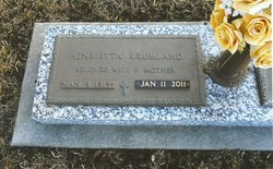
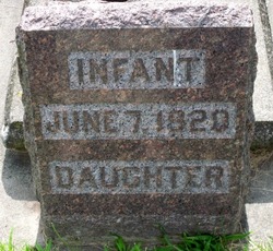
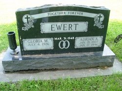
Henrietta “Hank” Ewert Krumland
| Birth | : | 9 Jan 1919 Columbus, Platte County, Nebraska, USA |
| Death | : | 11 Jan 2011 Genoa, Nance County, Nebraska, USA |
| Burial | : | Askvik, Eknes, Lindås kommune, Norway |
| Coordinate | : | 60.6149840, 5.4685350 |
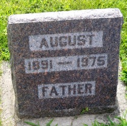
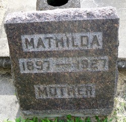
| Description | : | Henrietta "Hank" Krumland, 92 of Genoa, Nebraska, (formerly of Columbus) died Tuesday, January 11, 2011, at the Genoa Long Term Care Facility. The funeral service will be held on Saturday, January 15, 2011, at 10:30 AM at Immanuel Lutheran Church in Columbus with Rev. Patrick Sparling officiating. Interment will be in the Columbus Cemetery. Visitation will be from 9:30 AM until service time on Saturday at the church. In lieu of flowers, memorials are suggested to the Immanuel Lutheran Church. Henrietta was born January 9, 1919, in Columbus, Nebraska, to August and Mathilda (Hake) Ewert. She... Read More |
frequently asked questions (FAQ):
-
Where is Henrietta “Hank” Ewert Krumland's memorial?
Henrietta “Hank” Ewert Krumland's memorial is located at: Askvik, Eknes, Lindås kommune, Norway.
-
When did Henrietta “Hank” Ewert Krumland death?
Henrietta “Hank” Ewert Krumland death on 11 Jan 2011 in Genoa, Nance County, Nebraska, USA
-
Where are the coordinates of the Henrietta “Hank” Ewert Krumland's memorial?
Latitude: 60.6149840
Longitude: 5.4685350
Family Members:
Parent
Spouse
Siblings
Children
Flowers:
Nearby Cemetories:
1. Askvik
Eknes, Lindås kommune, Norway
Coordinate: 60.6149840, 5.4685350
2. Ostereidet
Bjorsviki, Lindås kommune, Norway
Coordinate: 60.6262510, 5.4872720
3. Øvreaas Cemetery
Myking, Lindås kommune, Norway
Coordinate: 60.6696990, 5.4115620
4. Hamre Church Cemetery
Hamre, Osterøy kommune, Norway
Coordinate: 60.5451230, 5.3505930
5. Seim Cemetery
Lindås kommune, Norway
Coordinate: 60.6166100, 5.2771700
6. Seim Kirk Cemetery
Seim, Lindås kommune, Norway
Coordinate: 60.6168310, 5.2769240
7. Myking Cemetery
Myking, Lindås kommune, Norway
Coordinate: 60.6998100, 5.3250100
8. Gjerstad Cemetery
Gjerstad, Osterøy kommune, Norway
Coordinate: 60.4997700, 5.5479800
9. Stanghelle gravplass
Stanghelle, Vaksdal kommune, Norway
Coordinate: 60.5496766, 5.7346329
10. Stamnes Cemetery
Stamnes, Vaksdal kommune, Norway
Coordinate: 60.6643990, 5.7493960
11. Salhus kirkegård
Salhus, Bergen kommune, Norway
Coordinate: 60.5031600, 5.2630100
12. Sæbø Cemetery
Saebo, Radøy kommune, Norway
Coordinate: 60.6125545, 5.1528831
13. Åsane gamle kirke
Bergen, Bergen kommune, Norway
Coordinate: 60.4748430, 5.3267720
14. Meland Old Cemetery
Frekhaug, Meland kommune, Norway
Coordinate: 60.5400310, 5.1878380
15. Haus Cemetery
Lonevag, Osterøy kommune, Norway
Coordinate: 60.4537900, 5.4937800
16. Mjelddalen
Lonevag, Osterøy kommune, Norway
Coordinate: 60.4530800, 5.5154200
17. Dale Kyrkjegarden
Dale, Vaksdal kommune, Norway
Coordinate: 60.5786245, 5.7992481
18. Vaksdal Kyrkjegard
Vaksdal, Vaksdal kommune, Norway
Coordinate: 60.4809350, 5.7514550
19. Arna
Bergen, Bergen kommune, Norway
Coordinate: 60.4189370, 5.4673490
20. Eidslandet Cemetery
Eidslandet, Vaksdal kommune, Norway
Coordinate: 60.7298760, 5.7982940
21. Mjeldheim Cemetery
Indre Arna, Bergen kommune, Norway
Coordinate: 60.4133800, 5.4676300
22. Sandnes Cemetery
Masfjorden, Masfjorden kommune, Norway
Coordinate: 60.8001300, 5.3027600
23. Biskophavn
Bergen, Bergen kommune, Norway
Coordinate: 60.4246390, 5.2979610
24. Manger Kyrkje
Manger, Radøy kommune, Norway
Coordinate: 60.6416830, 5.0417580


