
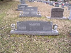
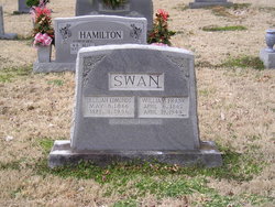
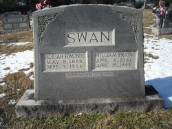
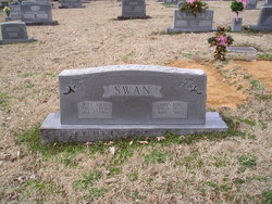
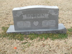
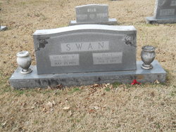
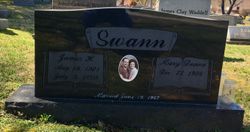
Henry Clay Swann
| Birth | : | 16 Jan 1899 Jackson County, Tennessee, USA |
| Death | : | 25 Jul 1990 Celina, Clay County, Tennessee, USA |
| Burial | : | Asbury United Methodist Church Cemetery, Allen, Wicomico County, USA |
| Coordinate | : | 38.2900009, -75.6903000 |
| Description | : | Son of Frank and Delilah Edmonds Swann. He owned and operated Celina Lumber Company for many years. He was also a prominent land developer, builder and appraiser. He was a member of the Church of Christ. Widower of Nora Fleming Swann, and husband of Eula Swann. CELINA - Funeral services for Henry Swann, 91, of Celina, will be held tomorrow, July 27, at 2 p.m. in Celina Church of Christ. Burial will be in the Fitzgerald Cemetery. Mr. Swann was dead on arrival at Clay County Hospital Wednesday (July 25, 1990. Born January 6, 1899 in Jackson County, he was the son... Read More |
frequently asked questions (FAQ):
-
Where is Henry Clay Swann's memorial?
Henry Clay Swann's memorial is located at: Asbury United Methodist Church Cemetery, Allen, Wicomico County, USA.
-
When did Henry Clay Swann death?
Henry Clay Swann death on 25 Jul 1990 in Celina, Clay County, Tennessee, USA
-
Where are the coordinates of the Henry Clay Swann's memorial?
Latitude: 38.2900009
Longitude: -75.6903000
Family Members:
Parent
Spouse

Siblings

Children
Flowers:


Nearby Cemetories:
1. Asbury United Methodist Church Cemetery
Allen, Wicomico County, USA
Coordinate: 38.2900009, -75.6903000
2. Hattie Banks Farm Cemetery
Crows Nest, Wicomico County, USA
Coordinate: 38.3198600, -75.6682500
3. Siloam United Methodist Church Cemetery
Salisbury, Wicomico County, USA
Coordinate: 38.3280700, -75.6823690
4. Denson-Bounds Cemetery
Simms Wharf, Wicomico County, USA
Coordinate: 38.3205510, -75.7262380
5. Bounds Cemetery
Wicomico County, USA
Coordinate: 38.3325170, -75.6871410
6. Flower Hill Church Cemetery
Eden, Somerset County, USA
Coordinate: 38.2727180, -75.6355880
7. Harcum Family Cemetery
Eden, Somerset County, USA
Coordinate: 38.3256553, -75.7314534
8. Greenbrier Cemetery
Wicomico County, USA
Coordinate: 38.2987800, -75.6290800
9. Mount Zion United Methodist Church Cemetery
Princess Anne, Somerset County, USA
Coordinate: 38.2605100, -75.7435200
10. Banks Family Cemetery
Fruitland, Wicomico County, USA
Coordinate: 38.3118450, -75.6312870
11. Flower Hill Cemetery
Eden, Somerset County, USA
Coordinate: 38.2678410, -75.6284940
12. Loretto Road Cemetery
Loretto, Somerset County, USA
Coordinate: 38.2378320, -75.6754680
13. George Price Cemetery
Whitehaven, Wicomico County, USA
Coordinate: 38.3208139, -75.7480164
14. Henry Crawford Farm Cemetery
Whitehaven, Wicomico County, USA
Coordinate: 38.3242516, -75.7485266
15. White-Smith-Fields Family Graveyard
Salisbury, Wicomico County, USA
Coordinate: 38.3359180, -75.6436180
16. Saint Bartholomew's Episcopal Church Cemetery
Whitehaven, Wicomico County, USA
Coordinate: 38.3071700, -75.7626000
17. Green Hill Episcopal Church Cemetery
Quantico, Wicomico County, USA
Coordinate: 38.3068280, -75.7630390
18. Palmer Cemetery
Fruitland, Wicomico County, USA
Coordinate: 38.3180180, -75.6182050
19. Saint Johns United Methodist Church Cemetery
Fruitland, Wicomico County, USA
Coordinate: 38.3184400, -75.6177290
20. John Wesley Winder Gravesite
Fruitland, Wicomico County, USA
Coordinate: 38.3112400, -75.6137720
21. Washington Methodist Church Cemetery
Salisbury, Wicomico County, USA
Coordinate: 38.3390656, -75.6337891
22. Brown Farm Cemetery
Friendship, Worcester County, USA
Coordinate: 38.2739900, -75.6077600
23. Mount Calvary United Methodist Church Cemetery
Fruitland, Wicomico County, USA
Coordinate: 38.3185950, -75.6133420
24. Senkbiel Road Cemetery
Quantico, Wicomico County, USA
Coordinate: 38.3175500, -75.7684600