Henry Collings
| Birth | : | 1788 Kentucky, USA |
| Death | : | 5 Sep 1812 Pigeon Roost Station, Scott County, Indiana, USA |
| Burial | : | Rookwood Catholic Cemeteries and Crematoria, Rookwood, Cumberland Council, Australia |
| Coordinate | : | -33.8793500, 151.0547850 |
| Plot | : | Unknown |
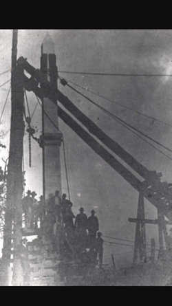
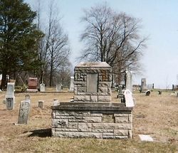
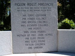
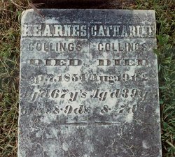
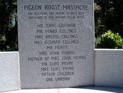
| Description | : | Henry was th s/o William Elston (Long Knife) Collings and Phoebe Hougland. He was married to Rachel Hoffman. When the Pigeon Massacre began, Henry was working in the fields and was severely wounded in the head. He made his way to an old shed and hid himself under a pile of flax and there he was found a day or two later. He told the others, "I went to jump a fence and Little Kill Buck shot me." He died of that wound two days after being shot. His pregnant wife was killed the day... Read More |
frequently asked questions (FAQ):
-
Where is Henry Collings's memorial?
Henry Collings's memorial is located at: Rookwood Catholic Cemeteries and Crematoria, Rookwood, Cumberland Council, Australia.
-
When did Henry Collings death?
Henry Collings death on 5 Sep 1812 in Pigeon Roost Station, Scott County, Indiana, USA
-
Where are the coordinates of the Henry Collings's memorial?
Latitude: -33.8793500
Longitude: 151.0547850
Family Members:
Parent
Spouse
Siblings
Children
Flowers:

Left by Anonymous on 04 Jul 2008

Left by Anonymous on 19 Aug 2008

Left by Anonymous on 06 Dec 2008
Left by Anonymous on 22 Dec 2008

In memory of your 4th gr. niece, Janet Marie (Vogel) Hartley. RIP
Left by Anonymous on 15 Oct 2009
Left by Anonymous on 20 Oct 2009
Left by Anonymous on 30 Jul 2010

Left by Anonymous on 01 Sep 2011

Left by Anonymous on 25 Aug 2014
Left by Anonymous on 17 Oct 2018
Left by Anonymous on 17 Jan 2022
Nearby Cemetories:
1. Rookwood Catholic Cemeteries and Crematoria
Rookwood, Cumberland Council, Australia
Coordinate: -33.8793500, 151.0547850
2. Rookwood Memorial Gardens and Crematorium
Rookwood, Cumberland Council, Australia
Coordinate: -33.8768500, 151.0598900
3. Rookwood General Cemetery
Rookwood, Cumberland Council, Australia
Coordinate: -33.8740500, 151.0591100
4. New South Wales Cremation Memorial
Rookwood, Cumberland Council, Australia
Coordinate: -33.8776400, 151.0627700
5. New South Wales Garden of Remembrance
Rookwood, Cumberland Council, Australia
Coordinate: -33.8776400, 151.0627700
6. Sydney War Cemetery
Rookwood, Cumberland Council, Australia
Coordinate: -33.8769700, 151.0636100
7. Sydney Memorial
Rookwood, Cumberland Council, Australia
Coordinate: -33.8773100, 151.0642800
8. Saint Felix de Valois-Catholic Church Cemetery
Bankstown, Canterbury-Bankstown Council, Australia
Coordinate: -33.9076100, 151.0351850
9. St. Thomas Anglican Cemetery
Enfield, Burwood Municipality, Australia
Coordinate: -33.8912070, 151.0916610
10. St Paul's Anglican Church
Burwood, Burwood Municipality, Australia
Coordinate: -33.8816114, 151.1027492
11. St. Mary's Roman Catholic Church Cemetery
Concord, Canada Bay City, Australia
Coordinate: -33.8677100, 151.1024300
12. Longbottom Cemetery
Concord, Canada Bay City, Australia
Coordinate: -33.8596140, 151.0986280
13. St. Luke's Anglican Church Columbarium
Concord, Canada Bay City, Australia
Coordinate: -33.8678417, 151.1068448
14. St. Saviour's Church of England Cemetery
Punchbowl, Canterbury-Bankstown Council, Australia
Coordinate: -33.9311480, 151.0552250
15. Granville Anglican Columbarium
Granville, City of Parramatta Council, Australia
Coordinate: -33.8333500, 151.0084450
16. St. John's Anglican Church Cemetery
Ashfield, Inner West Council, Australia
Coordinate: -33.8817160, 151.1278730
17. Moorefields Methodist Cemetery
Kingsgrove, Canterbury-Bankstown Council, Australia
Coordinate: -33.9343560, 151.0904450
18. St. Paul's Anglican Church Cemetery
Canterbury, Canterbury-Bankstown Council, Australia
Coordinate: -33.9081600, 151.1236000
19. Merrylands Anglican Church Columbarium
Merrylands, Cumberland Council, Australia
Coordinate: -33.8401100, 150.9870800
20. St David’s Presbyterian Cemetery
Haberfield, Inner West Council, Australia
Coordinate: -33.8823220, 151.1378500
21. Saint Annes Church Cemetery
Ryde, Ryde City, Australia
Coordinate: -33.8156960, 151.1042650
22. Gladesville Asylum Cemetery
Gladesville, Hunter's Hill Municipality, Australia
Coordinate: -33.8393010, 151.1342490
23. Lone Graves
Parramatta, City of Parramatta Council, Australia
Coordinate: -33.8186610, 150.9967800
24. St. John's Cemetery
Parramatta, City of Parramatta Council, Australia
Coordinate: -33.8168010, 150.9983310

