
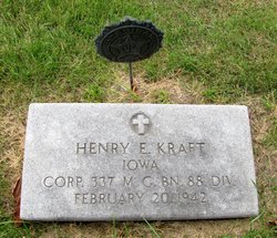
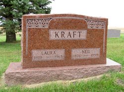
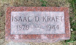
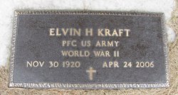
Henry Elvin Kraft
| Birth | : | 19 May 1888 Benton County, Iowa, USA |
| Death | : | 20 Feb 1942 Van Horne, Benton County, Iowa, USA |
| Burial | : | Salem Cemetery, Van Horne, Benton County, USA |
| Coordinate | : | 41.9928017, -92.0421982 |
| Description | : | Birth information and parental links provided courtesy of Colette Harrison. |
frequently asked questions (FAQ):
-
Where is Henry Elvin Kraft's memorial?
Henry Elvin Kraft's memorial is located at: Salem Cemetery, Van Horne, Benton County, USA.
-
When did Henry Elvin Kraft death?
Henry Elvin Kraft death on 20 Feb 1942 in Van Horne, Benton County, Iowa, USA
-
Where are the coordinates of the Henry Elvin Kraft's memorial?
Latitude: 41.9928017
Longitude: -92.0421982
Family Members:
Parent
Spouse
Siblings
Children

Flowers:


Nearby Cemetories:
1. Salem Cemetery
Van Horne, Benton County, USA
Coordinate: 41.9928017, -92.0421982
2. Saint Johns Lutheran Cemetery
Newhall, Benton County, USA
Coordinate: 41.9933014, -92.0093994
3. Prairie Cemetery
Van Horne, Benton County, USA
Coordinate: 41.9626440, -92.0282390
4. Calvary Cemetery
Van Horne, Benton County, USA
Coordinate: 41.9641991, -92.1138992
5. Wagner Cemetery
Newhall, Benton County, USA
Coordinate: 41.9848870, -91.9420910
6. Van Metre Cemetery
Keystone, Benton County, USA
Coordinate: 41.9614983, -92.1514969
7. Bellar-Eden Cemetery
Vinton, Benton County, USA
Coordinate: 42.0803000, -92.0470500
8. Fix Cemetery
Atkins, Benton County, USA
Coordinate: 42.0194431, -91.9251814
9. Bender Cemetery
Keystone, Benton County, USA
Coordinate: 42.0363998, -92.1536026
10. LaRue Cemetery
Benton County, USA
Coordinate: 42.0574989, -92.1438980
11. Holy Cross Cemetery
Keystone, Benton County, USA
Coordinate: 41.9961014, -92.1825027
12. Raetz Cemetery
Atkins, Benton County, USA
Coordinate: 41.9928017, -91.8977966
13. Saint Patricks and Saint Pauls Cemetery
Watkins, Benton County, USA
Coordinate: 41.8986800, -91.9728000
14. Mound Cemetery
Watkins, Benton County, USA
Coordinate: 41.8972015, -91.9713974
15. Pleasant Hill Cemetery
Blairstown, Benton County, USA
Coordinate: 41.8874630, -92.0836900
16. Ranstead Cemetery
Luzerne, Benton County, USA
Coordinate: 41.9201622, -92.1613846
17. Saint Michael's Cemetery
Norway, Benton County, USA
Coordinate: 41.9091988, -91.9263992
18. Norway Cemetery
Benton County, USA
Coordinate: 41.9093300, -91.9256200
19. Indian Cemetery
Garrison, Benton County, USA
Coordinate: 42.0999956, -92.1168495
20. Big Grove Cemetery
Benton County, USA
Coordinate: 42.1088982, -92.0867004
21. Parkers Grove Cemetery
Shellsburg, Benton County, USA
Coordinate: 42.0555992, -91.9028015
22. East-Eden Cemetery
Eden, Benton County, USA
Coordinate: 42.1091995, -91.9841995
23. Saint Stephens Lutheran Cemetery
Atkins, Benton County, USA
Coordinate: 41.9814987, -91.8720016
24. Keystone Cemetery
Keystone, Benton County, USA
Coordinate: 41.9939003, -92.2172012