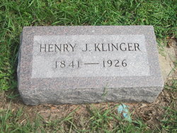
Henry J. Klinger
| Birth | : | 22 Oct 1841 Germany |
| Death | : | 20 Jul 1926 Monroe, Turner County, South Dakota, USA |
| Burial | : | Cedar Hill Cemetery, Mount Morris, Ogle County, USA |
| Coordinate | : | 42.0158005, -89.4238968 |
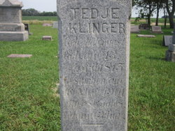
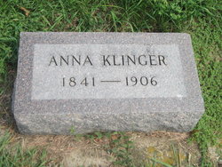
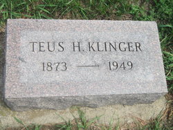
| Description | : | Henry was born to Elke Harms and Tedje (Addenyost) Klinger. Henry married Anna Hayenga on Mar. 9, 1866 in Germany. Ralph, Henry Jr., Teda, El, Albert and Teus H. were born to this union. |
frequently asked questions (FAQ):
-
Where is Henry J. Klinger's memorial?
Henry J. Klinger's memorial is located at: Cedar Hill Cemetery, Mount Morris, Ogle County, USA.
-
When did Henry J. Klinger death?
Henry J. Klinger death on 20 Jul 1926 in Monroe, Turner County, South Dakota, USA
-
Where are the coordinates of the Henry J. Klinger's memorial?
Latitude: 42.0158005
Longitude: -89.4238968
Family Members:
Parent
Spouse
Siblings
Children
Flowers:
Nearby Cemetories:
1. Cedar Hill Cemetery
Mount Morris, Ogle County, USA
Coordinate: 42.0158005, -89.4238968
2. Mount Zion Cemetery
Oregon, Ogle County, USA
Coordinate: 41.9930992, -89.4044037
3. Plainview Cemetery
Mount Morris, Ogle County, USA
Coordinate: 42.0424995, -89.4366989
4. Saint Mary's Cemetery
Oregon, Ogle County, USA
Coordinate: 42.0032997, -89.3767014
5. Oakwood Cemetery
Mount Morris, Ogle County, USA
Coordinate: 42.0483017, -89.4580994
6. Saint Brides Episcopal Cemetery
Oregon, Ogle County, USA
Coordinate: 42.0270271, -89.3536911
7. Coffman Family Farm Grounds
Stratford, Ogle County, USA
Coordinate: 41.9960556, -89.4936142
8. Riverview Cemetery
Oregon, Ogle County, USA
Coordinate: 42.0275002, -89.3399963
9. Riverside Cemetery
Oregon, Ogle County, USA
Coordinate: 42.0177994, -89.3308029
10. Better Place Forest
Ogle County, USA
Coordinate: 42.0411546, -89.3341425
11. County Farm Cemetery
Oregon, Ogle County, USA
Coordinate: 41.9919014, -89.3328018
12. Pine Creek Brethren Cemetery
Pine Creek Township, Ogle County, USA
Coordinate: 41.9538879, -89.4750824
13. Silver Creek Cemetery
Leaf River, Ogle County, USA
Coordinate: 42.0928001, -89.4083023
14. Oak Ridge Cemetery
Grand Detour, Ogle County, USA
Coordinate: 41.9380989, -89.4160995
15. Camling Cemetery
Leaf River, Ogle County, USA
Coordinate: 42.0882988, -89.3758011
16. Evergreen Cemetery
Polo, Ogle County, USA
Coordinate: 41.9446678, -89.4941101
17. Daysville Cemetery
Daysville, Ogle County, USA
Coordinate: 41.9742012, -89.3182983
18. Brooklyn Cemetery
Oregon, Ogle County, USA
Coordinate: 42.0668907, -89.3221283
19. Rice Cemetery
Mount Morris, Ogle County, USA
Coordinate: 42.1061172, -89.4517136
20. West Branch Cemetery
Haldane, Ogle County, USA
Coordinate: 42.0630989, -89.5355988
21. Lighthouse Cemetery
Daysville, Ogle County, USA
Coordinate: 41.9466667, -89.3023300
22. Grand Detour Cemetery
Grand Detour, Ogle County, USA
Coordinate: 41.9020500, -89.4117584
23. Fairmount Cemetery
Polo, Ogle County, USA
Coordinate: 42.0005989, -89.5766983
24. West Grove Cemetery
Forreston, Ogle County, USA
Coordinate: 42.0997887, -89.5292435

