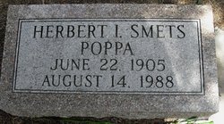
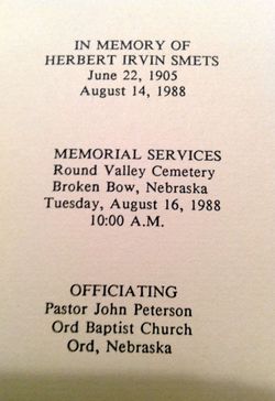
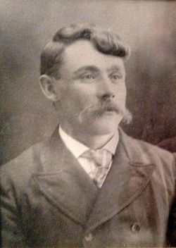
Herbert Irvin “Herb/Poppa” Smets
| Birth | : | 22 Jun 1905 USA |
| Death | : | 14 Aug 1988 Omaha, Douglas County, Nebraska, USA |
| Burial | : | Burks Falls Cemetery, Burks Falls, Parry Sound District, Canada |
| Coordinate | : | 45.6009200, -79.3979400 |
| Inscription | : | Poppa |
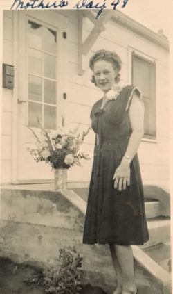
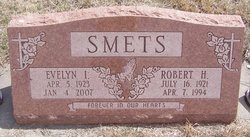
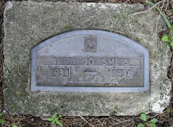
| Description | : | For much of the 1940s and 1950s Herb, his then wife, and their two daughters lived in Ord, Nebraska where Herb managed Sack Lumber Co. His older daughter is buried in the same cemetery. |
frequently asked questions (FAQ):
-
Where is Herbert Irvin “Herb/Poppa” Smets's memorial?
Herbert Irvin “Herb/Poppa” Smets's memorial is located at: Burks Falls Cemetery, Burks Falls, Parry Sound District, Canada.
-
When did Herbert Irvin “Herb/Poppa” Smets death?
Herbert Irvin “Herb/Poppa” Smets death on 14 Aug 1988 in Omaha, Douglas County, Nebraska, USA
-
Where are the coordinates of the Herbert Irvin “Herb/Poppa” Smets's memorial?
Latitude: 45.6009200
Longitude: -79.3979400
Family Members:
Parent
Spouse
Siblings
Children
Flowers:
Nearby Cemetories:
1. Chetwynd Cemetery
Burks Falls, Parry Sound District, Canada
Coordinate: 45.6182050, -79.3371300
2. Royston Cemetery
Ryerson, Parry Sound District, Canada
Coordinate: 45.5632100, -79.4698000
3. St. Mark's Anglican Cemetery
Emsdale, Parry Sound District, Canada
Coordinate: 45.5245350, -79.3161830
4. St. Gerard Roman Catholic Cemetery
McMurrich, Parry Sound District, Canada
Coordinate: 45.5012900, -79.4152300
5. Midlothian Memorial Cemetery
Midlothian, Parry Sound District, Canada
Coordinate: 45.5969800, -79.5654300
6. Saint Pauls Cemetery
Sprucedale, Parry Sound District, Canada
Coordinate: 45.4903908, -79.4618149
7. St Patrick's Roman Catholic Church Cemetery
Kearney, Parry Sound District, Canada
Coordinate: 45.5566347, -79.2183030
8. Knox United Church Cemetery
Kearney, Parry Sound District, Canada
Coordinate: 45.5600000, -79.2111667
9. Strong Community Cemetery
Sundridge, Parry Sound District, Canada
Coordinate: 45.7767448, -79.4004288
10. Saint Andrew's United Church Cemetery
Novar, Parry Sound District, Canada
Coordinate: 45.4455800, -79.2678400
11. Haldane Hill Cemetery
McMurrich, Parry Sound District, Canada
Coordinate: 45.4212400, -79.4242000
12. Saint Andrew's Presbyterian Cemetery
Novar, Parry Sound District, Canada
Coordinate: 45.4491300, -79.2514100
13. Spence Community Cemetery
Spence, Parry Sound District, Canada
Coordinate: 45.6794395, -79.6414413
14. East Bear Lake Cemetery
Bear Lake, Parry Sound District, Canada
Coordinate: 45.4583600, -79.5731300
15. Chapman Community Cemetery
Chapman, Parry Sound District, Canada
Coordinate: 45.6943265, -79.6374739
16. Zion Lutheran Deer Lake Cemetery
Parry Sound, Parry Sound District, Canada
Coordinate: 45.7932440, -79.5596210
17. Yearley Cemetery
Yearley, Muskoka District Municipality, Canada
Coordinate: 45.3749600, -79.4508700
18. Dufferin Methodist Cemetery
Spence, Parry Sound District, Canada
Coordinate: 45.4846896, -79.6830158
19. South River Cemetery
South River, Parry Sound District, Canada
Coordinate: 45.8359500, -79.3982400
20. Salvation Army Cemetery
Huntsville, Muskoka District Municipality, Canada
Coordinate: 45.3834100, -79.2496300
21. Etwell Cemetery
Etwell, Muskoka District Municipality, Canada
Coordinate: 45.3526440, -79.3860950
22. Siloam Cemetery
South River, Parry Sound District, Canada
Coordinate: 45.8499800, -79.4176500
23. Ravenscliffe United Church Cemetery
Ravenscliffe, Muskoka District Municipality, Canada
Coordinate: 45.3676000, -79.2629700
24. St. John the Baptist Cemetery
Ravenscliffe, Muskoka District Municipality, Canada
Coordinate: 45.3628000, -79.2806500

